• Home
  • About

A Runner's Story

A Runner's Story

Tag Archives: CDT

Sky on Fire

16 Sunday Sep 2018

Posted by Ed Mahoney in Colorado Trail, Running

≈ 2 Comments

Tags

bulletproof, CDT, Colorado Wildfires, continental divide, hiking, Never Summer Wilderness, RMNP, Willow Creek Pass

Never Summer

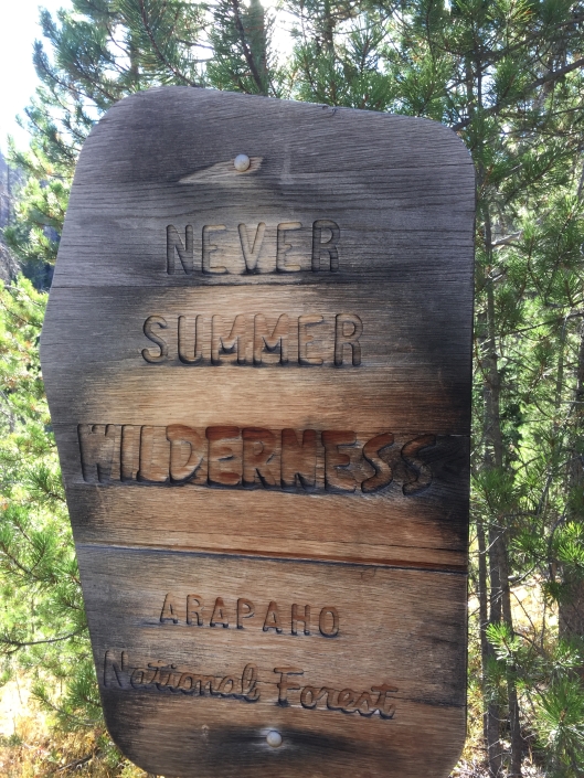
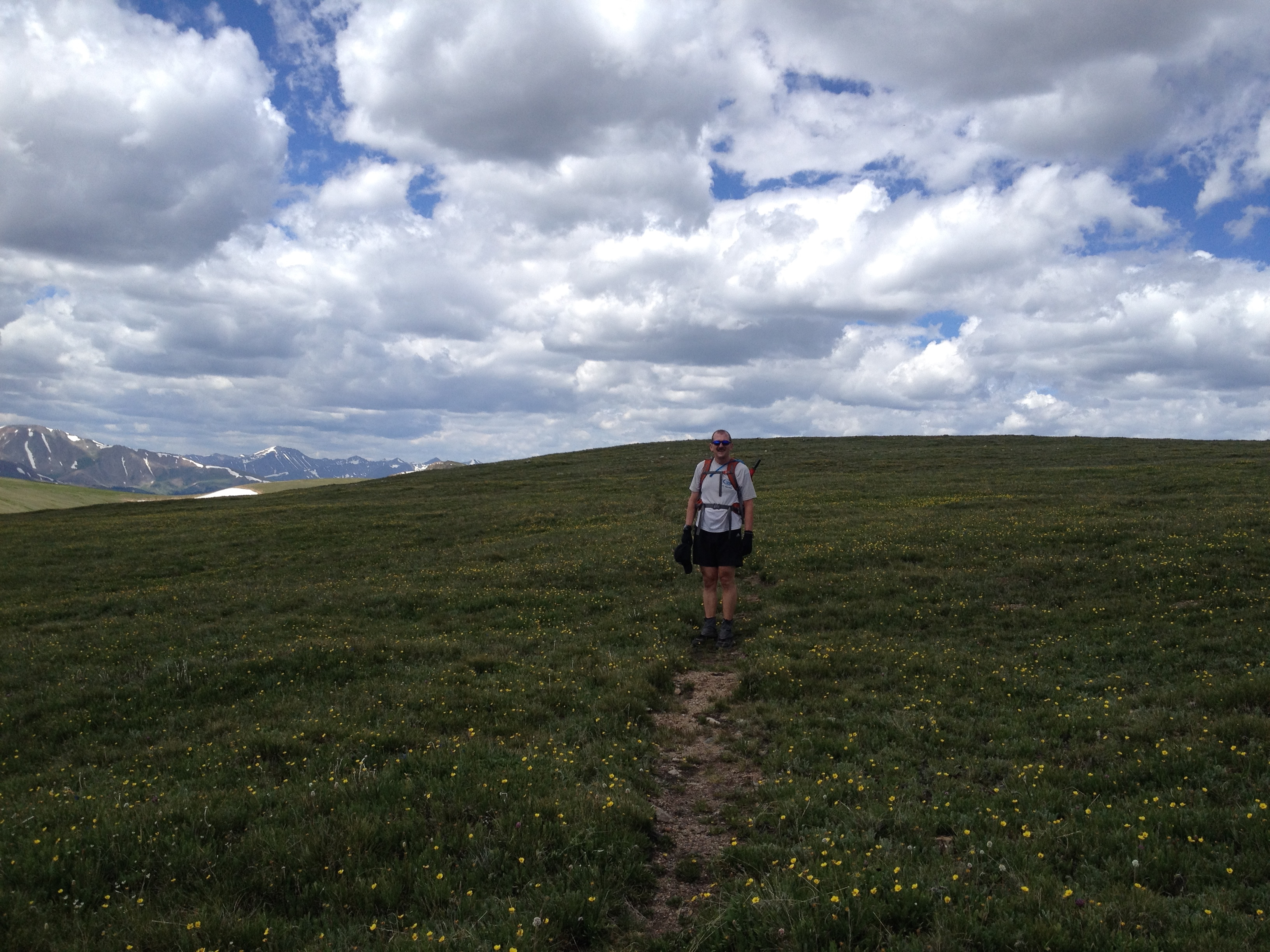
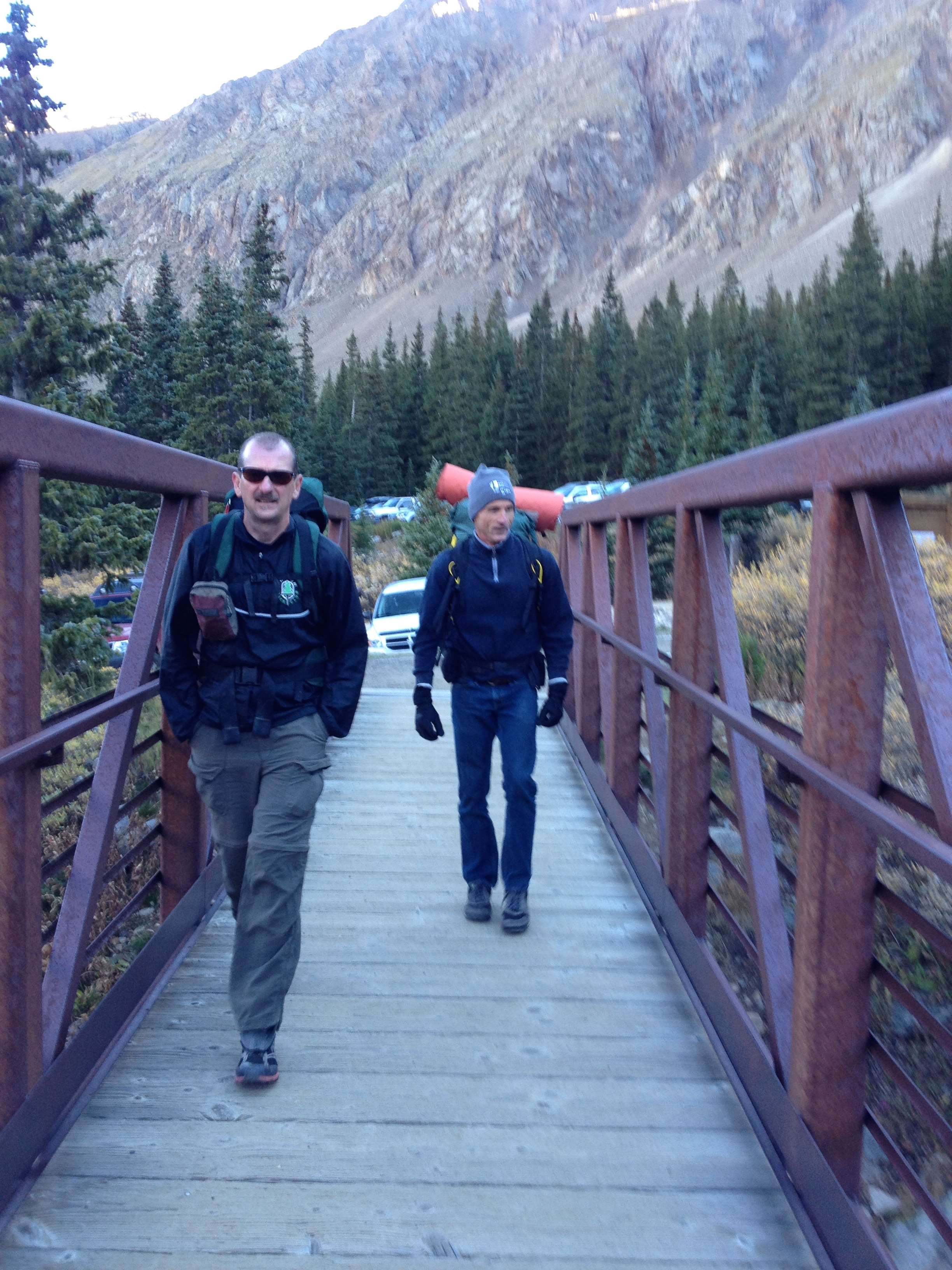
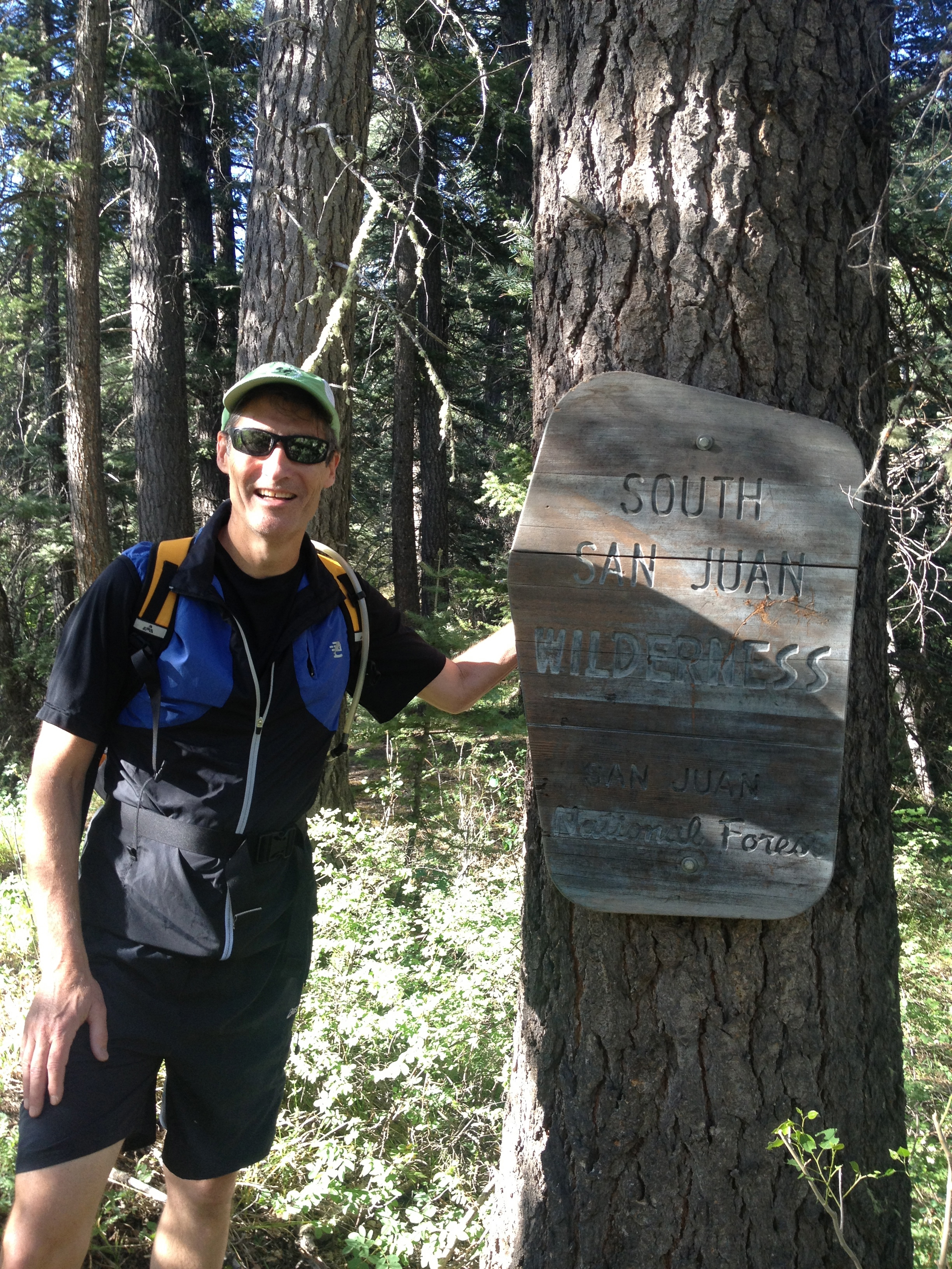
La Plata and I rejoined for a second hike this summer along the Continental Divide Trail.  We met at the Bowen Gulch trailhead off Hwy 34, inside the Rocky Mountain National Park.  We left my car there for our finish and drove through Granby for Hwy 125, which took us up to Willow Creek Pass.

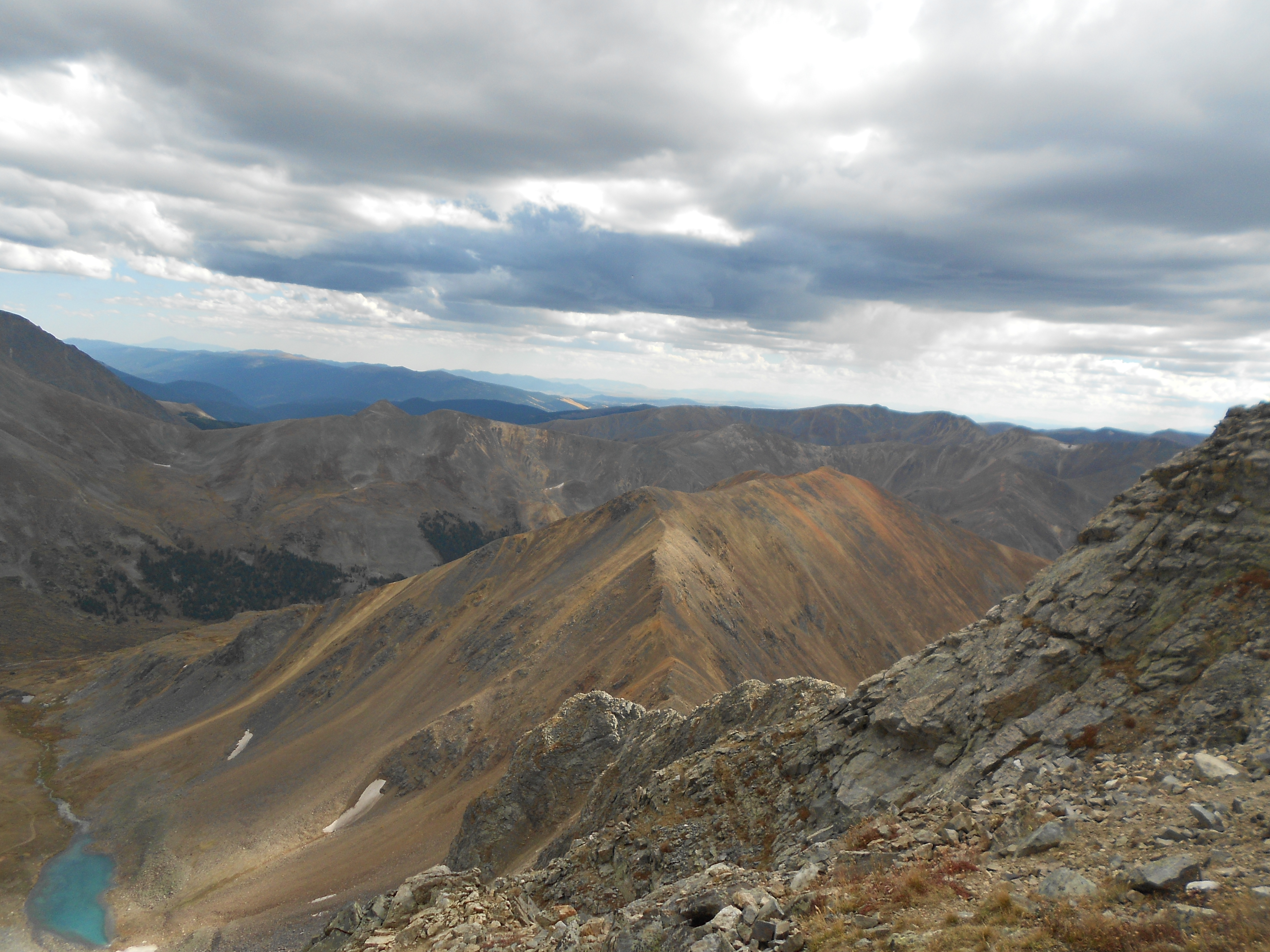
The yellow and burnt orange aspen were much thicker here than in RMNP.  La Plata said the colors were incredible between Durango and this valley.  Their color was echoed by the sun setting under plumes of smoke from the Kremmling fire as we drove up the pass.  The smoke filtered blues on top of hot pinks, mirroring the inferno below, telling the story of our summer with the sky on fire.

Willow Creek Pass

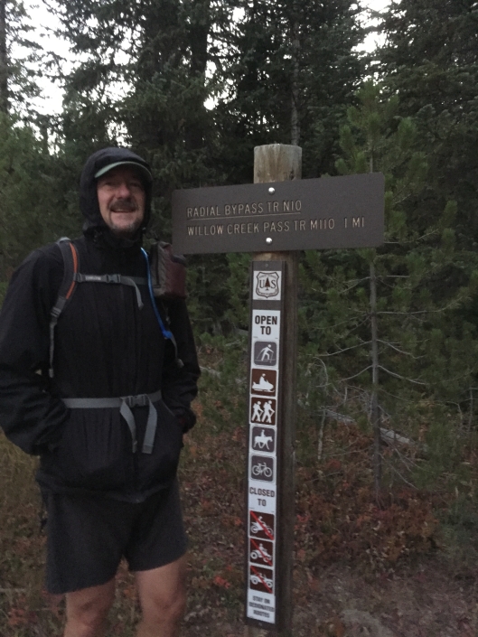
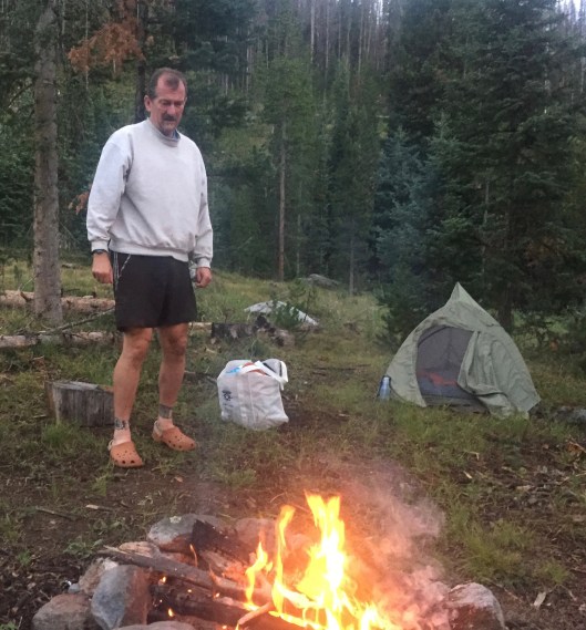
We set off at 6:30am and tracked forty-five minutes of fast-paced progress before I discovered I’d left the keys to my car back in La-Plata’s car at Willow Creek Pass.  This added ninety minutes to our twenty-two mile trek, and a good four more miles.  Today would be a marathon.

IMG_2595

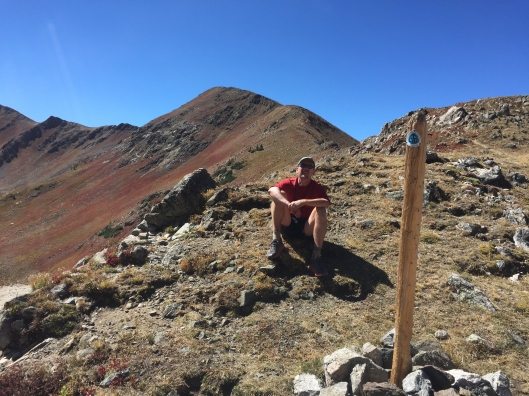
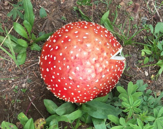
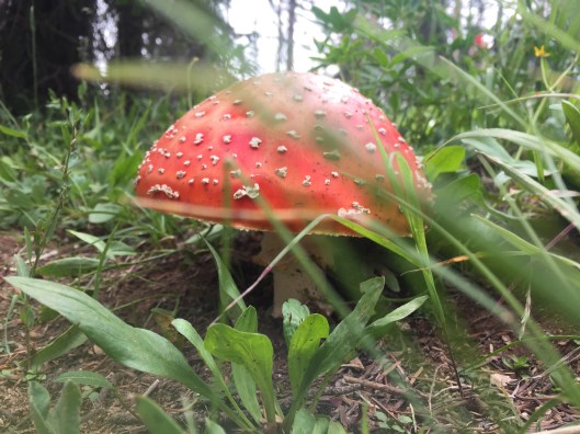
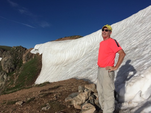
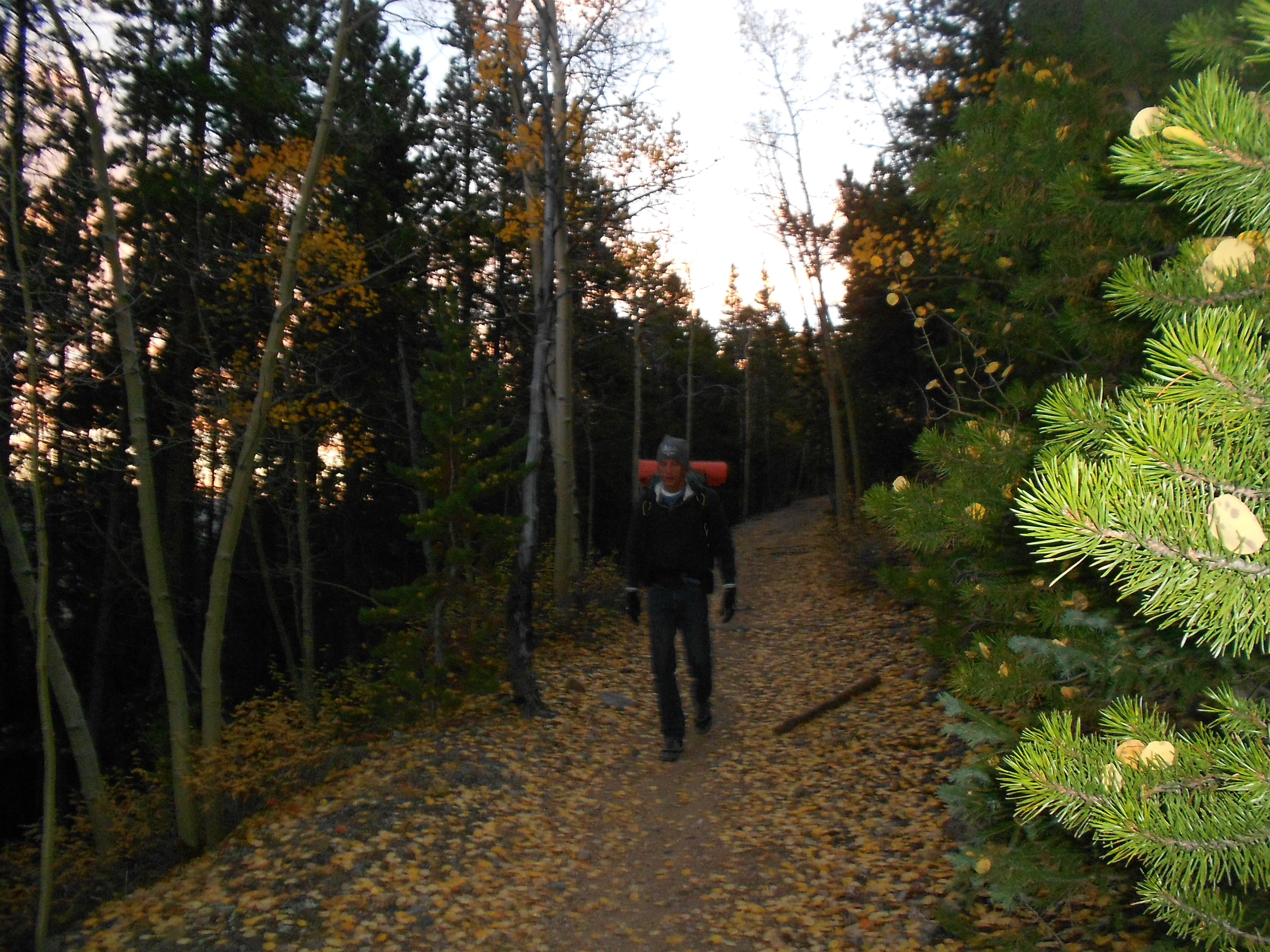
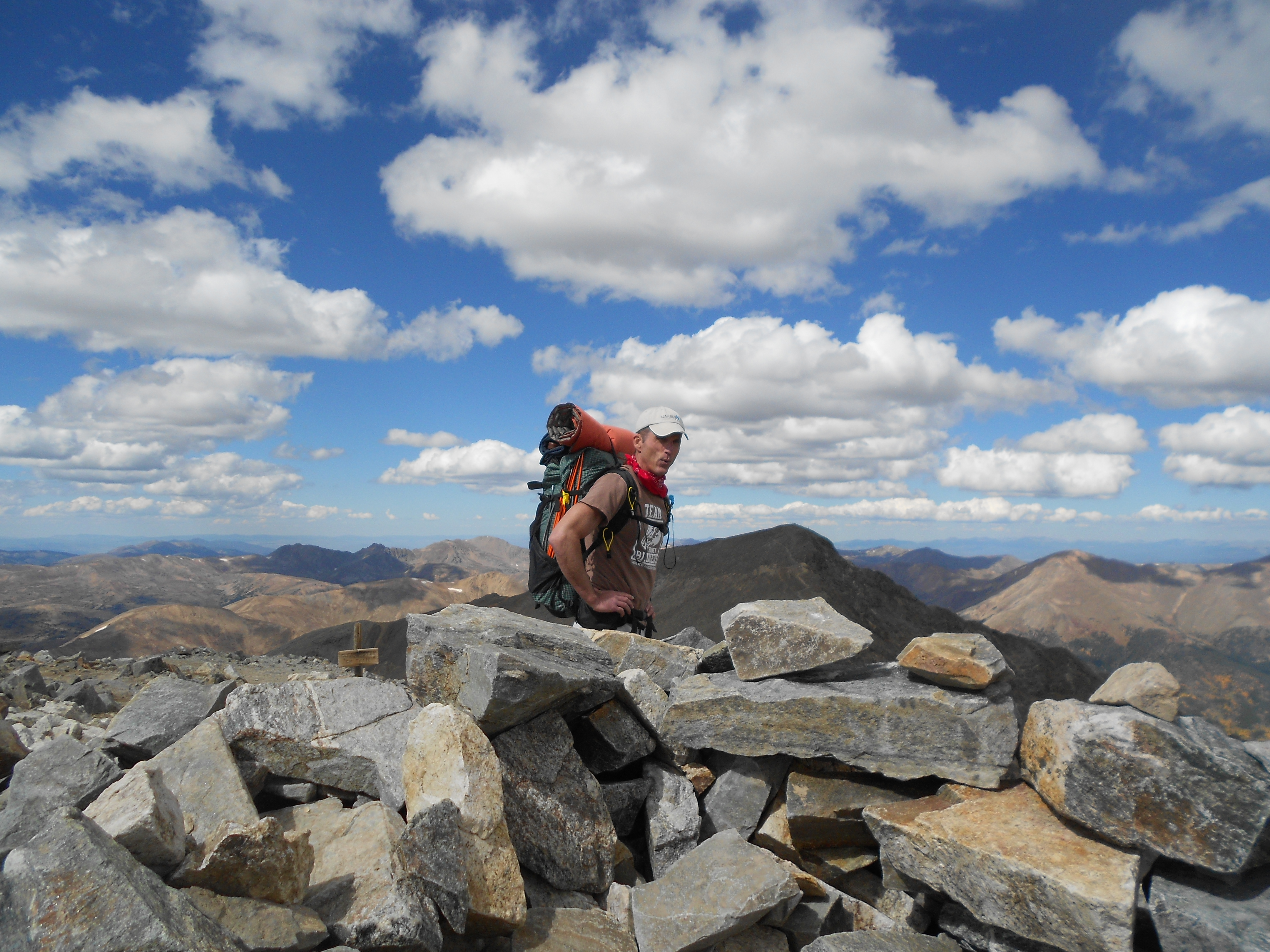
I discovered a new 200 calorie snack bar that I highly recommend – Bulletproof.  I ate their lemon cookie for breakfast.  Yum.  I doubt there is anything else on the health food market anywhere close to this tasty.  The Kremmling fire smoke is in the picture below – those aren’t clouds.

Bowen Pass 2

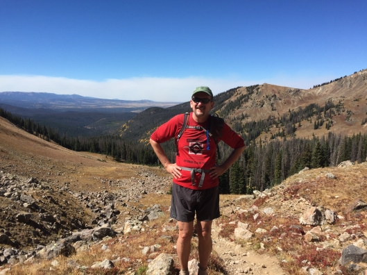
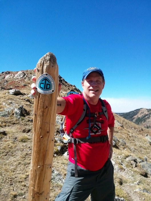
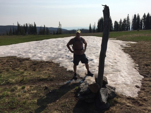
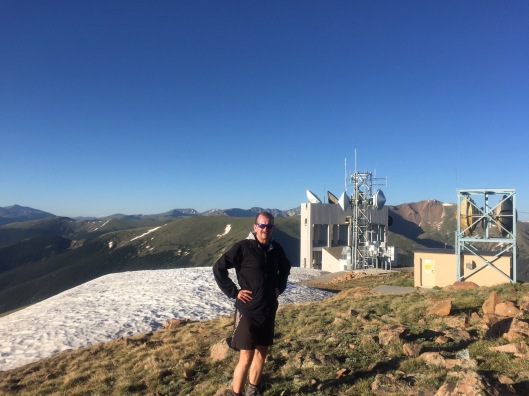
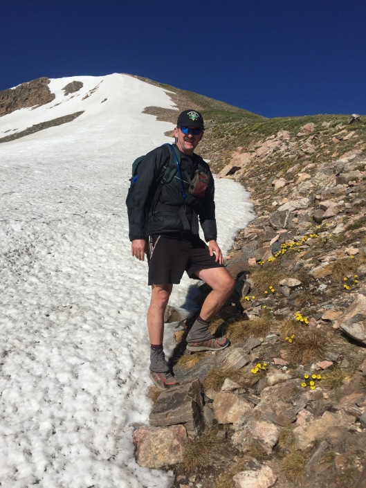
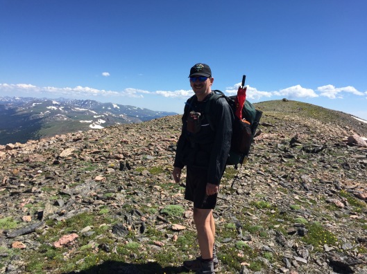
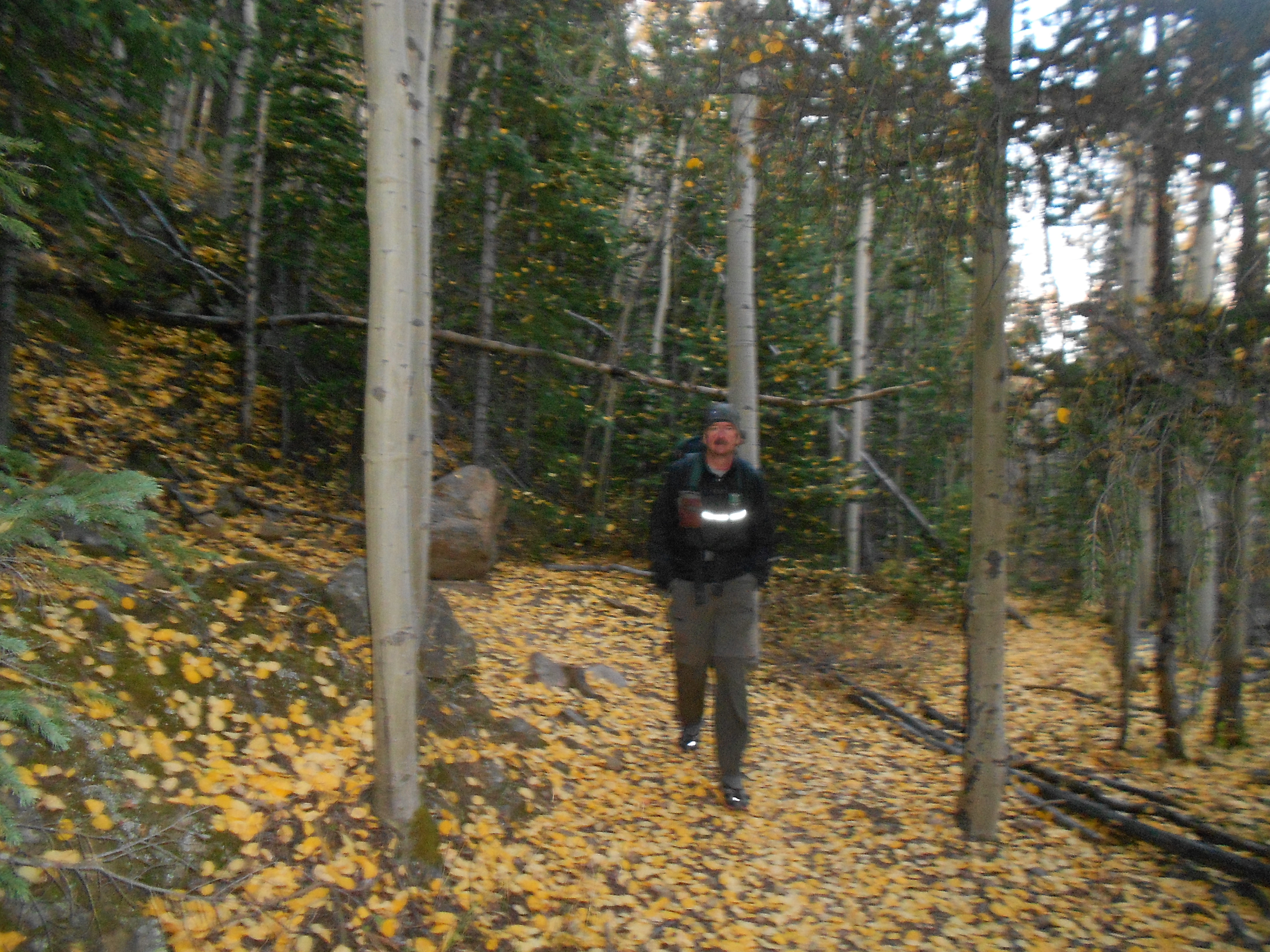
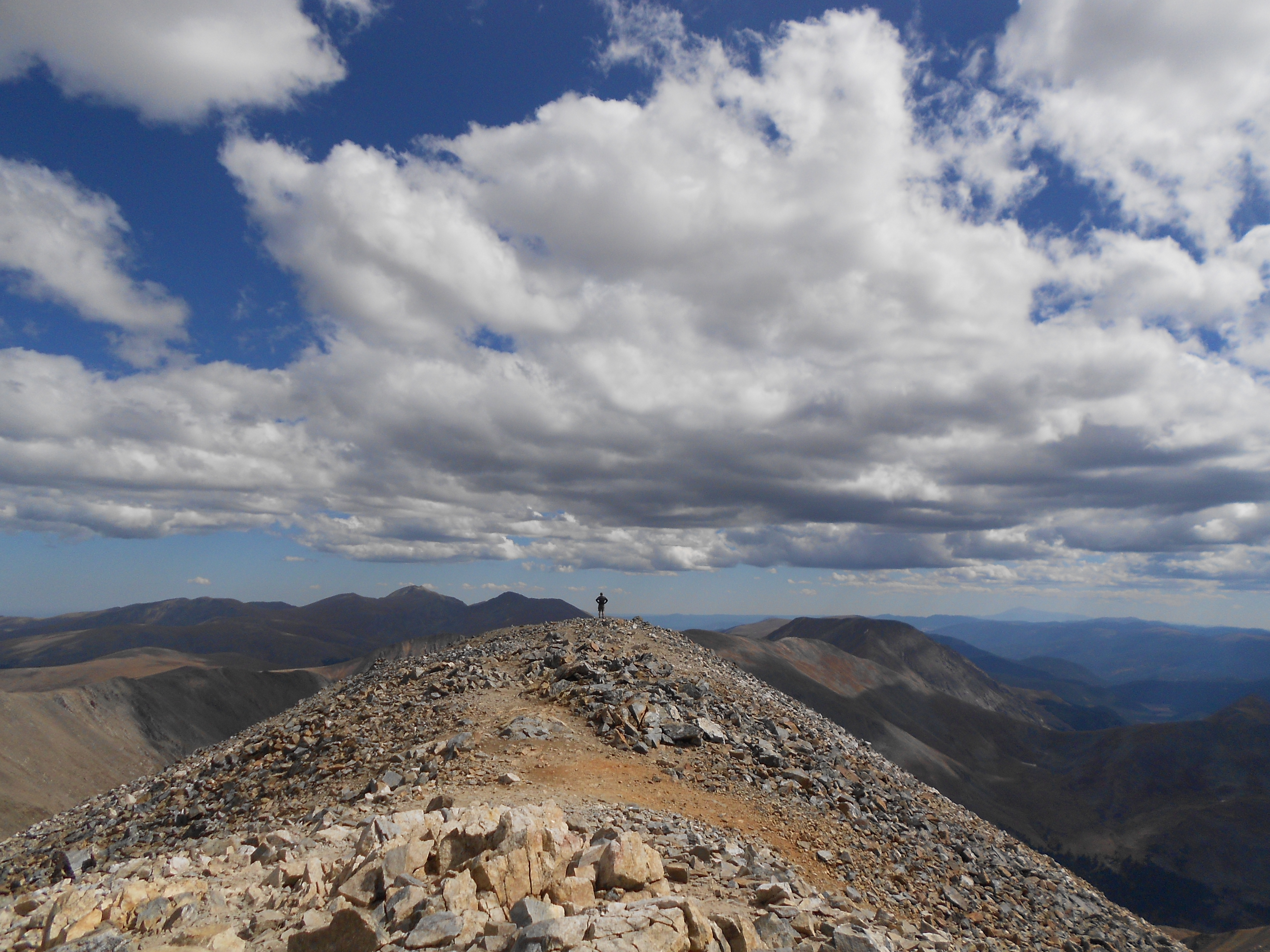
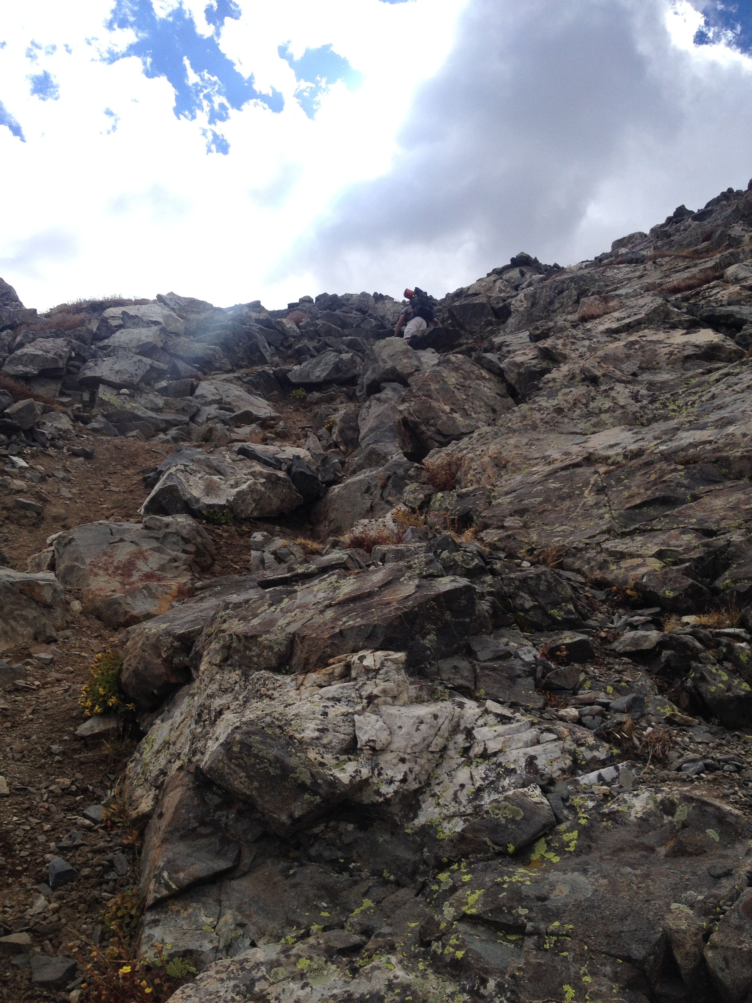
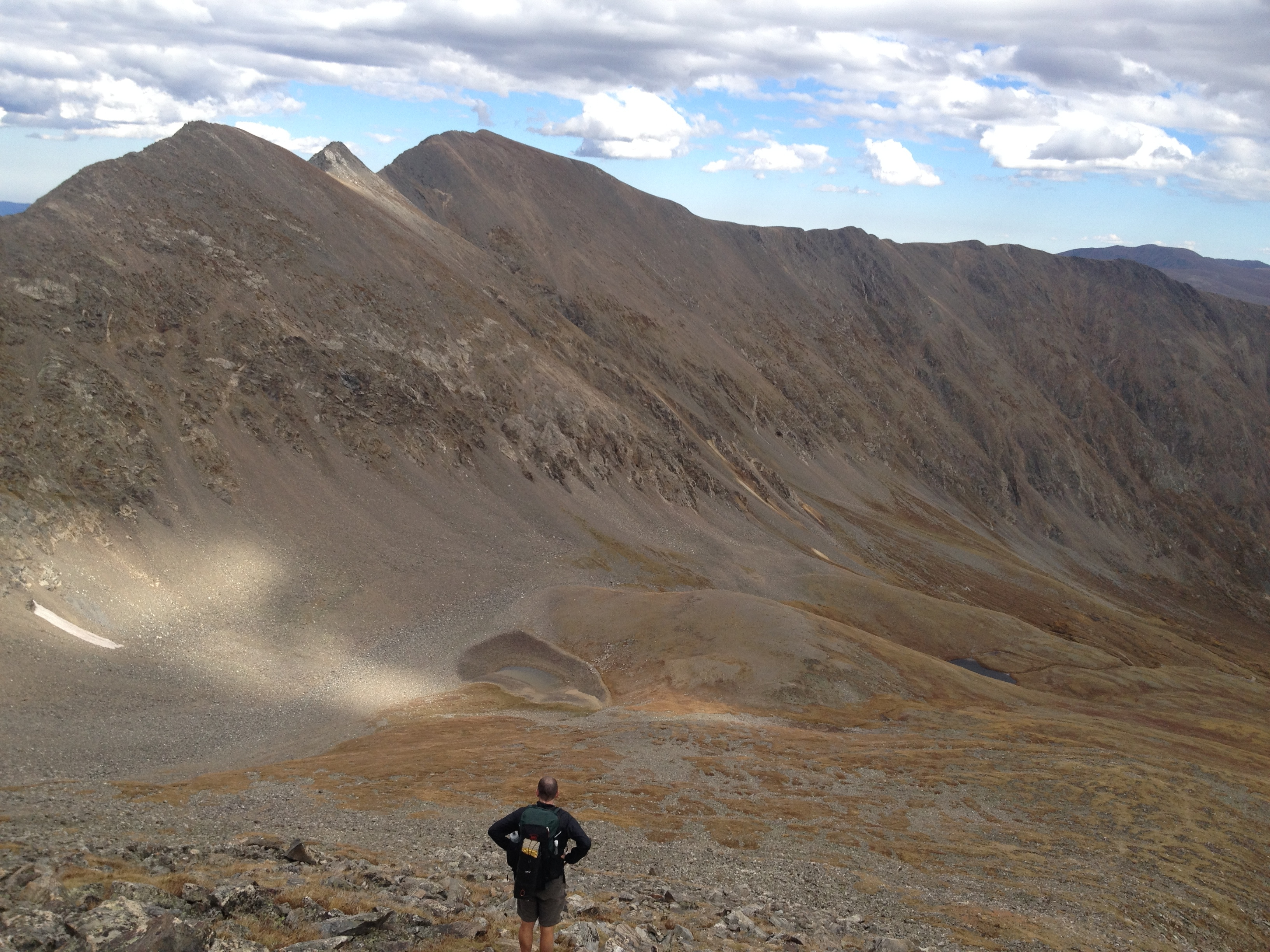
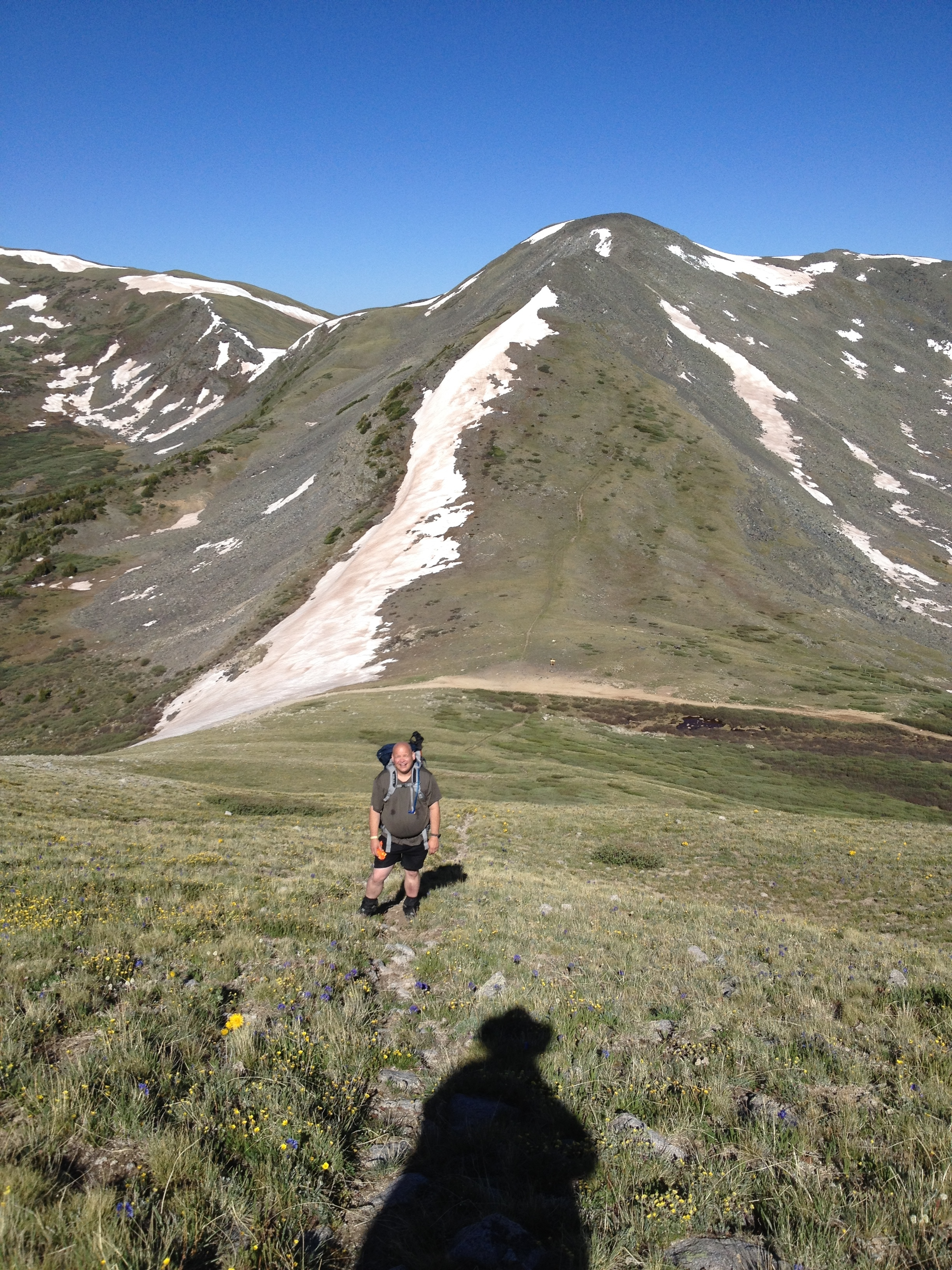
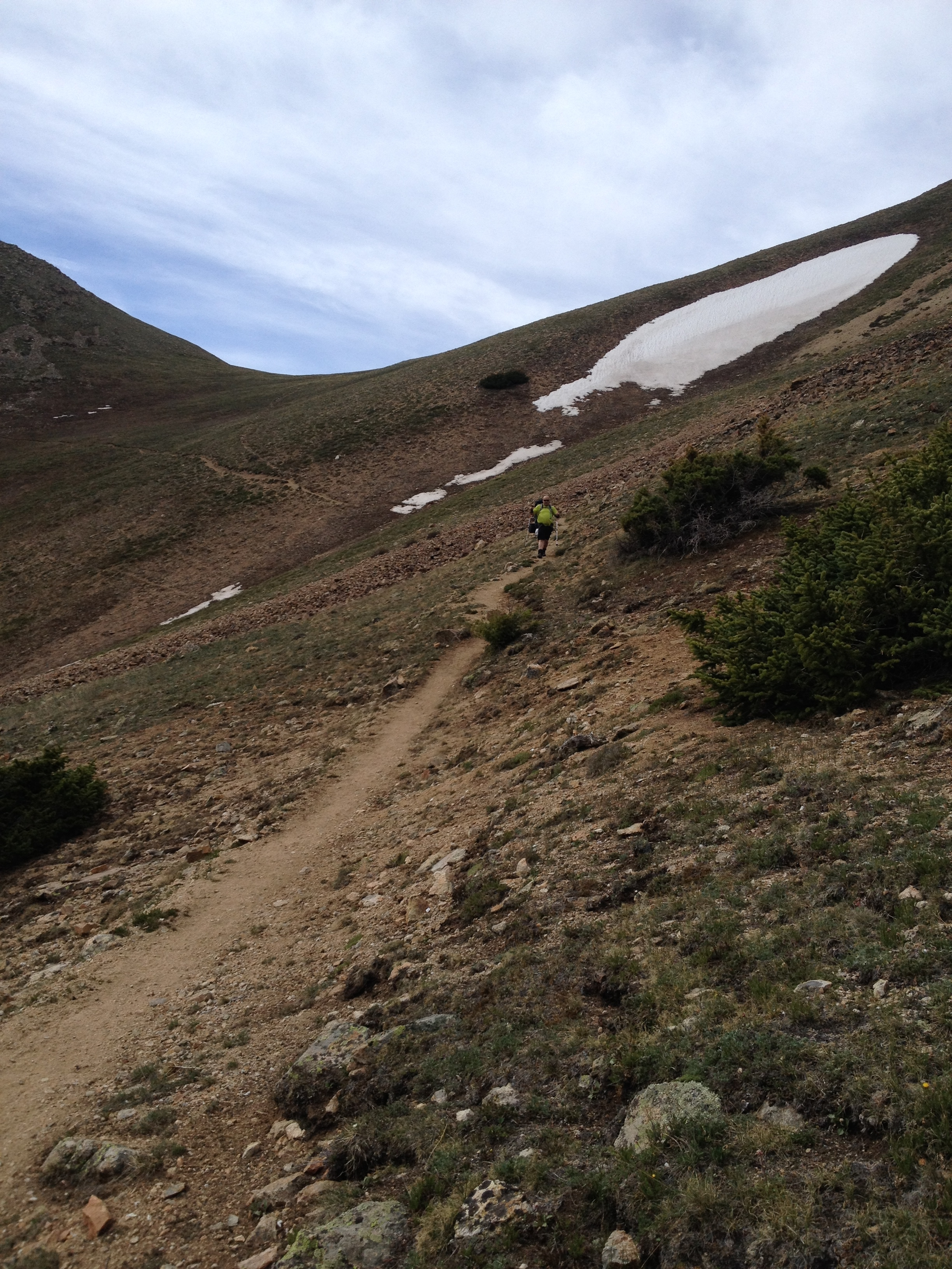
Hiking with La Plata is like trail running with anyone else.  Fortunately, the section of the Continental Divide Trail between the Willow Creek trailhead and Bowen Gulch near Grand Lake is mostly below tree line.  My breathing seemed good despite the altitude and La Plata’s torrid pace.  He schooled me with this unyielding pace for the earlier blunder with the keys, not slowing down until we crossed Bowen Pass, our high point a little above treeline.

Bowen Pass

Can’t thank him enough.  Always the coach, and actually a personal fitness instructor, this training will serve me well for the three days of trail half marathons in Utah and Arizona next month.  I did have to run at times to catch up with La Plata in the early going.  I took advantage of downhill sections of trail.  We maintained a strong two mile per hour pace.  That’s good for high altitude mountain trails.  Standard walking pace is about three miles per hour.  I don’t expect the Trailfest to be nearly this challenging, except that it’s three days in a row for a total of thirty seven miles.  Recovery will be paramount.

IMG_1672

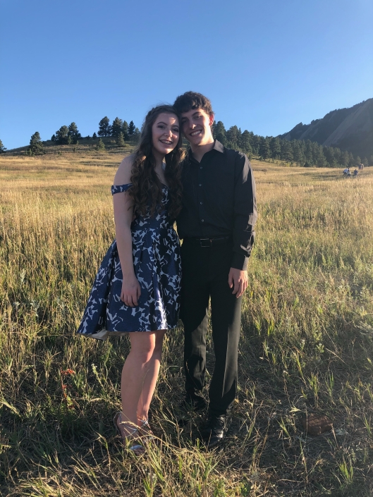
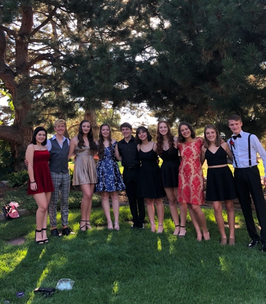
I missed the photo-taking for Ellie’s homecoming dance.  The kids looked good.  The first photo is with Ellie and her boyfriend Will at Chautauqua.  The second is the group shot.

IMG_1346 (1)

Share this:

  • Facebook
  • Twitter
  • Pinterest
  • LinkedIn
  • Reddit
  • More
  • Tumblr
  • Email
  • Print

Like this:

Like Loading...

Buffalo Pass

07 Monday Aug 2017

Posted by Ed Mahoney in Colorado Trail

≈ Leave a comment

Tags

CDT, Continental Divide Trail, magic mushrooms, Moose Watch Cafe, Rabbit Ears Pass, Steamboat Springs

buffalo pass TH
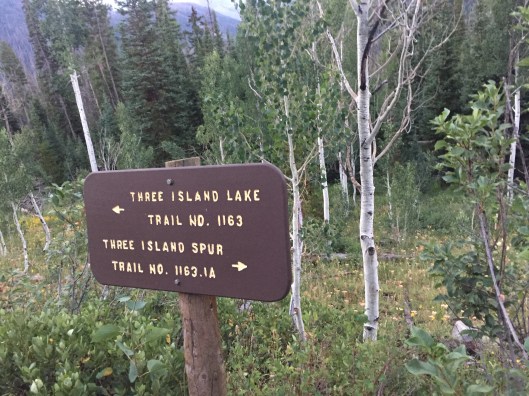
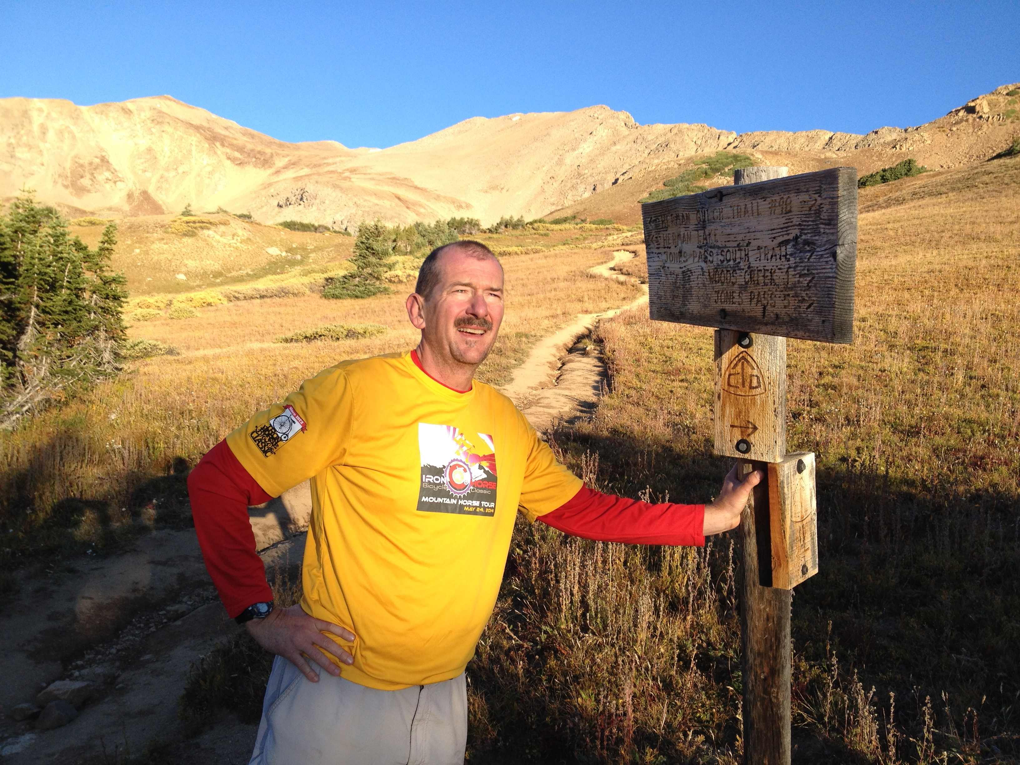
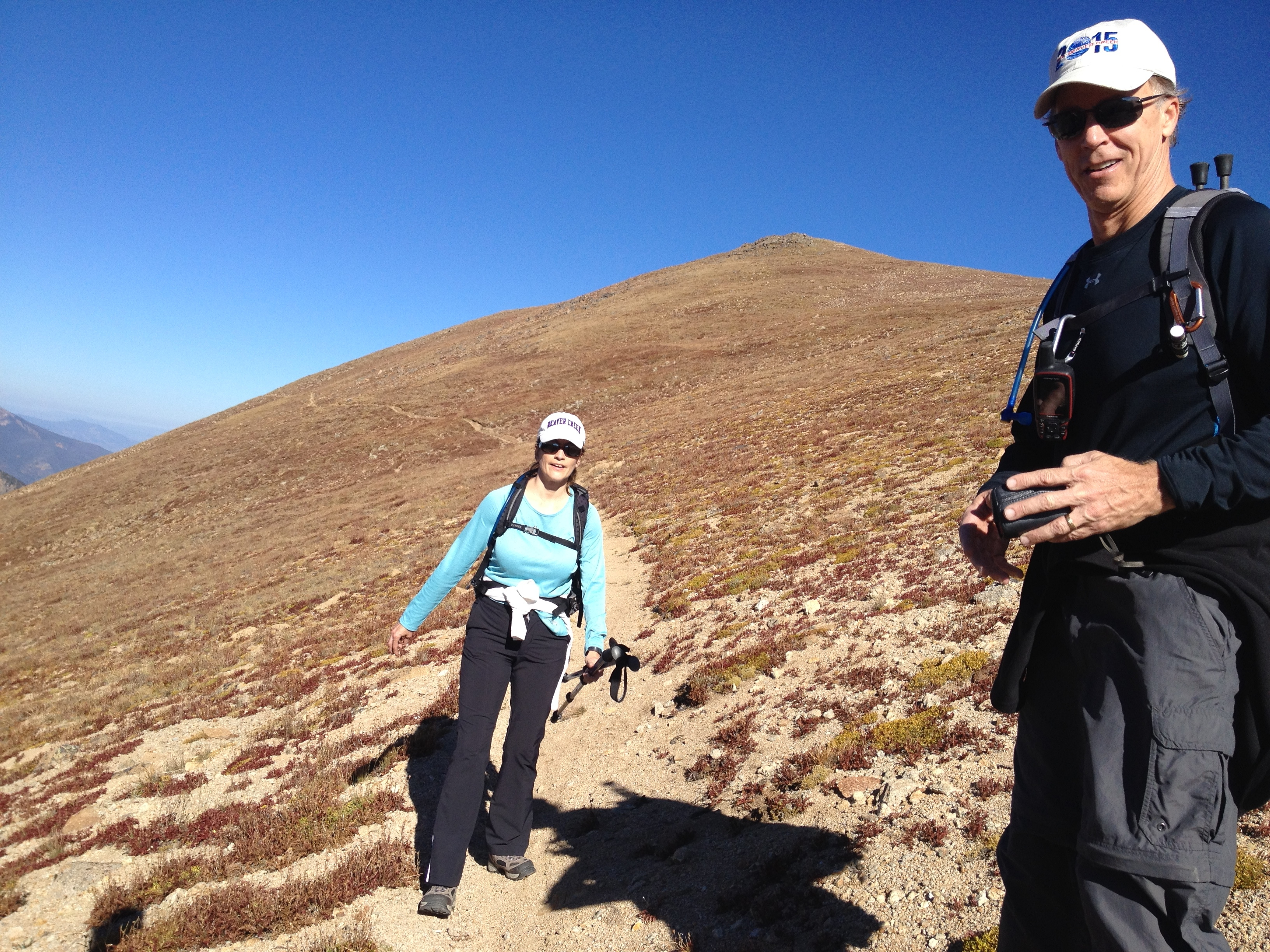
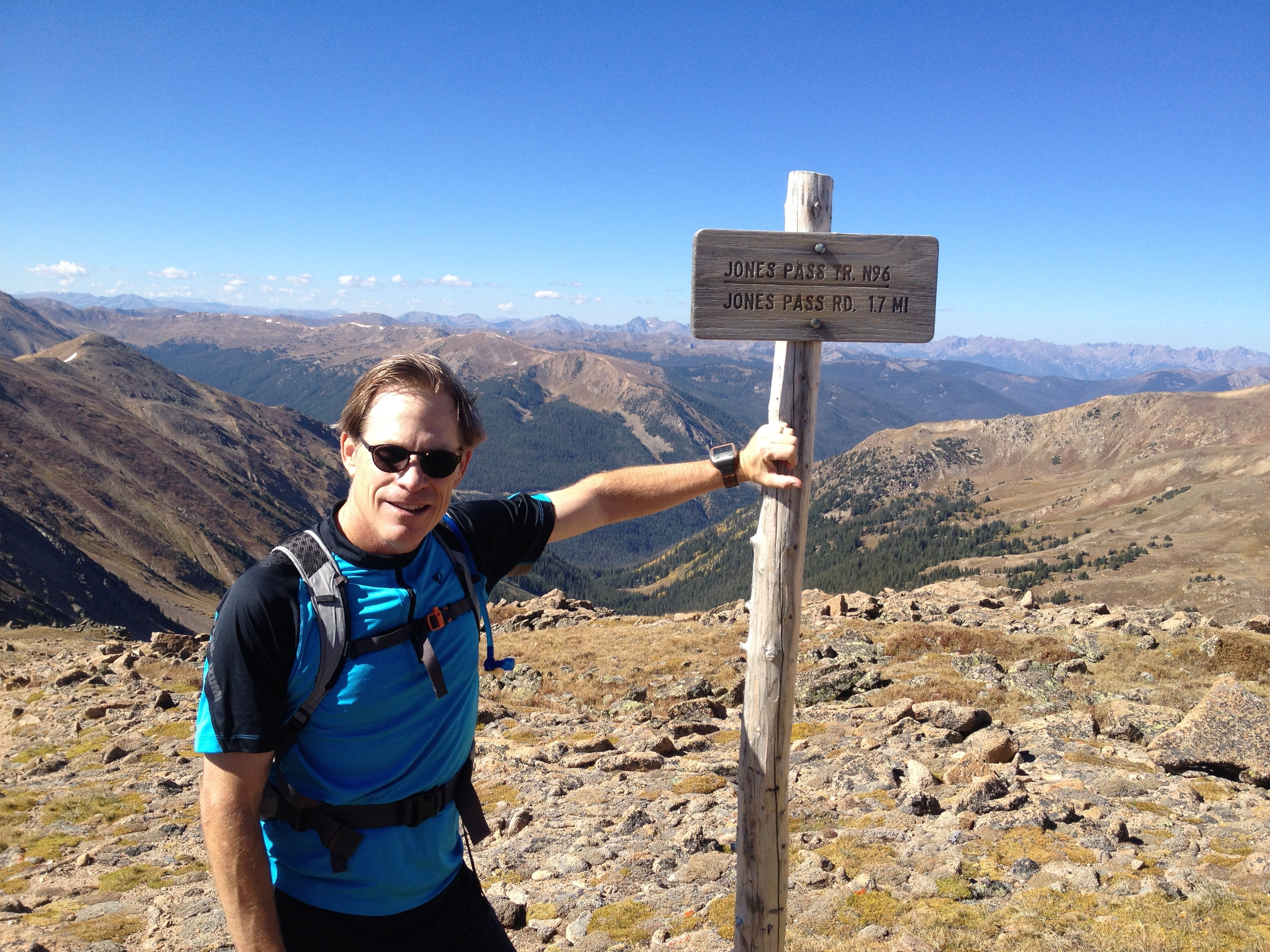
I continued my hiking with Rob on the Continental Divide Trail (CDT) near Steamboat Springs this past weekend.  We’ve been hiking northbound generally but the most efficient car shuffle for this outing suggested a southbound route.  We hiked two sections southbound, first 15 miles from Buffalo Pass to Rabbit Ears Pass on Saturday, then 24 miles from the Three Island Lake Trailhead to Buffalo Pass on Sunday.  For Rob, this leaves the section of trail between Grand Lake and Rabbit Ears, and the 50 miles of trail south of Wyoming, for him to complete all the CDT within Colorado.  He also he completed the northern half of New Mexico.

moose watch cafe

Saturday’s adventure began at the Moose Watch Cafe for a breakfast burrito and a few donuts.  I ate one of these maple bacon delights, along with something cream filled.

Wyoming Trail

It might be hard to read this sign but it says the Wyoming Trail.  Whenever we were in doubt, and the CDT is nothing if not poorly marked, we followed signs for the Wyoming Trail.  Apparently the section of CDT between Rabbit Ears Pass and Wyoming, is also known as the Wyoming Trail.

moose

Early in our hike, as we stopped to adjust our gear, this cow and her calf sprinted up behind us.  They stopped and acted a bit startled after spotting us, before continuing their trot deep into the woods.  Moose are really just super large deer.  They’re somewhat spectacular to see up close in the wild.


lakes

This section of trail consisted mostly of alpine meadows and lakes.  Everything, even the tundra above tree line on day two, was lush and green, like these high mountain daisies I’m standing in here.

parry primrose

I’m not totally certain what these flowers are.  My best guess is Parry Primrose.  Could be fireweed.

Rabbit Ears Pass

Saturday’s hike ended at Rabbit Ears Pass, just south of Steamboat Springs.  We saw a decent number of other hikers, and even more mountain bikers.  Even a few fishermen headed up to those alpine lakes.

butcherknife amputator IPA

To heal our sore muscles after the 15 mile trek, we dined in Steamboat and quaffed a few of the local Butcherknife Amputator IPAs.

camp fire

Despite the very wet ground, we got ourselves a camp fire for the night.

3 island lake TH

We started out the next day at the Three Island Lake Trailhead, 50 miles south of the Wyoming border.  Sunday’s hike was mostly above treeline, but the ground was still more soggy marsh.

first snow

The melt off these snow fields accounted for some of the sogginess, constant afternoon rains for the rest.

pano.jpg

The photo above captures what much of the top of the CDT looks like, fields of alpine flora with very little signs of an actual trail.  You just walk between the drop offs.

snow fields

Other times, you look for the next cairn to guide the path, when the trail is under near permanent slow fields, or like below when there’s not enough foot traffic to carve out a path through the fast-growing grass.

no path

This sign points to a spur trail, Grag’s Trail, that runs behind me.  You can’t make out a discernible trail in the grass, but you can spot the cairn over my shoulder pointing the way.  Our trail in this photo, is the Wyoming trail running horizontal, also without any visible path.

fly agaric top

There were so many photo perfect moments on the trail but for the most part, I simply experienced them without taking pictures.  Like when the team of elite mountain pixies came running past us.  Spaced over a 20 second spread, four unbelievably attractive runners ran by us at maybe a 7 minute pace.  Clearly under 8 minutes per mile.  At extreme altitude.  While they were wearing different racing outfits, you could see they were a team by how uniformly they maintained form, like a peloton in bike racing.

fly agaric profile

Either Rob and I really were passed by a quad of beautiful elite trail racers, or we took a bite out of this hallucinogenic Fly Agaric mushroom growing alongside the trail and imagined it.  After 8 hours, we completed Sunday’s 24 mile trek, this time entering Buffalo Pass from the north, satiated for that moment, hungry now for the next opportunity.

Share this:

  • Facebook
  • Twitter
  • Pinterest
  • LinkedIn
  • Reddit
  • More
  • Tumblr
  • Email
  • Print

Like this:

Like Loading...

Colorado River Headwaters

10 Sunday Jul 2016

Posted by Ed Mahoney in Colorado Trail

≈ 4 Comments

Tags

CDT, Charge, Cloudbuster, High Lonesome Trail, Knights Ridge Trail, Monarch Lake, NoBo Through Hiker, Peak Brewpub, Red Dog Saloon, SoBo Through Hiker, Squeaks

Berthoud Pass

This weekend’s fifty-four mile backpacking hike along the Continental Divide begins at Berthoud Pass at 6am.  The early start required a 3:30am wakeup from our stellar Shadow Mountain Lake beachside camp site in Grand Lake, where we leave one of our cars because that’s where this trek will end.

berthoud pass weather station

1100 feet of elevation gain later, Rob stands atop Mines Peak, the first of so many peaks that I lose count.  I didn’t capture stats with a Garmin, but traversing the Continental Divide Trail above the headwaters of the Colorado River likely included well over 10,000 feet of vertical on just the first of our three days.

mt Eva 1.jpg

My legs are so spent by the end of day one, I’m near tears when Rob tells me we have to scale yet another giant boulder field to avoid having to glacade down a scary snow cornice that covers the trail over Devil’s Thumb Pass.  We need to get around this snow to camp on the east side of the pass.

avalanche

We end day one having trekked twenty miles in thirteen hours.  Not a strong pace but considering 30 pound backpacks and terrain, we’re impressed with ourselves.  Thousand foot climbs followed immediately by thousand foot descents.  Boulder field after scree field after boulder field.  For this final scramble, I use my bare hands to steady myself against the cold, abrasive granite on each step.  I no longer trust my fatigued legs to land without buckling.

ridge

This photo of Rob above shows the typical tundra we walk across from Mines Peak to Devil’s Thumb Pass.  No trail for much of it, just a route for us to keep between the edges of East and West.  The Cairn at the top of this hill leads the way.

alpine flowers

The tundra isn’t all moonscape, alpine flowers are lush from this season’s strong snowfall.  I’ve never seen so many alpine daisies.

alpine daisies

Camping over the pass near Devil’s Thumb Lake offers us not just water to resupply, but the softest high mountain meadow grass to pitch our tents.  I go to sleep fearful I won’t wake with the strength needed to climb back up that pass to continue on the trail.  I credit the meadow with my recovery.  We wake to see Elk streaming across the mountainsides, crossing fields of melting snow.  I climb back up that 1000 foot pile of rocks, and for the most part, the rest of the hike is downhill.

squeaks

We meet Squeaks as we descend the High Lonesome Trail from Devil’s Thumb.  She looks to be about 65 years old.  She’s a south-bound (SoBo) through-hiker backpacking from the Wyoming border to New Mexico.  We’ve met other NoBo through-hikers, Charge, and later Cloud Buster.  She tells us about the rough blow-down we’ll face on Knights Ridge Trail.  Blow down are dead trees, some Aspen but mostly Lodgepole Pine, that fall from strong winds and block the trail.  Squeaks also tells us about the three or four family members who have joined her for sections of her hike.  I figure her pack weighs forty pounds.  I mean, look at it.  No idea how she can do this.

Monarch Lake 1

Day two takes us below tree line, where we remain the rest of our hike.  The downhill direction and the oxygen that comes with each downward step help us to complete over twenty miles in twelve hours.  Cooling off at Monarch Lake helped as well.

Monarch Lake 2

Shortly after Monarch Lake, we stumble across the world’s smallest bar, the Red Dog Saloon.  The bartender Lee, qualifies his boast of the world’s smallest bar by excluding Malaysia, where he says they have smaller bars.  Rob and I polish off a six pack of ice-cold Ranger IPA, a Colorado brewed 6.5 ABV thirst-quencher.

Ranger IPA

Rob considers renting a teepee for the night, but I convince him there’s yet more hiking before night fall.

teepee

We end the night at the southern tip of Lake Grandby, on a sandy beach.  This is the view from my tent.

Lake Grandby

We start out day three earlier than the others, at 5:30, and hike the final stretch alongside Lake Grandby, the Colorado River, and Shadow Mountain Lake.  Much of this is down near the water, some miles are up in high mountain meadows.  On our first climb, we watch a moose take a bath in a marshy pond.  He shakes the water off like a dog, sending shock waves across the meadow from the force of his hooves.  The prettiest flowers in these meadows above the Colorado River are these Columbine.

Columbine

The headwaters to the Colorado River are dammed up to form a sizable lake, although the northern end flows like a river.  I refill my LifeStraw water bottle, given to me last Christmas by my sister-in-law Susan, at a point where we need to cross a creek streaming into the river.  This water bottle filters untreated water so that it is safe to drink.  Worked awesome for me.  At another creek crossing, either the water is too high or the bridge is washed away, so we cross over the top of a beaver dam.  One of our more dicey creek crossings.

East Shore TH

We complete the twelve remaining miles on day three at the East Shore Trailhead after six hours.  A total of 54 miles, 20 above tree line, and 31 hours spent on the trail.  We celebrate this truly epic hike at the Peak Brewpub in Winter Park.

Peak Brewpub

Share this:

  • Facebook
  • Twitter
  • Pinterest
  • LinkedIn
  • Reddit
  • More
  • Tumblr
  • Email
  • Print

Like this:

Like Loading...

Grand Lake

09 Sunday Aug 2015

Posted by Ed Mahoney in Colorado Trail, Running

≈ Leave a comment

Tags

Boulder Marathon, CDT, continental divide, IllegalTrailRunners, massivemileage, RMNP, training plan

north inlet trailThe last thing I remember Friday night was looking up at the stars, undiluted from urban light sources, high in the Rocky Mountains outside Grand Lake.  Sleeping cowboy style, I dodged fallin’ stars aimed straight at me.  I finally tucked inside my tent after midnight once the temperature dropped.  Rob and I camped out here to hike a 25 mile segment of the Continental Divide Trail.  The accuracy of CDT maps are specious as my Garmin captured 29.5 miles.  Fortunately the weather was cool, between 40° and 60° so that our water lasted through those final four unplanned miles.

Grand Lake sits at the western entrance to Rocky Mountain National Park, and is also part of the headwaters to the Colorado River.  A quaint mountain town with wooden boardwalks and expensive but good restaurants, it’s worth a stop if you’re near Rocky Mountain National Park, or the Winter Park ski resort.  Grand Lake anchors the southern end of Trail Ridge Road.  Rob and I ate surprisingly good Mexican food at El Pacifico.  After two large margaritas, I was seeing stars.

Flat Top MountainThe 25 (29.5) miles would complete my 90 mile running week, for a total 510 miles of my massive mileage Boulder Marathon training plan.  I run 20 miles today to begin my 100 mile week – the final week before I begin my taper.  I can still report no muscle strains or injuries.  Keeping my fingers crossed.  I’ll start some strength training and work on my pace once I cut my miles by half.

We got some decent running in Saturday on the trail.  This section of the Continental Divide Trail is a loop that begins and ends at the North Inlet Trailhead outside Grand Lake.  It’s contained within the southwest corner of Rocky Mountain National Park, so permits are needed for camping.  We stealth camped, setting up our tents shortly after dusk to avoid the Park Rangers.  We encountered a number of group backpackers who camped along the trail.  One father was trekking his kids on a 3 day outing, targeting 8 mile days with their heavy packs.  There is a Big Meadow trail that shortcuts the CDT, forming a slightly shorter 24 or 25 mile loop.  Sporting light packs, we ran about two miles worth of the big loop.  The coolest part was running across the alpine tundra among the rock cairns above 12,000 feet.

burn zoneAnother cool section of trail was this burn area on the northern part of the loop.  Would have been hot without shade but we benefitted from partial clouds and 60° temperatures.  I’m happy mixing up hiking with my running.  I count the miles toward my training plan because hiking with Rob at high altitude is little different than running.  We maintained a 3 mph pace for essentially a 50K ultra.  Ascending above tree line had my cardio going.  I imagine I burned well over 3000 calories over the ten hour hike.  Once I finish my coffee this morning, I’ll set out on a 20 miler on the LoBo Trail to begin my 100 mile week.

Share this:

  • Facebook
  • Twitter
  • Pinterest
  • LinkedIn
  • Reddit
  • More
  • Tumblr
  • Email
  • Print

Like this:

Like Loading...

The Route

19 Sunday Jul 2015

Posted by Ed Mahoney in Colorado Trail

≈ Leave a comment

Tags

Breckenridge, CDT, Colorado wildflowers, continental divide, Frisco, Horseshoe Basin, Keystone, massivemileage, Salomon Speedcross 3, The Continental Divide Trail, trail shoes

narrow topThe Continental Divide Trail isn’t as well marked with signs as the Colorado Trail, and much of what I hiked this weekend with Rob wasn’t marked by trail at all.  The CDT along the mountaintops above Breckenridge, Frisco, Dillon and Keystone is essentially a route.  So few hikers travel this twenty mile section of alpine tundra that there is no trail.  The entire width of the mountaintops define the path.  Where I’m standing in this photo, the route is about as wide as the length of a football field.  Clearly, it narrows across that hill behind me.  This photo captures the pathless trail and general conditions above 13,000 feet as Rob and I hiked from Argentine Pass to Georgia Pass Saturday.

snow fieldWe didn’t have much snow to worry about.  This photo shows one of the larger snow fields we encountered, but we were able to hike alongside its edge.  Good thing as I wore my running trail shoes for this effort rather than hiking boots.  I wanted to test out my trail shoes, even though I knew they would fatigue my feet much more than boots.  The Salomon Speedcross trail runners are awesome.  I don’t think they have a rock plate, but their sole is strong enough to step across sharp rocks and their tread never slipped once for me.  I did notice some hot spots, but this was after 8 hours of hiking.  We completed the twenty-plus mile jaunt in 10.5 hours.

wide topEverything was so green, even above treeline where the ground oftentimes turns to moonscape rock.  The Cushion plant moss was easily 3 inches tall in places.  The Alpine Sunflowers and Forget-me-nots were thick, and the Marmots were quite fat as well – presumably from eating the lush grasses and flowers.  This photo captures Rob in a mountaintop field of Alpine Buttercups.

top viewI can’t say enough just how stunning the views were on this hike.  We spent at least eight hours hiking above treeline.  I applied the 20 miles to my weekly running goal, giving me 70 for the week and a total of 260 miles toward my marathon training plan.  We hiked an additional six miles this morning which I’ll apply to this coming week’s 80 mile goal.  74 more miles to go over the next six days.

Share this:

  • Facebook
  • Twitter
  • Pinterest
  • LinkedIn
  • Reddit
  • More
  • Tumblr
  • Email
  • Print

Like this:

Like Loading...

Silver Plume

02 Thursday Oct 2014

Posted by Ed Mahoney in Colorado Trail

≈ 2 Comments

Tags

Argentine Pass, CDT, continental divide, Silver Plume Tea Room

SignSeemingly everything in this gulch, if it isn’t named silver this or silver that, is named argentine something.  That doesn’t refer to the South American country, which one could easily think considering the creek on the other side of Argentine Pass is named Peru.  Argentine is Latin for silver.  The element Ag in your chemistry class.  So there you go.  This is where silver was discovered in Colorado over 100 years ago.

George on aspen trailWe’re up early this morning for trailhead coffee but skip the regular oatmeal.  We’re hoping to find something open in Silver Plume.  We drop down from Pavilion Point along three miles of the most perfect, picturesque running trail imaginable.  The sides are lined with golden yellow and burning orange Aspen.  The trail is buried in fallen leaves.  The dirt is soft and the grade smooth because 100 years earlier it provided footing for a silver mine train.  After the mines closed, the train carried tourists to McClellan Mountain.  So many of the trails today in Colorado were once the routes to work for miners.

aspen trailThis morning’s hike feels anti-climatic.  This is our third official day on the trail but we’re coming down from the Continental Divide.  Could be I find these Aspen trees so spectacular because I’ve been above treeline for the last two days.  Yesterday’s scrambling across a knife edge continues to thrill my memories.  I tell La Plata I want to complete that ridge with him when he returns.

Silver Plume Tea HouseThe trail bottoms out in Silver Plume at exit 226.  That suggests we have a five mile walk to Bakerville.  That’s fine, it will be easy hiking at relatively low altitude.  We enter the sleepy town looking for anything open.  La Plata queries a garage mechanic for water while I encounter a hotel proprietor and engage her in a conversation.  This pleasant lady owns the Windsor Hotel B&B and instructs me to turn right on Main Street in search of the best bakery ever.  George and I recover La Plata from the garage and we walk down Main Street.  We don’t find the bakery (maybe she said turn left) but discover the Silver Plume Tea Room instead.  They are closed for a party but forgot to lock the door and we wander in.  They graciously feed us thinking we might be gone before their brunch party begins.  Their food is incredible.  I have waffles with walnuts and drink copious amounts of flavorful coffee.  We take turns resupplying our camelbaks with water from their restroom, and leave after having pie for desert.

Breck Brew PubWe hike the service road to the Bakerville exit, leaving just three miles to our truck parked up a steep jeep road at the Gray’s Trailhead.  La Plata and I leave our backpacks with George at the overflow parking lot to make a quick run up to our truck.  We estimate we can manage a 2 mph pace if we don’t stop.  That will get us there in 90 minutes.  Instead, we get competitive and race up in 44 minutes.  A 4 mph pace.  A totally satisfying way to end our three days on the trail.  Next, we pick up La Plata’s truck and quaff some beers and lunch at the Breckenridge Brewery.  After, I drop George off at DIA and head home to finish the weekend with family.

Backpacking might not be the most logical weekend training regimen to prepare for the Denver Marathon.  I sort of think it is.  My legs are exhausted.  I’ll know for sure in a few weeks.

Share this:

  • Facebook
  • Twitter
  • Pinterest
  • LinkedIn
  • Reddit
  • More
  • Tumblr
  • Email
  • Print

Like this:

Like Loading...

Argentine Pass

30 Tuesday Sep 2014

Posted by Ed Mahoney in Colorado Trail

≈ 5 Comments

Tags

Argentine Pass, CDT, continental divide, Mount Edwards, Pavillion Point, Silver Plume

Argentine PassLa Plata calls us to trailhead coffee at 5:30am and we’re back on the trail by 6:30.  Another group of hikers launch even earlier from the Argentine Pass Trailhead and pass us on the ascent with their much lighter backpacks.  One of the gentlemen is 72 years old.  We chat with them on the pass and discover we are trekking backwards on the CDT.  Turns out we should have taken the trail on the left coming off Grays Peak.  The high point behind La Plata and me in this photo standing atop Argentine Pass is Grays Peak.  Rather than bushwhack our way into the valley, the CDT continues along the ridge to the right in this picture.  We are correct in that this pass is part of the CDT, but we should be going the other direction.  Hmm.

above treelineWe do the math on turning around and determine it will be highly unlikely we will reach Georgia Pass in time for George to make his flight home Sunday evening.  We determine our best course of action is to complete the loop by crossing the ridge we missed and return to our original starting point via Grays Peak.  This might allow us to go into town for a nice dinner.  We can find a suitable hike for Sunday.  We’re flexible.  I’m quite excited about the prospect of real food for dinner.  While La Plata actually has an agenda to complete the entire CDT from Mexico to Canada – eventually – I’m happy doing whatever.  I just like to get out from my basement office and breathe some fresh air.  George agrees and we head back toward Grays Peak in a loop.

Horseshoe BasinMuch of the trail resembles the photo above with La Plata and George walking seemingly aimlessly among the rocks and tundra above treeline.  Apparently this section of the CDT entertains few hikers because there is no discernible trail.  The path is essentially a ridge though, connecting Argentine Peak to Argentine Pass to Mount Edwards to Grays Peak.  We try to follow the cairns, or in narrower sections, simply stay between the edges.  The ridge varies in width from 50 yards to maybe 10 yards.  The view is incredible.  This photo looks down into Horseshoe Basin, where we camped the previous night.  That’s Ruby Mountain behind me.

narrowing ridgeGeorge and I are both a little disappointed that we aren’t now hiking down slope.  Argentine Pass is the highest pass on the CDT.  Climbing it for breakfast was no small effort.  This ridge is a series of hills undulating up and down, with Mount Edwards as the high point until reaching Grays Peak.  We don’t reach Grays Peak though.  As you can see in this photo of La Plata descending Mount Edwards towards Grays Peak, the ridge begins to narrow.  The section beyond is referred to as a knife edge.

hold on to somethingIn this photo, La Plata demonstrates the need to begin holding on to the top of the ridge for balance.  This isn’t nearly as thin as the ridge eventually becomes, but I’m not comfortable taking pictures on the more exposed sections.  I need both hands.  We traverse some extremely exposed trail, above 2000 foot slopes.  I’m surprised with myself that I am comfortable with it.  We don’t reach the even scarier parts though.

2000 feet downWith this view looking down 2000 feet as motivation, we make the decision to turn around.  None of us feel uncomfortable with the exposure.  But we figure it will take us four hours to cross this series of increasingly more exposed ridges to Grays Peak.  Carrying 35 pound backpacks is the reason for our slow pace.  It also will lead to balance issues.  We know that we will be highly fatigued after two hours of this unnerving trek and that we will begin to lose confidence in our footing.  Having to take another step, totally bonked, with no room for error, is not something any of us care to experience.  We also expect the chance of rain, with the corresponding lightening, while out on the knife edge.  We make the tough call to turn around.

back from the knife edgeI say tough call because we really have no good plan at this point for getting home in time.  Our first thought is to hike out of Horseshoe Basin below.  We don’t have a map so we don’t know the distance, but suspect we could find our way to Keystone.  And we could do so by end of day Sunday assuming we can hitch a ride along the way.  We discuss options as we hike back over the ridge.

GeorgeNone of us are overly concerned.  We made the right call for safety.  We are now faced with the possibility of walking until Monday afternoon plus likely needing to hitchhike to reach our car.  I learn a little something about La Plata and George.  Like me, this is just another part of the trail.  We almost enjoy it.  We take it in stride and work the problem.  We encounter a half dozen jeeps and another six quads upon our return to Argentine Pass.  We’ve fully considered the route out Horseshoe Basin and ask them about what’s on the other side.  Jeeps can’t drive over the pass but can only come up on the eastern side.  We figure from Georgetown.

Really?  40 minutes?It’s exceptional really just how ignorant most of these tourists are of where they came from.  I say this knowing full well that I’m essentially lost myself.  One guy tells us it was just a forty minute drive on his Quad from Georgetown.  That equates to an easy hike for us but I know if that were true, I would be able to see the town from here.  No one can actually tell us anything meaningful.  It’s like even the drivers weren’t paying attention.  One does consult his GPS, after I prompt him too.  That tells us it is 17 miles to Guanella Pass Road, and another 3 miles to Georgetown.  We determine that is doable and more deterministic than hiking toward Keystone.  We have a new plan.

MooseWe save time on the descent by bushwhacking straight down, cutting across all the jeep road switchbacks.  We nearly beat some of the jeeps down.  The bottom begins a comfortable trail that follows an old mining railroad.  The gradual grade helps our legs recover after the brutal plummet off the pass.  And we are rewarded for our efforts by sighting this moose.  Not something one sees when roaring by in a loud vehicle.  To see the moose, you might have to click to enlarge the photo.

Leavenworth Creek RdWe have to hike for several hours along this jeep road, but it turns quite picturesque with Aspen trees.  We encounter a mountain biker who informs us we don’t need to hike to Georgetown.  There’s a trail that splits off the road that leads to Silver Plume.  At that point, it’s only a 3 mile hike into town.  It takes us until nearly nightfall to reach this point and we setup camp.

tentOur camp site is across from a large chimney that apparently used to have a house attached to it.  We learn later this is Pavilion Point.  If you click on this photo of my tent, you’ll notice a line of car lights in the distance.  Three miles downhill is I-70.  We are so close to Silver Plume, we can taste breakfast.  We suspect the walk from there to our trailhead might be 6 miles, give or take.  We should be fine.

Share this:

  • Facebook
  • Twitter
  • Pinterest
  • LinkedIn
  • Reddit
  • More
  • Tumblr
  • Email
  • Print

Like this:

Like Loading...

Grays & Torreys

29 Monday Sep 2014

Posted by Ed Mahoney in Colorado Trail

≈ Leave a comment

Tags

CDT, continental divide, Grays & Torreys, Horseshoe Basin, Mount Edwards, Silver Plume, Stevens Gulch

GeorgeI take a half day Thursday, which at IBM somehow adds up to 5.5 hours.  I rent a high clearance 4WD vehicle and pick up George from DIA.  George is La Plata’s ole UT college buddy.  He lives in Austin with his French wife Nathalie and two sons.  On our drive up to Summit County, I discover George, while soft-spoken, is an ex-Marine.  He’ll be fine over the next few days.  He’s prepped well with hikes in the Guadalupe Mountains.  And George writes a great blog.  Not sure how to describe the content.  Mostly athletic oriented, but he’s a horizontal thinker who can mix up genres.

Grays TrailheadWe meet up with La Plata at Empire Burgers in Breck.  Afterward, we drive to the Georgia Pass trailhead to camp for the night.  This trailhead is located on the Middle Fork of Tiger Road.  We seem to forget this and drive up the South Fork of Tiger Road.  We spend a good hour searching for the trailhead in the dark, on a wicked 4WD jeep road.  We finally determine to try the other trailhead we are familiar with.  It would add three miles to our hike.  Fortunately, this turns out to be the TH we were looking for to begin with.  Issue is there are three forks to Tiger Road.  North, Middle and South.  The two THs to Georgia Pass on the Colorado Trail are on the North and Middle Forks, not the South Fork.  Great camping spots on the Middle Fork.

Grays THLa Plata wakes us up before sunrise with trailhead coffee.  We leave behind his truck and take mine into Frisco for breakfast.  I forget the name of the place, but I have huevos rancheros and La Plata picks up the tab.  Then George generously pays for my gas on the way out of town.  We drive back toward Denver, through the tunnel, and take the Bakerville exit 221, just a few miles east of Loveland Pass.  There’s a large parking area here.  I imagine it’s for the Grays Trailhead for people without 4WD, but could be overflow parking for the Loveland Pass Ski Area.  There is a paved bike path from this lot all the way to Loveland Pass.  I plan to bring my friends up here sometime to run it.

DSCN0069We drive the dirt road up through Stevens Gulch to the trailhead.  There are two popular 14ers accessible from this trailhead – Grays and Torreys.  We snag the last available parking spot.  Breakfast slowed us down and we don’t launch until nearly 9am.  Unlike many trails, this one begins at treeline with a gentle grade.  I imagine George appreciates the easy warmup as we intend to climb both 14ers – first Torreys, then Grays.  And that’s what we do.  The trail leads up a few miles to a Y junction where the left leads to Grays and the right to Torreys.  We hike toward Torreys because Grays is on the path we expect to continue on for the Continental Divide Trail.  Both peaks are named for botanist colleagues of the botanist who first climbed these mountains in the late 1800s.  In the photo above with us three standing at the trailhead sign, Grays is on the left and Torreys on the right.

Grays PeakOur branch of the trail reaches a massive cairn on the ridge between the two peaks.  There is another option to turn toward a different approach up Grays.  We smartly drop our 35 pound backpacks at the cairn before the half mile climb up Torreys.  We expect a long day and need to conserve energy.  I find the views interesting atop the peak because I am so familiar with Summit County.  The peak actually forms the border between Summit and Clear Creek counties.  In the second photo above of the three of us, the Keystone ski slopes are to the left, behind my right shoulder.  Lake Dillon and Frisco are further back.  You can’t see it in this pic but we can also see the Breckenridge ski slopes back behind Keystone.  Click to enlarge any of the photos.  The photo here of George is on Grays Peak and looks back upon Torreys.

ScoutWith the close proximity to Denver, there are countless other hikers.  The slope spreads them out well enough so it doesn’t feel crowded, but we enjoy some lively conversation.  One girl carries a Captain America shield over her backpack.  Another girl wants us to know where to meet her later for pizza and beer in Idaho Springs.  She doesn’t guess from our bulging backpacks that we plan to stay out on the trail for a few days.

scree plungeLa Plata scouts our descent down the eastern slope of Grays Peak while George and I rest.  There are three routes and we aren’t exactly certain because we didn’t bring a map.  I do have an app of the CDT on my iPhone but it’s difficult to make sense of it without the GPS showing our location.  I have it in airplane mode to conserve power.  I only use it as a camera.  We elect to take the trail that appears to be the most direct route down to Peru Creek where we expect to camp for our first night.  We can see the trail across Horseshoe Basin climb up to Argentine Pass, and we know that pass is on our route, so we feel confident.

Mount RubyTo call our descent steep would be an understatement.  We plunge down a wicked slope of rocks and scree.  Some of the most treacherous scree I’ve ever encountered.  We take care to ensure we don’t send an avalanche down on each other’s heads.  And we debate the senselessness of the phrase, “head’s up”.  We’re certain though we prefer this route over the trail option to the right.  It would trek across some jagged crags to Ruby Mountain.  That option is pictured here with the small lake at the bottom.  We later meet a hiker who traversed it.  He rates it a class 4 which means scrambling with your hands and massive exposure.  Our route is only class 2, but as difficult as any hiking I’ve ever done.  I follow Nathalie’s ski advice to George, “turn inside”.  The comparison to downhill skiing is fair.  We all agree we wouldn’t want to return up this trail.

Mount Edwards RouteThis photo depicts the trail option to the left that we could have taken from the top of Gray’s Peak.  It doesn’t look easy either.  And we don’t exactly see a trail on it.  We find out later, this is in fact the route we should have taken.  Instead, we bushwhack our way to the bottom.  We ultimately find the trailhead for a trail to Argentine Pass.  We’re fairly certain we are back on track now and begin searching for a spot to camp.

campfireThere are no good flat spots but we find a site that is good enough.  It’s close to a flowing creek.  Having water is more critical than a flat site to sleep.  We pitch our tents as the sun sets an alpenglow on the side of Mount Argentine.  I scratch my forehead on a tree branch while pitching my tent.  I don’t pay it much attention as I inhale my freeze-dried Mountain House dinner.  La Plata sparks up an exceptional fire and we retire shortly after dark with plans to start early again tomorrow.

Share this:

  • Facebook
  • Twitter
  • Pinterest
  • LinkedIn
  • Reddit
  • More
  • Tumblr
  • Email
  • Print

Like this:

Like Loading...

Berthoud Pass

21 Sunday Sep 2014

Posted by Ed Mahoney in Colorado Trail, Running

≈ 7 Comments

Tags

Boulder Marathon, boulder marathon cancelled, CDT, continental divide, Denver Marathon, GoGo Squeez, New Balance Leadville 2010, Pearl Izumi

sunriseI receive the email Friday afternoon informing me that the October 5th Boulder Marathon is cancelled.  I have made such a big deal out of this race that I’m stunned.  But only momentarily.  I quickly recover and register for the Denver Marathon October 19th before it’s full.  I’m fast to move on.

A few hours later, I drive up via I-70 to Idaho Springs.  I meet La Plata at the Tommyknocker brew pub at 6:30.  We break bread and share grape.  More specifically, we have jalapeno poppers and mac-n-cheese with red chili.  This is similar to Cincinnati chili, but with mac rather than spaghetti.  Very satisfying and highly recommended.  After dinner, we shuffle my van to the massive parking lot on top of Berthoud Pass and camp down at the Herman Gulch Trailhead off I-70 at exit 218.

Herman LakeThis site is less than ideal with incessant engine noise reverberating along the canyon walls throughout the night.  I don’t sleep well, but at least it’s warm.  We breakfast on oatmeal and trailhead coffee.  At 6:30am, we hit the trail.  We gain 3000 feet in elevation over the first six miles.  By this time, we also shed our cold weather gear and are down to running shorts and a T.  I wear my Pearl Izumi 2and1 ultra trail running shorts.  The long seam brief works well to protect against chaffing.  These shorts are great but could use additional pockets.  I’d like to see what I call a “shark knife pocket” stitched on the brief alongside the outside thigh.  It would be underneath the shorts so it would not be visible.  I’m thinking of two or three times the size of the gel pockets along the back sides.

saddleDespite the steep grade, we get in a little running each mile.  I can’t begin to describe how perfect this supple trail is for running.  You can see it well here if you click to enlarge this photo.  The ground feels raw with fresh dirt.  We’re quickly above treeline and mostly stay above 12,000 feet.  Our highest point is 13,200.  Not surprisingly for a trail following the Continental Divide, it runs mostly along the very top of the ridge with unbelievable views in every direction.  At one point, we are running a thin ridge lined with craggy rocks.  I feel like I’m running across Godzilla’s spine.

ridgeThe sun is out strong and creates interesting light between glare and shade along the ridge.  You can see how the trail undulates along the ridge in this photo with La Plata.  You can even see some snow to the right.  The cool air countered the full sun and kept us comfortable all day.  We both forget to wear hats but apply liberal amounts of sunscreen continuously.  Still, the backs of my legs are now sunburned.

beaver creek coupleThe muscles in the backs of my legs are hurting too.  The 6000 feet of total elevation gain is a tremendous workout for my calves, hamstrings and glutes.  This twenty-plus mile run along the Continental Divide Trail (CDT) is perfect marathon training.  Rather than the three hour, twenty mile workouts I’ve been running on the weekends, this run will take eight hours.  We planned for eight and we finish with twelve minutes to spare.  Clearly, it’s mostly hiking, but at an aggressive pace.  Averaging over 12,000 feet, we are often winded as if we are running.  It feels great to be up here with light packs.  The weight in my pack is mostly from the 70 ounces of water in my camelback reservoir.  I also carry warmer gear should the weather turn bad – which it never does.  For nutrition, I carry Epic Bars and Hammer Gels.  I have Skratch mixed in my water.  The idea is to practice consuming what I will rely upon for my marathon to ensure my stomach can handle it and that it keeps my muscles from cramping.  Everything works out great.

rocksMy new trails shoes also do well.  These New Balance Leadville 1210s have a rock plate in the front of the sole.  I don’t feel it in there, these shoes are so pliable, but I never feel any rocks either so it does the job.  These would have been fine shoes to race the Boulder Marathon in, on that course’s dirt roads.  Their tread proves capable on this extreme trail by gripping loose dirt with confidence during steep descents.  My ankles are quite fatigued now, hiking boots would have provided better support.  But I love being able to run a trail with light shoes and pack.  I’m thinking though about buying new shoes for the Denver Marathon as that run is entirely on paved streets.  I’ve been thinking about buying a pair of Hokas.  I know they are a bit gimmicky, but everyone I’ve talked to, like Gadget Girl, absolutely loves them.  I would need to train in them of course first, but I have time for that.

jones passAnother new item I intend to pick up for the Denver Marathon is a gel-like snack La Plata gave me – GoGo Squeez.  It’s 30 calories less than my 90 calorie Hammer Gel, although 3 times the volume at 3.2 ounces.  Still, the real fruit content is yummy.  Not often you can say that about these sports foods.  Plus the twist cap is convenient and overall the pack is less sticky than gels.  There is nothing better than real food.  Fruit performs well in terms of supplying quick energy.  All these products do well on my stomach while running.  And fortunately, I didn’t have issues with the poppers from the night before.

berthoud passI expect to see more people out on this trail, being so close to Denver.  I can’t imagine a better day to be out here.  We do see a couple wearing Beaver Creek caps.  Several other hikers and one trail runner.  And a few bikers.  They really impress me with the technical nature of this trail.  Good for them though, riding on top of the world.

jennysSaturday’s 20.6 mile trail run was so much better than I could have imagined.  Perfect in every way.  From the weather, to our pace, to my conditioning that made itself evident.  Despite the altitude, my breathing felt strong.  And the workout my legs received will help me in the Denver Marathon.  We lunch at Jenny’s, a small cafe in Empire.  We both eat the half pound buffalo burger.  Very tasty.  We will meet up again next weekend for a forty mile backpacking hike along the CDT that extends from near Breckenridge to the Grays and Torreys Peaks.  We’ll be joined on this outing by La Plata’s college buddy, George Schools.  George is an extremely fit athlete from Austin.  This could turn out to be a three-day race under the load of 35 pound backpacks.  Can’t wait.

Like this:

Like Loading...

Alpine Tunnel

12 Saturday Jul 2014

Posted by Ed Mahoney in Colorado Trail

≈ 2 Comments

Tags

CDT, Colorado Trail, continental divide, CT, Hancock Trailhead, high school reunion

TunnelOur final morning begins with a short hike, couple of miles maybe, back to the trailhead and La Plata’s truck.  We lighten up our packs since we won’t need tents or sleeping bags for today’s hike.  We then set out on our first northbound direction toward the Alpine Tunnel.  This is what remains of an old rail line that supplied miners back in the day.  The trail itself actually follows the old tracks, although only a few timbers remain.

DCIM41[N3862354W10635535T40D992EAH0DBB84]There is a surprising amount of snow on the trail.  Probably because the trail appears to be on the east side of a hill.  And we are just under treeline as you can see in this photo.  Each of us brought along our trekking poles in case we need them, which we do later.  Initially though this trail, following an old railroad grade, is fairly pedestrian.  Discounting the extreme altitude.

Alpine TunnelWe also brought along head lamps thinking we would need them to walk through the tunnel.  We were wrong.  That’s the east portal of the tunnel behind us.  Nowhere are there any signs or clues that the tunnel has been caved in for years.  Maybe the west side is open but we don’t go there.  Instead we hike up over the ridge to Tunnel Lake.  This is where the trail becomes challenging.  Snowfields are quite large.  One forces us to bushwhack across a boulder field which is arguably more dangerous, albeit quicker to navigate.

Alpine Tunnel LakeMike and I turn around at this lake while La Plata sprints a few minutes further to capture the pass as part of his CDT quest.  Maybe Mike is trying to get to DIA early for his flight but he leads the return at such a torrid pace I am unable to keep up.  He must have gotten in shape on this trip.

And seriously, what a week.  Every day was simply amazing but at the same time, the week was totally exhausting.  We are all ready to return home to our families, while talking about our next hike.  La Plata wants to train us with some snow and ice skills.  Mike wants to get his three boys up here.  I want a shower.  We clean up again at the Mount Princeton Hot Springs which is located on the drive off this mountain.  Three hours later I drop off Mike at DIA.  There most definitely will be a next time.

Share this:

  • Facebook
  • Twitter
  • Pinterest
  • LinkedIn
  • Reddit
  • More
  • Tumblr
  • Email
  • Print

Like this:

Like Loading...

Cottonwood Pass

10 Thursday Jul 2014

Posted by Ed Mahoney in Colorado Trail

≈ Leave a comment

Tags

CDT, Collegiates West Loop, Colorado Trail, CT, high school reunion

Cottonwood PassThe Cottonwood Pass segment of trail had me more excited than any other during our planning phase because it begins at over 12,000 feet and stays there.  It snakes back and forth between peaks from the east to west to east sides of the Continental Divide.  Of course, with this season’s deep snow pack, it’s questionable how much of the trail will be passable.  Almost immediately, we find ourselves bushwhacking off trail around glacial snow fields.

snow packWe plow over the easier snow fields, as Mike demonstrates here.  It’s early morning so we don’t post-hole into soft snow.  We do have to dig our boots into the snow pack though to gain our footing.  This is a slow process.  Fortunately there aren’t too many of these snow fields to navigate.  It’s cloudy with strong winds.  We suspect a storm is moving in so we keep a strong pace.  Atop the first big hill we find a man-made wind break and tuck in behind the rocks for a spell.  You find these rock walls on top of peaks occasionally.

wind screenWe turn around after an hour or so once the trail becomes too buried under snow.  We rush back at an even faster clip to beat the storm.  Not that it’s raining or lightening, but because the wind is brutal – easily a sustained 25 mph.  It’s almost comical when we pass another hiker, seemingly from some Monty Python skit, with a net chasing alpine butterflies.  Seriously.  Our hike south of Cottonwood Pass was short by our standards, but presented us with some spectacular views.  I intend to return to this trailhead someday.  We’re not done though.  We move on to our next trail – Hancock Lake.

Hancock LakeFor this destination, we pass through BV again on our way south.  This might actually have been the day we lunch at K’s Diner.  I think I said it was yesterday in my previous blog post.  The days are starting to run together in my memory.  Next time I’ll take notes.  I generally use my photos for a digital record.  Unfortunately I didn’t take as many pics these days.  I did get some of Mike’s pics this week though after he shared them on dropbox.

We scout a decent camping site along the trail up to Hancock Lake and snag it by dropping off our packs.  The lake and Hancock Pass are not that far up the trail.  Mike stops at the lake while I follow La Plata to the base of the pass.  He’s running and I finally give up to rest at the bottom.  La Plata is trying to hit a good point, such as the top of the pass, because he will return later from the south to hike there again from Monarch Pass.  This is part of his goal to complete the entire Continental Divide Trail in sections.

campfireThis is our last night camping.  La Plata builds his most admirable flame of the week.  This site isn’t as devoid of dry wood as most.  We recount our experiences from the week.  Climbing a peak.  Water rustling.  Skinny dipping.  Post-holing in snow.  La Plata and I are so incredulous of Mike’s determination to tough out this altitude.  We consider our favorite gear.  I have several; my hiking boots, my puffy jacket, my sleeping pad and my water purifier.  All winners.  At 11,000 feet, the temperature cools down dramatically with the dropping sun so we retire to our tents with the coming darkness.  Tomorrow will be our last hike, to the Alpine Tunnel.

Share this:

  • Facebook
  • Twitter
  • Pinterest
  • LinkedIn
  • Reddit
  • More
  • Tumblr
  • Email
  • Print

Like this:

Like Loading...

Tincup Pass

06 Sunday Jul 2014

Posted by Ed Mahoney in Colorado Trail

≈ Leave a comment

Tags

Asian Palate, Buena Vista, BV, CDT, Collegiates West Loop, Colorado Trail, CT, Deerhammer Distillery, high school reunion, Mirror Lake, Tin Cup

Mirror LakeWe sleep in to almost 5:40 this morning.  Today is a recovery day.  We breakfast again at the Roosters Crow Cafe because it was that good the first time.  I keep it light and only order one plate this time around.

First stop after breakfast is the Mount Princeton Hot Springs near Nathrop – a few minutes south of BV.  This hotel and spa is located along Chalk Creek and sits only two miles east of the eastern loop of the Colorado Trail.  Once there we acquire day passes to the spa.  First order of business is a shower and shave.  This spa is a little oasis in the wild.  We receive big fluffy towels and robes, razors and combs, and libations.  After we clean up, we spend the morning lounging in multiple hot springs of various temperatures and drinking Bloody Marys.  The bartender runs them through a juicer which we don’t exactly approve of, but drink willingly anyway.  Mike and I schedule treatments for mid afternoon while La Plata does laundry.

tincup passAfter a late lunch we drive back over Cottonwood Pass, leaving my car at the trailhead on top and take La Plata’s four wheel drive truck down into Tin Cup.  We camp along Mirror Lake for a continuation of our epic adventure.  The first photo above is of our early morning rise with the trail off to the left of the lake and Tincup Pass in the background.  This photo is at the top of the pass, but we’re not yet done climbing.

ascentWe could stop here but instead determine to mount our first peak of the trip.  It’s unnamed but rises north of the pass another 1100 feet. The jaunt to the pass itself was about three miles and took us only an hour bearing lighter packs.  The climb up this unnamed peak is less than a mile but takes nearly another hour due to a steep slope.

Mike leads us to the top and the views are impressive.  This is the Continental Divide and we can see both sides.  Crested Butte fifty miles to the west.  Aspen’s Maroon Belles to the north.  God’s country everywhere.  At over 12,000 feet, possibly heaven.  The descent is tough on the quads and knees but quick.  I leverage my trekking poles for stability.  We reach Mirror Lake in another hour and this completes our shortest day to date.  We head back over Cottonwood Pass Road for lunch at K’s Burger joint in BV.  We run some errands and actually I forget what all we did for the afternoon.

panoramic

Soon enough, we find ourselves sitting at the bar in the Deerhammer Distillery on Main Street – which is also Cottonwood Pass Road.  Lenny serves us their products paired with stories.  We learn that whiskey begins as beer mash, but is then distilled.  We first drink Whitewater Whiskey which is, well, white.  Or clear to be more exact.  There is no color because it spends very little time aging in an oak cask.  We follow this up with a more traditional oak-aged whiskey.  A single malt named Down Time.  Our final tasting is of a gin distilled over very unique botanicals.  With this knowledge of their stock, we order more Bloody Marys fueled with Deerhammer Gin.

Deerhammer DistilleryAfter happy hour, we cross the street to dine at the Asian Palate.  La Plata and I have been here before.  The three of us sit at the sushi bar to interact with the chef.  He relates to us how the finer dining scene in the Arkansas River Valley has pushed north from Salida into BV and might one day reach Leadville.  He’s a Vail transplant.  We eat our fill while mapping out a strategy for backpacking the next two days.  Our plan is for more day hikes like today.  The benefit being we are able to leave heavier gear like our tents and sleeping bags in the car.  Our packs will easily weigh less than half their original weight, and in fact do.  Before dusk, we ride back up Cottonwood Pass Road and find a nice camp spot at a trailhead to an older CDT trail route.  We’re learning our way around the Collegiates.  Tomorrow, we plan to begin from Cottonwood Pass and hike south as far as the snow allows.


Share this:

  • Facebook
  • Twitter
  • Pinterest
  • LinkedIn
  • Reddit
  • More
  • Tumblr
  • Email
  • Print

Like this:

Like Loading...

Collegiates Three Day Loop

05 Saturday Jul 2014

Posted by Ed Mahoney in Colorado Trail

≈ Leave a comment

Tags

CDT, Collegiates East Loop, Collegiates West Loop, Colorado Divide Trail, continental divide, Cottonwood Pass, Eddyline, Texas Creek, Winfield

Clear Creek ReservoirI wake up at what becomes our typical morning rise – 5:30am.  Mike is already up and packing his gear.  He’s fresh and ready for another day.  I monitor his breakfast to ensure he eats plenty because today will be a Bataan 16 mile march.  The altitude and amount of climbing should be less strenuous but that distance carting a 35 pound pack isn’t trivial.  The plan is to carve out a mini 3 day loop from the 160 mile overall Collegiates loop.  Our original plan had been to hike southbound down the western loop but the snowpack changed that yesterday.  And we obtained reports from other northbound thru-hikers that other segments are impassable as well.

Today begins with a 6 mile stretch on a jeep road that follows Clear Creek down to its reservoir.  We pass through Winfield, an old mining town – ghost town now – that sits unattended as a walk through museum of sorts.  Pretty cool.  The museum signs tell stories of water feuds and killings.  About the time we discover we’re low on water ourselves, the creek becomes fenced in by a local ranch with no-trespassing signs that warn of prosecution.  This is funny at first in light of the Winfield stories, but we actually are running low on water and have a full day’s hike in front of us.

aspen groveOur experience hiking this segment of the east Collegiates Loop in 2011 suggests we might not find much water.  That was later in the year and the creeks should be running strong now, but do we risk it?  We find a good spot to jump the fence and rehydrate our camelbaks on the private ranch land.  Let them shoot us.  This is a health and safety issue.  We quickly reach the trailhead to the CT after this resupply and launch up a sizable hill.  The first photo above shows us on this climb with Clear Creek Reservoir and the private ranch below us in the background.  The top of the ridge has us enter countless aspen groves like the one pictured here.  Turns out there are a couple of strong running streams once we crest the ridge.

above Twin LakesFortunately the final ten miles on the eastern loop are mostly in the trees because today is hot.  And we take advantage of every water source we encounter.  We’re nearly giddy with relief once we spot the Twin Lakes coming down from a ridge.  Sixteen miles with heavy packs, up and down massive hills, at altitude, is tough.

skinny dipEven La Plata, the trail master, is exhausted.  He revives himself by skinny dipping in the Twin Lakes.  Likely as unauthorized as our water rustling earlier in the day.  Mike and I soak our feet.  We’re true trail trash by now.  About the only thing we haven’t done is frequent respectable dining establishments with three days of sweat and trail dirt in our clothes and hair.  We do that next.

eddylineFrom the Twin Lakes trailhead, we drive 20 minutes south to BV – our newly adopted mountain town that serves as base camp.  We dine at Eddyline Brewery and not one of us thinks to clean up in the restroom.  Too much hiking in the sun makes you stupid.  Total trail trash.  Eddyline, as well as a micro brewery, is essentially a pizza and burger joint.  I don’t recommend ordering a steak, it’s not their specialty.  We’re all satiated with food and beer by the time we leave.  We cross the street and stealth camp along the Arkansas River.  Tomorrow will be a rest and recovery day at the Mount Princeton Hot Springs.

Share this:

  • Facebook
  • Twitter
  • Pinterest
  • LinkedIn
  • Reddit
  • More
  • Tumblr
  • Email
  • Print

Like this:

Like Loading...

Lake Ann Loop

04 Friday Jul 2014

Posted by Ed Mahoney in Colorado Trail

≈ Leave a comment

Tags

CDT, Collegiates, Collegiates West Loop, Colorado Trail, continental divide, CT, Huron Peak, Lake Ann Pass, REI, Stratus sleeping pad, The Three Apostles

Clear CreekWe sleep hard and wake up refreshed around 5:30am.  You would expect we slept well given our previous day’s activites, but I found it surprising.  My experience camping on the cold, hard ground is that I’m typically up every hour peeing in the woods.  Mike and I both credit our incredibly comfy REI sleeping pads.  Mine is the REI insulated air Stratus model.  It weighs less than 1.5 pounds and compresses to almost nothing inside my pack.  It’s just wrong that most pads are larger and heavier than sleeping bags.  I highly recommend this blow-up air pad.

map readingSipping our camp coffee, we recount our previous day’s activities and assess the corporeal damage.  Our encounter near Twin Lakes yesterday with a young girl running harnessed to a pony has by now taken on mythological proportions in our memories.  She looked 16 but might have been a 20-something elite runner.  She was physically bound in leather straps to a pony and running behind it similar to the sport of skijoring.  This morning she is a nymph traveling by unicorn.  The affects of fatigue and coffee at altitude.  My legs feel totally refreshed today but my shoulders are bruised from the weight of the pack.  My right shoulder has a burn from sliding off and on the shoulder strap.  Mike and I are both ready to join Rob though on yet another massive hike up yet another mountain pass.

trail signsWe set out again following La Plata along a comparatively flatter trail that traces the contours of the south fork of Clear Creek as it rises towards its headwaters in Lake Ann.  We have our trail legs under us today and our pace begins strong.  I made adjustments to my backpack during the first hour of yesterday’s hike and the better fit mitigates that weighty beast of burden.  The weather is ideal for hiking and even our southern compadre wears shorts today, and in fact every day.

shirtlessWe meet several other hikers today, including northbound thru-hikers.  These are hikers who begin the CDT at the Mexico border and continue onward to Canada.  We are considered section hikers ourselves.  One such group of NoBo thru-hikers is a family of two athletic parents and a young girl no more than 12 years old.  They relate their experience traversing Lake Ann Pass.  A large snow field sits on the north side of the pass and they were required to glacade down – sliding on their bottoms using an ice ax like a rudder for control.  A twelve year old did this!  Amazing!

creek crossingWe consider the possibility that we might not be able to cross Lake Ann Pass.  Final determination requires closer inspection so we continue our trek onward.  We face a number of challenges on our way up to Lake Ann.  Creek crossings are savagely perilous.  I’m thankful for my waterproof boots.  Snow pack across the trail increases as we approach Lake Ann above 11,000 feet.  This reduces our pace to well under one mile per hour.  Mike learns what a momentum killer it is to post-hole up to his crotch in freezing snow.  Two days earlier he was basting in the 90° heat of Austin, Texas.

CT SignAs we near Lake Ann, our progress slows to a crawl.  We vote for La Plata to drop his pack and sprint up the rest of the way to scope out the possibility of us navigating the snow field atop the pass.  Mike and I sit down to rest.  La Plata returns 15 minutes later to report that we don’t stand a chance of crossing the pass.  We don’t have the gear or quite frankly the skills and any attempt would be reckless.  Way too early in this epic hike to kill ourselves on day two.  Instead we map out plan B, deciding to make a loop out of returning to our car at Twin Lakes via the eastern loop of the Colorado Trail.  We can’t reach that tonight but will hike a jeep road in the morning across the valley.  It will be long at 16 miles but also below treeline, compensating the effort.  La Plata and I are evasive in our responses to Mike when he queries us on the distance.

IMG_4025Today’s hike isn’t finished yet as we have several miles to backtrack and then hike up the trail that would lead to Mt. Huron.  We have incredible views of the three Apostles all day, which are in the background of the fourth photo in this blog post.  The temperature drops and it rains on our descent.  This evolves into rather heavy snow, more than yesterday.  Not so much as to obscure the trail but we found ourselves gearing up with rain protection on our return.

campOnce we reach a 4WD jeep road, we begin to discover choice camp sites.  We desire one with ready access to water and stop once we find that.  Mike retires to his tent without dinner.  He may have experienced some altitude sickness today which makes it difficult to eat or drink.  He misses out on our first campfire.  We figure he’ll feel better once he stops hurting.  We’ll check on him if he wakes up in the morning.

Share this:

  • Facebook
  • Twitter
  • Pinterest
  • LinkedIn
  • Reddit
  • More
  • Tumblr
  • Email
  • Print

Like this:

Like Loading...

Hope Pass

29 Sunday Jun 2014

Posted by Ed Mahoney in Colorado Trail

≈ 2 Comments

Tags

America's Biggest Loser, Buena Vista, BV, CDT, Collegiates West Loop, Colorado Trail, continental divide, CT, high school reunion, Hope Pass, Mike O'Neill, Patagonia, Punky's Diner, Roosters Crow, RRHS, Salomon, Twin Lakes, wieght loss training

Punkys DinerTogether with two friends, Mike and Rob whom I have known for 38 years, I set out last weekend to hike the Collegiates Western Loop of the Colorado Trail, where it follows the Continental Divide Trail west of Buena Vista.  We met up in BV for BBQ at Punky’s Diner.  Very tasty.  Afterward we camped off Cottonwood Road since we were parking one of the cars here in the middle of our planned route.  In the morning we ate breakfast at the Roosters Crow Cafe and began our southbound trek just north of BV at Twin Lakes.

Mt ElbertThe Twin Lakes are perched at 9200 feet off Hwy 24 and 82.  We parked at the trailhead on the east side of the lakes and hiked the East Collegiate Loop CT well over a mile before reaching the intersection with the CDT and West Collegiate Loop.  This newly designated trail runs for about three miles relatively flat and then rises through Little Willis Gulch over the next four miles to 12,540 feet, peaking at Hope Pass between Mt. Hope and Quail Mountain. I am pictured here with Rob aside the Twin Lakes with Colorado’s highest peak, Mount Elbert, in the background.

scrambleCarrying a 35 pound backpack, the 16% grade up to Hope Pass was exhausting.  Despite the cool mountain morning air, I sweat profusely.  I rethink my decision to not whack off my hair before this excursion.  My three months of preparing for this effort consisted mostly of recovering from my surgery in early April.  Walking, then running, and pelvic floor exercises.  Man, I should have performed more leg weights and run some hills.  My travails are nothing though compared to Mikes’.

tree climbMike weighed 280 pounds when he committed to join us in early April.  He lost a little over 40 pounds in his three months of training.  Essentially, Mike was carting two additional backpacks in body weight than me up this hill.  I wasn’t sure if this hike would be possible for Mike.  Boy was I wrong.  America’s Biggest Loser could not have pulled off what Mike accomplished.  Averaging one mile per hour, Mike completed 12 miles in 12 hours at two miles of altitude.  His FitBit reported his progress in terms of stair steps but otherwise lost its ability to accurately record the extreme results.

impassThe trail over Hope Pass was buried under impassable snow.  Rob lead us in a path that bushwhacked around the snow field. The Colorado Facebook page warned hikers that the Western Loop was still impassable due to such snow fields.  With Rob, trail name La Plata, we were undeterred and ultimately reached the summit.

Hope Pass SummitThis was Mike’s first such summit, but only the first of many passes and saddles that lie before us.  Despite our initial qualms, La Plata and I put our doubts aside about Mike’s ability to hike this trail with the unrelenting demonstration of will power required to mount this pass.  For Mike, the views reinforced his commitment and confidence to continue forward.

descentWe were then presented with a steeply dropping trail on the south side of the pass, three miles through switchbacks along Sheep Gulch – down into Clear Creek which lays between 9800 and 10,000 feet.  It’s beyond me how runners of the Leadville 100 run over this pass in both directions as part of that storied ultra.  The four mile ascent, nine miles total for the day, left us with very little strength for the descent.  Our trekking poles kept us steady despite fatigued knees and burning thighs.  Eventually, after a grueling plummet down Sheep Gulch, we reached a restful spot to make camp.

Sheep Gulch THWe took stock of our accomplished day as we setup our tents and replenished our water supplies.  Mike and I were both quite pleased with some of our recent purchases – namely our Patagonia puff jackets and Salomon hiker boots.  Mike was mixed on his collapsible trekking poles – they can be an irritating burden at times.  And he didn’t care for the Epic protein bars although I absolutely loved them.  200 calories of tasty meat.  Yum.  Ending the day exhausted, there would be no campfire.  I’m not sure we even made it to campers midnight – 9pm.  We retired early and prepared for day two which would include another 12,000 foot pass above Lake Ann.

Share this:

  • Facebook
  • Twitter
  • Pinterest
  • LinkedIn
  • Reddit
  • More
  • Tumblr
  • Email
  • Print

Like this:

Like Loading...
← Older posts

Search this blog

Categories

Buy Full Spectrum Cyberwar at Amazon

Buy Cyber War I at Amazon

Buy on Amazon India for ₹99

Buy on Amazon U.K. for £2.27

English Edition on Amazon Germany

Buy on Amazon Brazil for R$11.29

Archives

Blog Stats

  • 118,497 hits

Girlfriend Cult

Recent Comments

Ed Mahoney on The Ups and Downs
OmniRunner on The Ups and Downs
A lo Hawk on The Ups and Downs
Ed Mahoney on The Ups and Downs

Recent Posts

  • The Ups and Downs April 18, 2021
  • The Crew Chief April 10, 2021
  • Gojira April 3, 2021
  • Running Nostalgic on a LoBo 8 Miler March 27, 2021
  • Deer Mountain March 20, 2021
  • Sun Lizard, Dying Turtle March 11, 2021
  • Back on the Trail March 7, 2021
  • Deep from the Heart of Texas February 19, 2021
  • The Passing of Connye Fay January 18, 2021
  • Cozy Bear vs Fancy Bear December 20, 2020
  • the day TCP died December 5, 2020
  • The Covid Twenty November 28, 2020
  • Shanahan Ridge October 30, 2020
  • American Soap October 3, 2020
  • On Reading – the Woman’s Edition September 19, 2020
  • 112° August 29, 2020
  • Go Bag August 23, 2020
  • Ouray August 2, 2020
  • The Graduate July 26, 2020
  • Second Edition July 3, 2020
  • Saharan Dust June 28, 2020
  • My Day June 21, 2020
  • We are the Media June 11, 2020
  • The Hot Runner June 7, 2020
  • Lily Mountain Trail May 23, 2020
  • Runner’s Pandemic Etiquette May 17, 2020
  • Keurig Runner May 10, 2020
  • Guitar Hero April 18, 2020
  • Snow & Rain April 2, 2020
  • The Morning After March 14, 2020
  • Running Through Sadness February 22, 2020
  • The ATX Half February 16, 2020
  • Digital Tracking January 24, 2020
  • Winter Secret January 5, 2020
  • I Used to Run December 27, 2019
  • Zilker Park December 24, 2019
  • The Gift of Glove December 21, 2019
  • The Trail Conspiracy December 7, 2019
  • Writing Naked November 23, 2019
  • In a Fall’s Winter November 2, 2019
  • Running Errands October 19, 2019
  • An October Run October 13, 2019
  • Argentine Trail October 6, 2019
  • Fall Weekends September 28, 2019
  • Mount of the Holy Cross September 22, 2019
  • The Wedding Performers September 8, 2019
  • The Wedding Hike September 1, 2019
  • Brittany Noel Got Married August 30, 2019
  • Cybersecurity is Complex August 19, 2019
  • Part III: Water, Rock, Man August 13, 2019

Colorado=Security

Blogroll

  • Alohawk's Blog
  • Barbie's Blog
  • Boggy Creek Lumpster
  • George Schools Blog
  • I, Cringely
  • Prostate Chronicles
  • Shut Up + Run
  • Sustainable Sunrise
  • The Rogue Botanist

Web Sites

  • Amazon Author Page
  • Austin Marathon
  • Bolder Boulder
  • Brit's YouTube Songs
  • Colorado Marathon
  • Colorado Runner Magazine
  • Colorado Trail
  • Girlfriend Cult
  • Lobo Media Ltd
  • My YouTube Site
  • Race Pace Calculator
  • Shoes & Brews
  • Trail Runner Magazine
  • Zaremba Graphic & Web Solutions

Goodreads

Top Posts & Pages

  • The Ups and Downs
  • Foot Fetish
  • Runner Porn
  • Telephone Pole Intervals
  • Gojira

Top Clicks

  • youtu.be/3jaM6-5BK4U
  • edmahoney.files.wordpress…

RSS Feed

  • RSS - Posts
  • RSS - Comments

Blog at WordPress.com.

Cancel

 
Loading Comments...
Comment
    ×
    loading Cancel
    Post was not sent - check your email addresses!
    Email check failed, please try again
    Sorry, your blog cannot share posts by email.
    <span>%d</span> bloggers like this: