• Home
  • About

A Runner's Story

A Runner's Story

Tag Archives: BV

Running Bums

01 Tuesday Mar 2016

Posted by Ed Mahoney in Running

≈ Leave a comment

Tags

Buena Vista, BV, Daughters of Distance, retirement, Texas State, Vanessa Runs

dirtbag runners
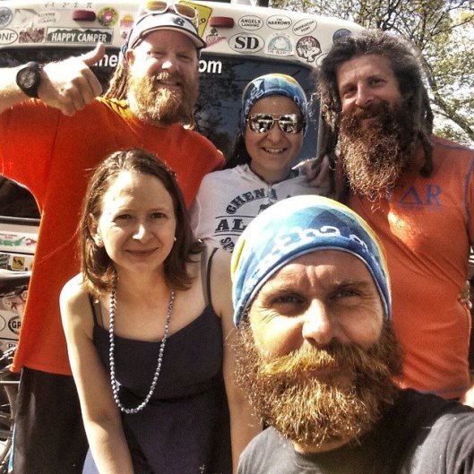
You’ve heard of ski bums.  Maybe you were one.  It never ceases to amaze me how many people I meet in Colorado who tell me they originally moved here as a ski bum.  This photo captures running bums.  I grabbed it from Vanessa Run‘s FB site, hope she doesn’t mind.  Vanessa refers to such runners as dirtbag runners.  She actually co-hosts a site for dirtbag runners, so I’m not making this up.  Their Instagram site has some awesome running photos.  Vanessa is a classic running bum herself.  She lives out of an RV, runs trail races all over the continent, and writes the occasional running book like The Summit Seeker or Daughter’s of Distance.  She’s wearing the sunglasses.

I started thinking of running bums when my Austin running buddy Ken used the term to describe Jon as he caught me up-to-date on some guys we both used to run with back in the day.  Jon was one of my college cross country coaches at Texas State.  One of those coaches who runs with his charges.  He was only a few years older than the rest of us.  He was such a running bum.  He ate grass-fed smoothies decades before they were in vogue.  I never, ever saw him wear anything other than running sweats. To his credit, they were fashionable and not some Chariots of Fire gray cotton sweats.  To our dismay, he never washed them.  Jon smelled so bad, the entire team would have tears in our eyes when trapped in a van with him.  We drove once together from Central Texas all the way to Kansas.  Brutal.

Still, Jon was such a pleasant person.  He could talk about anything.  I imagine he still can. He became a letter carrier in Austin.  Ken brought him up to let me know Jon recently received a hip replacement and can no longer run.  Nightmare scenario for me.  I can’t imagine the impact on Jon.  He was such a running bum.  I don’t know that he ever won any of the big races but he was an elite athlete.  Running with him was an honor.  Bummer.

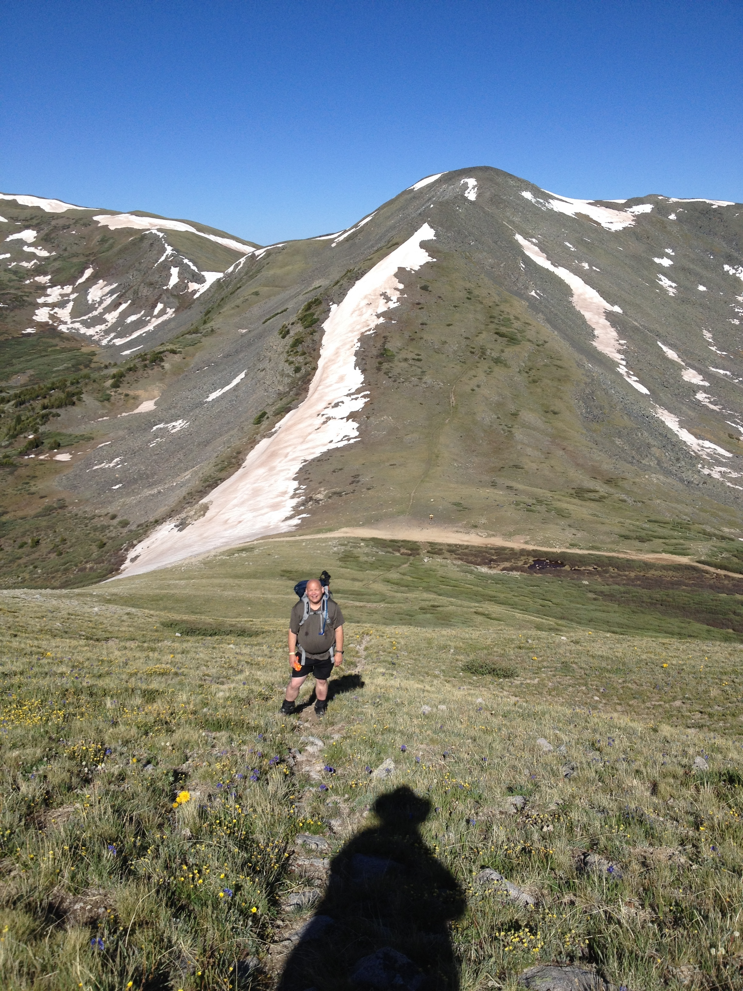
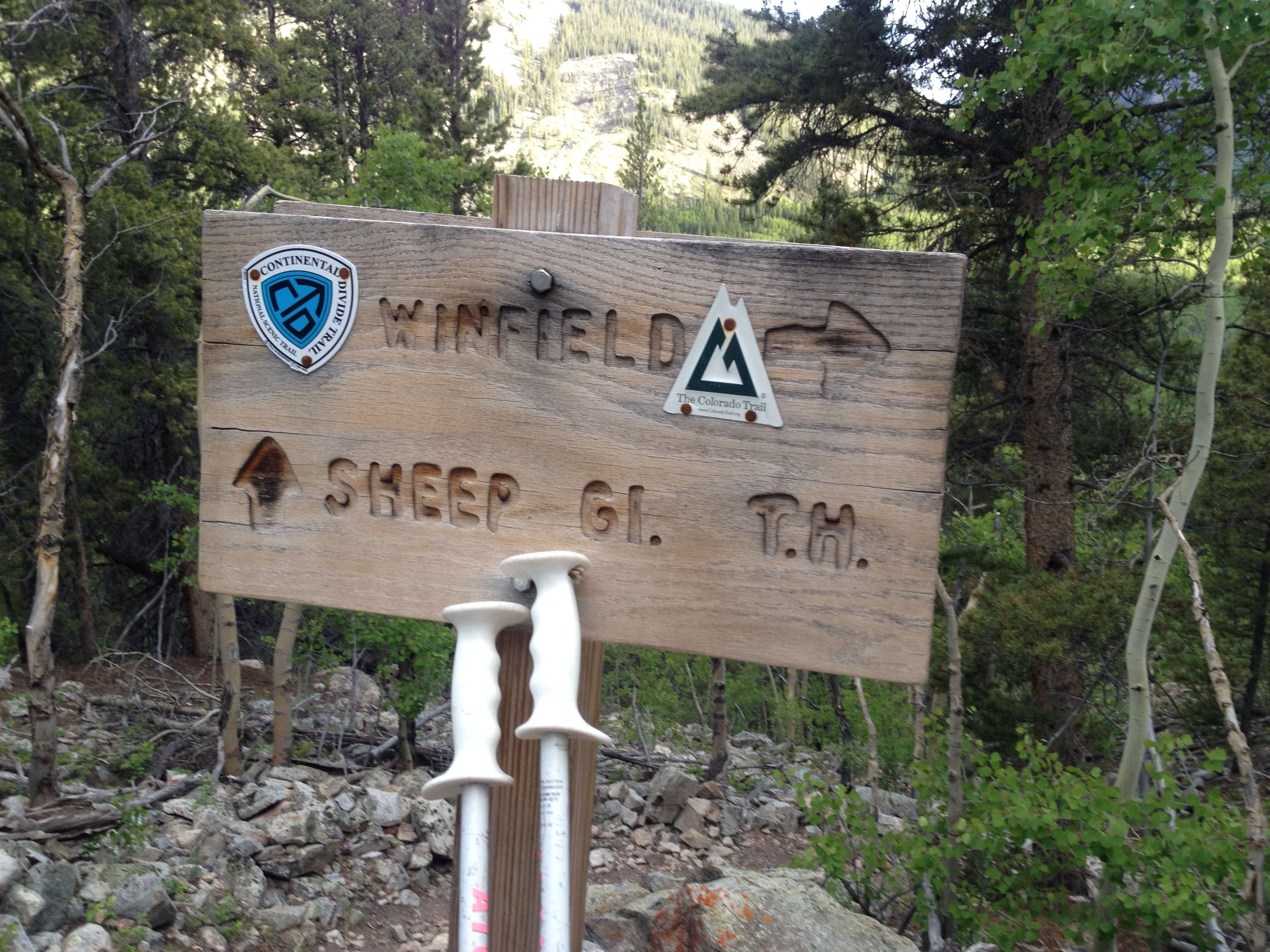
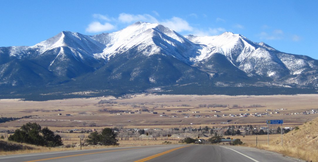
I wouldn’t mind becoming a running bum.  Not now, too many bills and commitments.  But in retirement.  I’ve been working on Karen to warm her up to the idea of moving to somewhere like Buena Vista.  That would put the Colorado Trail and the Collegiates at my doorstep.  Some of the finest trail running to be found anywhere in the world.  I could retire there.  Karen points out the tough winters and lack of nearby medical facilities at a time in our lives we might visit doctors more regularly.  I don’t know.  Fairly certain old people live there.  Old running bums.

Share this:

  • Facebook
  • Twitter
  • Pinterest
  • LinkedIn
  • Reddit
  • More
  • Tumblr
  • Email
  • Print

Like this:

Like Loading...

Tincup Pass

06 Sunday Jul 2014

Posted by Ed Mahoney in Colorado Trail

≈ Leave a comment

Tags

Asian Palate, Buena Vista, BV, CDT, Collegiates West Loop, Colorado Trail, CT, Deerhammer Distillery, high school reunion, Mirror Lake, Tin Cup

Mirror LakeWe sleep in to almost 5:40 this morning.  Today is a recovery day.  We breakfast again at the Roosters Crow Cafe because it was that good the first time.  I keep it light and only order one plate this time around.

First stop after breakfast is the Mount Princeton Hot Springs near Nathrop – a few minutes south of BV.  This hotel and spa is located along Chalk Creek and sits only two miles east of the eastern loop of the Colorado Trail.  Once there we acquire day passes to the spa.  First order of business is a shower and shave.  This spa is a little oasis in the wild.  We receive big fluffy towels and robes, razors and combs, and libations.  After we clean up, we spend the morning lounging in multiple hot springs of various temperatures and drinking Bloody Marys.  The bartender runs them through a juicer which we don’t exactly approve of, but drink willingly anyway.  Mike and I schedule treatments for mid afternoon while La Plata does laundry.

tincup passAfter a late lunch we drive back over Cottonwood Pass, leaving my car at the trailhead on top and take La Plata’s four wheel drive truck down into Tin Cup.  We camp along Mirror Lake for a continuation of our epic adventure.  The first photo above is of our early morning rise with the trail off to the left of the lake and Tincup Pass in the background.  This photo is at the top of the pass, but we’re not yet done climbing.

ascentWe could stop here but instead determine to mount our first peak of the trip.  It’s unnamed but rises north of the pass another 1100 feet. The jaunt to the pass itself was about three miles and took us only an hour bearing lighter packs.  The climb up this unnamed peak is less than a mile but takes nearly another hour due to a steep slope.

Mike leads us to the top and the views are impressive.  This is the Continental Divide and we can see both sides.  Crested Butte fifty miles to the west.  Aspen’s Maroon Belles to the north.  God’s country everywhere.  At over 12,000 feet, possibly heaven.  The descent is tough on the quads and knees but quick.  I leverage my trekking poles for stability.  We reach Mirror Lake in another hour and this completes our shortest day to date.  We head back over Cottonwood Pass Road for lunch at K’s Burger joint in BV.  We run some errands and actually I forget what all we did for the afternoon.

panoramic

Soon enough, we find ourselves sitting at the bar in the Deerhammer Distillery on Main Street – which is also Cottonwood Pass Road.  Lenny serves us their products paired with stories.  We learn that whiskey begins as beer mash, but is then distilled.  We first drink Whitewater Whiskey which is, well, white.  Or clear to be more exact.  There is no color because it spends very little time aging in an oak cask.  We follow this up with a more traditional oak-aged whiskey.  A single malt named Down Time.  Our final tasting is of a gin distilled over very unique botanicals.  With this knowledge of their stock, we order more Bloody Marys fueled with Deerhammer Gin.

Deerhammer DistilleryAfter happy hour, we cross the street to dine at the Asian Palate.  La Plata and I have been here before.  The three of us sit at the sushi bar to interact with the chef.  He relates to us how the finer dining scene in the Arkansas River Valley has pushed north from Salida into BV and might one day reach Leadville.  He’s a Vail transplant.  We eat our fill while mapping out a strategy for backpacking the next two days.  Our plan is for more day hikes like today.  The benefit being we are able to leave heavier gear like our tents and sleeping bags in the car.  Our packs will easily weigh less than half their original weight, and in fact do.  Before dusk, we ride back up Cottonwood Pass Road and find a nice camp spot at a trailhead to an older CDT trail route.  We’re learning our way around the Collegiates.  Tomorrow, we plan to begin from Cottonwood Pass and hike south as far as the snow allows.


Share this:

  • Facebook
  • Twitter
  • Pinterest
  • LinkedIn
  • Reddit
  • More
  • Tumblr
  • Email
  • Print

Like this:

Like Loading...

Hope Pass

29 Sunday Jun 2014

Posted by Ed Mahoney in Colorado Trail

≈ 2 Comments

Tags

America's Biggest Loser, Buena Vista, BV, CDT, Collegiates West Loop, Colorado Trail, continental divide, CT, high school reunion, Hope Pass, Mike O'Neill, Patagonia, Punky's Diner, Roosters Crow, RRHS, Salomon, Twin Lakes, wieght loss training

Punkys DinerTogether with two friends, Mike and Rob whom I have known for 38 years, I set out last weekend to hike the Collegiates Western Loop of the Colorado Trail, where it follows the Continental Divide Trail west of Buena Vista.  We met up in BV for BBQ at Punky’s Diner.  Very tasty.  Afterward we camped off Cottonwood Road since we were parking one of the cars here in the middle of our planned route.  In the morning we ate breakfast at the Roosters Crow Cafe and began our southbound trek just north of BV at Twin Lakes.

Mt ElbertThe Twin Lakes are perched at 9200 feet off Hwy 24 and 82.  We parked at the trailhead on the east side of the lakes and hiked the East Collegiate Loop CT well over a mile before reaching the intersection with the CDT and West Collegiate Loop.  This newly designated trail runs for about three miles relatively flat and then rises through Little Willis Gulch over the next four miles to 12,540 feet, peaking at Hope Pass between Mt. Hope and Quail Mountain. I am pictured here with Rob aside the Twin Lakes with Colorado’s highest peak, Mount Elbert, in the background.

scrambleCarrying a 35 pound backpack, the 16% grade up to Hope Pass was exhausting.  Despite the cool mountain morning air, I sweat profusely.  I rethink my decision to not whack off my hair before this excursion.  My three months of preparing for this effort consisted mostly of recovering from my surgery in early April.  Walking, then running, and pelvic floor exercises.  Man, I should have performed more leg weights and run some hills.  My travails are nothing though compared to Mikes’.

tree climbMike weighed 280 pounds when he committed to join us in early April.  He lost a little over 40 pounds in his three months of training.  Essentially, Mike was carting two additional backpacks in body weight than me up this hill.  I wasn’t sure if this hike would be possible for Mike.  Boy was I wrong.  America’s Biggest Loser could not have pulled off what Mike accomplished.  Averaging one mile per hour, Mike completed 12 miles in 12 hours at two miles of altitude.  His FitBit reported his progress in terms of stair steps but otherwise lost its ability to accurately record the extreme results.

impassThe trail over Hope Pass was buried under impassable snow.  Rob lead us in a path that bushwhacked around the snow field. The Colorado Facebook page warned hikers that the Western Loop was still impassable due to such snow fields.  With Rob, trail name La Plata, we were undeterred and ultimately reached the summit.

Hope Pass SummitThis was Mike’s first such summit, but only the first of many passes and saddles that lie before us.  Despite our initial qualms, La Plata and I put our doubts aside about Mike’s ability to hike this trail with the unrelenting demonstration of will power required to mount this pass.  For Mike, the views reinforced his commitment and confidence to continue forward.

descentWe were then presented with a steeply dropping trail on the south side of the pass, three miles through switchbacks along Sheep Gulch – down into Clear Creek which lays between 9800 and 10,000 feet.  It’s beyond me how runners of the Leadville 100 run over this pass in both directions as part of that storied ultra.  The four mile ascent, nine miles total for the day, left us with very little strength for the descent.  Our trekking poles kept us steady despite fatigued knees and burning thighs.  Eventually, after a grueling plummet down Sheep Gulch, we reached a restful spot to make camp.

Sheep Gulch THWe took stock of our accomplished day as we setup our tents and replenished our water supplies.  Mike and I were both quite pleased with some of our recent purchases – namely our Patagonia puff jackets and Salomon hiker boots.  Mike was mixed on his collapsible trekking poles – they can be an irritating burden at times.  And he didn’t care for the Epic protein bars although I absolutely loved them.  200 calories of tasty meat.  Yum.  Ending the day exhausted, there would be no campfire.  I’m not sure we even made it to campers midnight – 9pm.  We retired early and prepared for day two which would include another 12,000 foot pass above Lake Ann.

Share this:

  • Facebook
  • Twitter
  • Pinterest
  • LinkedIn
  • Reddit
  • More
  • Tumblr
  • Email
  • Print

Like this:

Like Loading...

Collegiates West Loop

21 Saturday Jun 2014

Posted by Ed Mahoney in Colorado Trail

≈ 2 Comments

Tags

AT, Buena Vista, BV, CDT, Clear Creek, Collegiates, Collegiates West Loop, Colorado Divide Trail, Colorado Trail, Coney Island, CT, DIA, high school reunion, Hope Pass, La Plata, Mike O'Neill, PCT, Robert Graham

mt-princeton-coloradoI leave for the airport in another hour or two.  I will pick Mike up this morning from under the Southwest Air Arrivals sign at DIA.  His Southwest Flight 4316 from Austin arrives at 10:15am and he should be standing there by 11am.

I’ll bring along a photo album of my 500 mile Colorado Trail hike with Rob from three summers prior for Mike to peruse on the drive to Buena Vista.  We’ll take Hwy 285 which I find more scenic than I-70.  The two routes are equidistant.  I plan to begin telling tales of the danger and pain that Mike can expect over the next week of backpacking.  For instance, I’ll inform him, “Trailheads invariably reside along creek beds so that, regardless of direction, you begin hiking uphill.  Your calves go numb after a half hour and never really thaw out the rest of the day.  Whatever remains of your burning thighs is completely shredded on the subsequent thirty minute downhill.  All you will think about for the next eleven hours is dinner to refuel your unsustainable calorie burn.”  Mike will no doubt attempt to change the subject but I’ll maintain this dialog the entire three hour drive to BV.  I’ll watch for the color to drain from his face when he spots the massive 14ers that will dominate our windshield coming down out of the canyon into BV.  I’ll tell him these are the foothills to where we’ll be backpacking on the Continental Divide Trail further west.  If Mike begins to feign altitude sickness, I’ll change the topic to dinner.  “Want to do Sushi tonight?  There’s a place on East Main Street called Asian Palate.  They pour a wicked Saketini.”

Unicoi GapI would of course only treat a good friend so poorly.  I met Mike in 1976.  Both our families recently relocated to Texas for jobs.  Mine from Iowa.  Mike’s dad worked for IBM and they moved down from Poughkeepsie.  Nearly everyone’s parents worked for IBM in our high school as IBM was turning off the lights in their New York factories and joining the sunbelt, tech crowd in Austin.  We first met on the football team.  Then basketball.  Then track.  We both realized we weren’t big enough for Texas football and joined the cross country team our sophomore year.  Running turned out to be our sport as we lead our team to State our senior year.  Making state in Texas is like making global in smaller states.

Mike went on to UT but later joined me at Texas State to run Cross Country for a year.  I believe he double-majored in either accounting or finance and information systems.  Mike, Rob and I got into triathlons after college for maybe a year or two and trained together.  Mike soon married, had kids and moved to Atlanta for a job.  We went twenty years without seeing each other until my firm acquired an Atlanta cyber security company and I began to travel there.

We hook up with Rob (trail name La Plata until he completes the CDT) in BV.  La Plata has solo through-hiked both the Pacific Crest Trail (PCT) and the Appalachian Trail (AT).  He section-hiked the Colorado Trail (CT) with me over a six month period in 2011.  This new 80 mile section of the CT that we intend to backpack coincides with the Continental Divide Trail (CDT) along the western side of the Collegiates, so La Plata is killing two birds with one stone.  He’ll hike the section south of Monarch Pass earlier today while Mike and I are driving.

CT and CDTRob moved to Texas his junior year, meeting Mike and me during our sophomore year – on the cross country team.  Both of Rob’s parents were IBMers.  Ironically, I’m the only one of us three to work for IBM now.  Perhaps not so ironic.  La Plata was an intense hiker even back then.  We nick-named him Trail Master during one of our storied camping trips to Pedernales Falls.  La Plata obtained his EE from UT and worked a few years for Lockheed before going back for a masters in education in physical fitness.  He married, moved around a bit – Seattle, then Portland – before settling in Colorado.  We’ve been hiking together since.  We always would say, “We need Mike to join us.”

Mike and I will find La Plata somewhere in BV.  We’ll shuffle his car to the trailhead atop Cottonwood Pass and descend back down to BV for dinner.  Mike and I will have lunched earlier on the road trip in Baily at Coney Island.  La Plata has a stealth camp setup near the Arkansas River where we plan to ensconce for the night.  Sunday, we’ll head for the Twin Lakes trailhead to launch an epic backpacking excursion.

40.137598 -105.107652

Share this:

  • Facebook
  • Twitter
  • Pinterest
  • LinkedIn
  • Reddit
  • More
  • Tumblr
  • Email
  • Print

Like this:

Like Loading...

The Gap

11 Sunday May 2014

Posted by Ed Mahoney in Colorado Trail, Running

≈ Leave a comment

Tags

Buena Vista, BV, Collegiates West Loop, Colorado Trail, continental divide, high school reunion, Hope Pass, Mt. Princeton Hot Springs

CanyonRan for the second day in a row.  I dressed in tights and a light jacket to withstand the blowing snow and 38°, but man it felt so good.  I can feel that I’ve lost my strength.  My speed is back at zero.  But I also can sense that I could regain my fitness fairly quickly with enough discipline.  Thirty days will not create too large of a gap to overcome before my next big event.  Of course, my next big event is no longer the Bolder Boulder on Memorial Day – I’ll be walking that with Ellie.  My next race is now set for the fall – the Boulder Marathon.  I took second in my age division last time around.  The goal this year is to maintain pace with my buddy Chris Price and try to win my age group.  This photo is of my last event two weeks before surgery – the Moab Half Marathon.

wild and crazy guysIf I broaden my scope beyond simply running, my next big event is really an 80 mile hike along the Continental Divide on the Collegiates West Loop of the Colorado Trail.  I’ll pick up Mike at DIA, Saturday morning June 21.  He’ll fly out from his home in Atlanta.  We’ll drive three hours directly to Buena Vista to hook up with Rob.  This photo captures the three of us preparing for a 10K road race 35 years ago in high school.  I know what you’re thinking.  I haven’t aged much.

Hope Pass saddleWe plan to start from Twin Lakes and hike south toward Monarch Pass. This is where Mike and I gain our trail legs. The Twin Lakes Trailhead sits at 9200 feet off Hwy 24 and 82. The trail leads south/southwest and rises through Little Willis Gulch over the next six miles to 12,500 feet, peaking at Hope Pass (pictured here) – which is the highest point of the Leadville 100 trail run. This is an average 10% rise, which at altitude will have Mike and me breathing as hard as if we were running. I only mention me and Mike because Rob is a mountain goat.  The trail then drops steeply, three miles through some switchbacks along Sheep Gulch down into Clear Creek which lays between 9800 and 10,000 feet. This 16% down slope should sufficiently shred all our knees. We’ll end our first day either here in Sheep Gulch or a few miles down along Clear Creek and set up camp.

We follow Clear Creek west along the Pack Trail for three miles and veer left (south) at the South Fork. We follow this course and reach Lake Ann after six additional miles. Assuming this is day two, we might rest here at 11,800 feet for lunch. We start up again heading south and rise up to a saddle at 12,600 feet after another mile.  We quickly drop back down to 11,000 and bounce along a series of undulations between 11K and 11,200 feet before settling around 11,400 feet along the Timberline Trail. After eight and a half miles, we drop through Prospector Gulch to Texas Creek. This puts us back onto Pack Trail and we follow the creek for another four miles before crossing it. We could camp out somewhere within those four miles. After crossing Texas Creek, we rise up above treeline and continue for yet another four miles, veering onto the South Fork of Texas Creek until we reach Cottonwood Pass which sits at 12,200 feet. One of our cars will be parked here with a cooler of libations.

We’ll shuffle a car down to Monarch Pass, likely adjust our gear, and then eat a real dinner in BV.  If we have time, we’ll also squeeze in a bath at the Mt. Princeton Hot Springs.  The second forty miles of our backpacking trip will continue from Cottonwood Pass and end at Monarch Pass.  The average elevation will hover at 12,000 feet.  Despite it being the end of June, at this altitude there will be snow.  The entire 80 mile hike will take either five or six days.  We have enough time in our plan for contingencies.  I agreed to this get together just after my surgery while still sporting a catheter tethered to my bladder.  A boy needs goals.  I had no ideal then if I’d be prepared but now that I’m running again I feel fully confident I can hang with these guys.  Time to close the gap.


Share this:

  • Facebook
  • Twitter
  • Pinterest
  • LinkedIn
  • Reddit
  • More
  • Tumblr
  • Email
  • Print

Like this:

Like Loading...

CPTR

29 Sunday Apr 2012

Posted by Ed Mahoney in Running

≈ 2 Comments

Tags

BV, CPTR, sara

Airplanes typically maintain cabin pressure at an equivalent altitude of 6,900 feet, by pumping pressurized air into the aircraft.  This is to avoid hypoxia, altitude sickness, decompression sickness and barotrauma.  The starting line to the Collegiate Peaks Trail Run hovers at about 8000 feet – and routes runners upward from there.  Actually there was a small dip the first half mile down to the river crossing, the rest seemed forever uphill with over 3000 feet of elevation gain.

I met Rob in Buena Vista Friday evening.  We listened to some of the pre-race prep at the information session at 7pm, then we went to eat some pizza at the Eddyline Pub.  The place has pretty good food.  Pizza was outstanding.  Our waitress Sara sat with Rob for a picture.  This was walking distance from the Community Center where the race will start and where we heard the pre-race information session.  We stealth camped within walking distance yet again.  There were a few RVs and other runners camping in their cars.  We chose to setup our tents.  Being so close to the race start would be convenient considering the gun fires at 6:30am.

We woke at 4:30 and I discovered what gear I forgot at home. First was my coffee cup.  It fell out of my camping bucket after my Moab trip and ended up in a kitchen cabinet – where it still sits.   I used an empty Gatorade bottle for my coffee.  Worked out ok.  As we were gearing up, I learned that I also forgot my gators.  I figured they probably weren’t critical and turns out they weren’t.  Would have been nice though.  It’s difficult determining what to wear that early in the morning when it’s still cold out but I planned to wear the long-sleeved tech t-shirt I got with my race packet.  I added my short-sleeve tech t-shirt I got from the Moab race as a bottom layer to cut the wind.  I was able to take off the bottom shirt later as I warmed up.

My big decision was on shoes.  I seriously wanted to wear my new Merrell’s but my recent foot injury precluded that option.  I needed some cushion.  I went with my road training shoes over my trail shoes.  I had the impression these trails wouldn’t be too technical and my road shoes are softer.  I’m pretty lucky to be able to run at all.  I had to take off two days from running after straining my foot.  Then I ran 3 miles Tuesday followed by 7 miles Wednesday wherein my foot hurt too much again to run Thursday or Friday.  I drove out here on faith that I’d be able to put some pressure on my foot.

My new Camelbak running vest helped keep me warm as we queued up for the run.  There could not have been much more than 300 runners.  These ultras are smaller affairs.  Everything’s different about an ultra.  The runner’s all look amazing.  I love to see a crowd like this of such fit people.  The age skew is definitely older.  And I would guess over half were women.  Mostly really pretty women.  I call this an ultra because while some of us are running 25 miles, others are running 50 today.

I’m blogging this before I receive pictures which is too bad because this is one of the most scenic courses I’ve ever run.  I wish I would have carried my iPhone to take my own shots.  Bad call leaving that behind.  But at least I didn’t lose it like I did my car key.  I stored my key in the vest pocket and it dropped out on the trail.  Thankfully a runner picked it up from the trail and turned it into lost and found.

The trail and course were incredible.  We launched from the community center on a little bit of road but hit the trail quickly.  A funnel squeezed the line of runners after a half mile as we crossed the river but generally there was ample room to pass – even on the single track although there were lots of jeep trails.  The ground was rarely rocky and oftentimes sandy.  It was soft from rain earlier in the week.  The first half of the course provided the most awesome views of the Collegiate Peaks – simply spectacular.  Quite a few runners would stop to snap pictures.  The second half of the course wound through canyons on sandy river beds snaking through rocky walls on both sides.  The course was very well marked and easy to follow.

Many runners were willing to chat, especially after the line thinned out half way into the course.  An ultra has a different feel to it.  The participants enjoy what they’re doing.  It’s not a workout to them.  As hard as running 25 can be, these runners are in their essence and enjoying every minute of it.  I don’t know the science behind it, but women do very well at ultra distances.  And I think of the younger runners at this event, most were girls.

My biggest pain in this race was from my shorts chaffing my legs.  There wasn’t any vaseline at the aid stations so I had to tough it out.  Otherwise the aid stations were perfectly positioned about every four miles and offered good food and drink.  My legs were completely spent by 18 miles and it reminded me of the IPR where the last 7 miles were downhill.  Thankfully the down slope was rarely steep, unlike Telluride.  I was surprised I did some downhill walking but my legs were that exhausted.  I even walked a bit of the final mile.  If you look at the garmin results I linked above, you can figure I was mostly walking anywhere the mile split is over 15 minutes.  My time was 5:33 (a 13 minute per mile pace) which is what I expected to run and I’m pretty happy with it.  With two big climbs, this course isn’t easy, but it’s possibly one of the most beautiful in Colorado.  As bonus, BV has some good eateries.  From the town to the runners and race direction, this event is an outstanding experience.  Highly recommended.

40.137598 -105.107652

Share this:

  • Facebook
  • Twitter
  • Pinterest
  • LinkedIn
  • Reddit
  • More
  • Tumblr
  • Email
  • Print

Like this:

Like Loading...

CT Cronica: The Collegiates

24 Sunday Jul 2011

Posted by Ed Mahoney in Colorado Trail

≈ 1 Comment

Tags

Buena Vista, BV, camelbak, Chaffee County, Jans Restaurant, KSBV 93.7, Mt. Princeton Hot Springs, Quincys, South Park

You drive out of the Interlocken parking lot after meeting with a business partner at 5:35pm on Thursday.  And you take two more work calls while driving on Hwy 36.  This is not the early start for Buena Vista you were hoping for, but you get lucky with traffic and find yourself driving once again on Hwy 285.  You recall what a milestone it was to cross Georgia Pass on segment 6 and leave behind Hwy 285 for I70 and Hwy 9 and highways 91 and 24.  But now that the CT trail heads are down by Buena Vista it makes sense to take 285 out of Denver again.  It really is a scenic drive, certainly beats the tunnel.  Plus, Salida/Buena Vista has Colorado’s most badass classic rock station ever and as you reach South Park you tune to 93.7 KSBV.  You reach the North Cottonwood Creek/Silver Creek Trail Head around 8:35, just as darkness is setting in.  You believe the Guidebook is incorrect in that this is the Silver Creek Trail Head, while the North Cottonwood Creek TH is another 1.5 miles up the road.  A good reference for Chaffee County trail heads to access the Collegiate Wilderness Area is at this web site.  Regardless of trail heads, Chaffee CR 365 borders on the need for 4WD.  Fortunately you see Tumbleweed parked at the Silver Creek TH and pull up alongside his car.  He chuckles when he sees you in business dress.  You are taking Friday off to squeeze in a massive 3-day, 61 mile hike through the Collegiates, but it sort of sucks to have to work so late and show up like this.  Not a biggie though.  There’s just enough time to setup your tent before total nightfall.

Your late arrival isn’t critical because you won’t shuffle cars tonight.  Instead, you plan to take breakfast at an early open diner in BV (you learn the locals refer to Buena Vista as BV).  You do have time to chat and drink a beer before going to sleep.  Tumbleweed tells you some of his AT and PCT hiking stories.  Surprisingly you have yet to hear them all.  In the morning you drive into BV on Crossman Street and turn right onto Main Street.  You stop at the first open diner that appears good based on the parking lot being full.  You enter Jans Restaurant and discover mostly only old people eat breakfast this early.  No matter.  You order a short stack of blueberry pancakes with a side of bacon and coffee.  They’re fantastic and too big to finish.  You drive off for the Clear Creek Trail Head north of BV near Granite feeling like it will take today’s 18 miles to put a dent in that breakfast.  Having finished segment 11 at this trail head, you knew it would not make a decent spot to camp.  There’s parking for only 3 cars, although countless cars can park alongside the road.  There are no trees and the ground looks very uninviting.  That’s Tumbleweed pictured next to a cairn at the Clear Creek TH waiting on you to gear up.

You start off today with a little running but very soon, after you cross a new footbridge, the slope increases dramatically.  The guidebook states you’ll climb for 1.5 miles, drop, then repeat a slightly higher climb.  These two climbs make up the first half of today’s hike with the remainder a low drop into your camp site.  You think of this in runner’s math of two quarters followed by a half.  You note how strong and refreshed you feel starting out.  The only injuries nagging you this year have been in your feet, plantar fasciitus in your left foot and some sore toes on your right.  You don’t feel any of this now.  The first slope is sufficiently steep enough to make your lower buttocks burn.  But you maintain a decent pace throughout the hills.  Nearly halfway though the CT you’ve developed your trail legs and can maintain cadence despite terrain.

After running out of water on segment 11, you determine to only drink from your 2 liter camelbak on this hike.  When that’s empty, you’ll have your two water bottles.  This way if you do in fact empty your camelbak, you’ll have a measured amount of water left that you will be able to control based on the remaining distance.  No surprises.  It’s a mistake to drink from the water bottles first and end with the camelbak.  This hike goes well though and although you do deplete your camelbak’s 2 liters, you don’t finish all your bottled water.  Perhaps because you’re shaded much of the hike.  You rise above treeline for a short spell on the highpoint at around 9 miles, but then you duck back under the branches for the remaining 9 mile downhill.  The second half does throw in some surprise hills, but you average a 4 mile an hour pace the final 10K, which is pretty decent for mountain hiking.  This is because you run most of the second half of today’s hike.  And you planned to run it, but had it not been for Tumbleweed taking charge after the trail top you might have continued walking.  Your legs were stuck in their walking cadence and you completely forgot about running.  You might have also been thinking about pacing yourself for the 3 days.  A little preventative pain management.  You have no idea how your legs, and especially your feet will fair over the course of 3 days and 61 miles.  You finish today with tender feet and soak them in the icy cold creek for relief.

This is applied pain management.  The water is cold to the point of nearly stopping your heart as you enter the creek.  It even continues to burn a bit after you exit the natural ice bath.  This should stop the swelling.  And if that’s not enough, after shuffling the second car, you stop off at the Mt. Princeton Hot Springs for some hot bath treatment.  This is brilliant and you soak in those hot springs for a good hour.  This should prepare you for tomorrow’s longer 22 mile hike.  You consider adding this to your routine tomorrow as well since you’ll finish near here.  Refreshed, you head to Quincys for dinner, based on the recommendation of some locals you met on the trail.  Ironically, the same old people you ate breakfast with at Jans are dining here as well.  You really do keep early hours on these hikes.  The menu is simple at Quincys – prime rib or roast sirloin.  Since the menu says “roast” sirloin, you opt for the prime rib.  This is a satisfying dinner and you sleep really well afterward.  Two more days of hiking the Collegiates await you if your body sufficiently recovers.  You’ll see how you feel in the morning.

40.137598 -105.107652

Share this:

  • Facebook
  • Twitter
  • Pinterest
  • LinkedIn
  • Reddit
  • More
  • Tumblr
  • Email
  • Print

Like this:

Like Loading...

Search this blog

Categories

Buy Full Spectrum Cyberwar at Amazon

Buy Cyber War I at Amazon

Buy on Amazon India for ₹99

Buy on Amazon U.K. for £2.27

English Edition on Amazon Germany

Buy on Amazon Brazil for R$11.29

Archives

Blog Stats

  • 134,401 hits

Girlfriend Cult

Recent Comments

georgeschools on Last Run of the Year
Anonymous on Last Run of the Year
asustainablesunrise on Christmas, for me…
asustainablesunrise on Craft Shopping for Christ…
georgeschools on Craft Shopping for Christ…

Recent Posts

  • A Runner’s Day January 7, 2023
  • Last Run of the Year December 31, 2022
  • Christmas, for me… December 26, 2022
  • Craft Shopping for Christmas December 10, 2022
  • A Slow, Late Fall Run November 25, 2022
  • November Runs November 20, 2022
  • Tech Debt November 19, 2022
  • The Runner’s Field of Battle November 13, 2022
  • Stealin’ from God October 24, 2022
  • A New Start October 23, 2022
  • Baby Margot Birthday October 9, 2022
  • The City of Flowers September 24, 2022
  • Dog Park by the Sea September 19, 2022
  • The Lane of Pain September 17, 2022
  • Run Rabbit Run August 28, 2022
  • Wild Horses August 21, 2022
  • The Day Running Died August 17, 2022
  • Boulder Marathon Training – Week One August 7, 2022
  • Mount Sanitas July 30, 2022
  • The Trail and Me July 23, 2022
  • Mount Zirkel Wilderness July 13, 2022
  • Full Team Hike July 4, 2022
  • Village to Village July 3, 2022
  • Beaver Creek July 2, 2022
  • Summer is Here June 12, 2022
  • Birthdays May 22, 2022
  • Fall River Road March 25, 2022
  • A Tale of Two Gerasimov’s March 11, 2022
  • The Hero February 26, 2022
  • Full Spectrum Cyberwar February 24, 2022
  • Run Nan, Run February 20, 2022
  • Running Sunrise to Sunset February 13, 2022
  • Cyberpunk Runner February 5, 2022
  • A Winter’s Run January 15, 2022
  • Turkmenistan January 2, 2022
  • Counting Families at Christmas December 26, 2021
  • Austin Boardwalk December 23, 2021
  • Like Christmas for the First Time December 19, 2021
  • Restoration November 27, 2021
  • India Kinks November 15, 2021
  • Run a Little, Write a Little November 6, 2021
  • Horizons October 30, 2021
  • The Vitality Kick and other Abnormal Obsessive Behaviors October 19, 2021
  • The Ten Week Plan October 11, 2021
  • Pearl Street Marathon October 10, 2021
  • Confidence Builder October 2, 2021
  • Margot Faye September 25, 2021
  • Due Day September 12, 2021
  • Beats per Minute September 6, 2021
  • Reality and Running September 5, 2021

Colorado=Security

Blogroll

  • Alohawk's Blog
  • Barbie's Blog
  • Boggy Creek Lumpster
  • George Schools Blog
  • I, Cringely
  • Prostate Chronicles
  • Shut Up + Run
  • Sustainable Sunrise
  • The Rogue Botanist

Web Sites

  • Amazon Author Page
  • Austin Marathon
  • Bolder Boulder
  • Brit's YouTube Songs
  • Colorado Marathon
  • Colorado Runner Magazine
  • Colorado Trail
  • Girlfriend Cult
  • Lobo Media Ltd
  • My YouTube Site
  • Race Pace Calculator
  • Shoes & Brews
  • Trail Runner Magazine
  • Zaremba Graphic & Web Solutions

Goodreads

Top Posts & Pages

  • Sucker Punch
  • Foot Fetish
  • 2011 Roadmap
  • Big Girl Pants
  • Wolf Mountain Trail

Top Clicks

  • edmahoney.files.wordpress…
  • edmahoney.files.wordpress…
  • runsignup.com/Race/UT/Kan…

RSS Feed

  • RSS - Posts
  • RSS - Comments

Blog at WordPress.com.

  • Follow Following
    • A Runner's Story
    • Join 245 other followers
    • Already have a WordPress.com account? Log in now.
    • A Runner's Story
    • Customize
    • Follow Following
    • Sign up
    • Log in
    • Report this content
    • View site in Reader
    • Manage subscriptions
    • Collapse this bar
 

Loading Comments...
 

    %d bloggers like this: