• Home
  • About

A Runner's Story

A Runner's Story

Tag Archives: hiking

Red Rocks

15 Sunday Aug 2021

Posted by Ed Mahoney in Britt&Eric, Colorado Trail, Ellie Rose

≈ 1 Comment

Tags

hiking

The family that hikes together, in my experience, brunches together. Which is what we did today. It’s never occurred to me to hike Red Rocks before, the trails aren’t exposed at night when I’ve gone there for concerts. But Red Rocks has an extensive, family-friendly trail system.

Ellie’s sorority house is only a ten minute drive away, so we picked her up and met Brit and Eric at the Trading Post trailhead. The Trading Post trail is a 1.5 mile loop around spectacular red rock formations. Very little shade so consider wearing a hat.

Share this:

  • Facebook
  • Twitter
  • Pinterest
  • LinkedIn
  • Reddit
  • More
  • Tumblr
  • Email
  • Print

Like this:

Like Loading...

Mount of the Holy Cross

22 Sunday Sep 2019

Posted by Ed Mahoney in Colorado Trail

≈ 2 Comments

Tags

hiking

Kirby Cosmos

Rob and I met up at Kirby’s Cosmos BBQ, Friday in Minturn, a few miles past Vail.  We later dispersed-camped in the Holy Cross Wilderness.

rob

We woke early and hit the trail at 6:30 am, when there was enough sunlight to hike without headlamps.  We first drank coffee under the moon and stars, unfiltered from the light pollution of cities in the clear 35° air.

rob 3

Saturday’s objective was to summit Mount of the Holy Cross, a fourteener south of Vail.  The twelve mile, roundtrip trail started at the Half Moon Trailhead.  It consisted of two hills, the first was a thousand foot climb, the second was a three thousand foot ascent.  The aspen were just turning bright yellow.

aspen

We passed by two tired women descending almost as slowly as we were climbing. This section of trail resembled a steep staircase.  One of them called out, “It’s easier in the rocks.”  Most everything above tree line was a boulder field.  I can’t explain why she said it, or what she meant by it.  When is hiking through the rocks ever easier?

rob n ed 2

Near the end of the hike, we saw a couple of hikers stopped on the trail ahead of us, apparently talking.  As they saw us approach, they departed, going separate directions.  The one hiking toward us turned back around and shouted to the other, “You should also look into the Ten Commandments.”

As he neared us, I saw that much of his outfit, including hat, sunglasses, scarf and shirt, were all sporting a red, white and blue striped pattern.  And he might have been wearing make-up.  Very eye-catching.  He looked as if the clown in Stephen King’s It made babies with Uncle Sam.  There was something off with this guy.  He was either going to start preaching the Bible to us, or shred us with an AK-47, but he passed without incident.

rob n ed

Hikers, in their trail reports, generally describe this as an exhausting hike.  It was.  It was six miles of vertical in each direction, with about 5500 feet of elevation gain, and took us close to nine hours.  There’s camping at the trailhead, but an even better camping spot along a creek after the first hill.  That would make reaching the peak before sunrise more doable.  Incredibly beautiful views and a memorable hike.


Share this:

  • Facebook
  • Twitter
  • Pinterest
  • LinkedIn
  • Reddit
  • More
  • Tumblr
  • Email
  • Print

Like this:

Like Loading...

Sky on Fire

16 Sunday Sep 2018

Posted by Ed Mahoney in Colorado Trail, Running

≈ 2 Comments

Tags

bulletproof, CDT, Colorado Wildfires, continental divide, hiking, Never Summer Wilderness, RMNP, Willow Creek Pass

Never Summer

La Plata and I rejoined for a second hike this summer along the Continental Divide Trail.  We met at the Bowen Gulch trailhead off Hwy 34, inside the Rocky Mountain National Park.  We left my car there for our finish and drove through Granby for Hwy 125, which took us up to Willow Creek Pass.

The yellow and burnt orange aspen were much thicker here than in RMNP.  La Plata said the colors were incredible between Durango and this valley.  Their color was echoed by the sun setting under plumes of smoke from the Kremmling fire as we drove up the pass.  The smoke filtered blues on top of hot pinks, mirroring the inferno below, telling the story of our summer with the sky on fire.

Willow Creek Pass

We set off at 6:30am and tracked forty-five minutes of fast-paced progress before I discovered I’d left the keys to my car back in La-Plata’s car at Willow Creek Pass.  This added ninety minutes to our twenty-two mile trek, and a good four more miles.  Today would be a marathon.

IMG_2595

I discovered a new 200 calorie snack bar that I highly recommend – Bulletproof.  I ate their lemon cookie for breakfast.  Yum.  I doubt there is anything else on the health food market anywhere close to this tasty.  The Kremmling fire smoke is in the picture below – those aren’t clouds.

Bowen Pass 2

Hiking with La Plata is like trail running with anyone else.  Fortunately, the section of the Continental Divide Trail between the Willow Creek trailhead and Bowen Gulch near Grand Lake is mostly below tree line.  My breathing seemed good despite the altitude and La Plata’s torrid pace.  He schooled me with this unyielding pace for the earlier blunder with the keys, not slowing down until we crossed Bowen Pass, our high point a little above treeline.

Bowen Pass

Can’t thank him enough.  Always the coach, and actually a personal fitness instructor, this training will serve me well for the three days of trail half marathons in Utah and Arizona next month.  I did have to run at times to catch up with La Plata in the early going.  I took advantage of downhill sections of trail.  We maintained a strong two mile per hour pace.  That’s good for high altitude mountain trails.  Standard walking pace is about three miles per hour.  I don’t expect the Trailfest to be nearly this challenging, except that it’s three days in a row for a total of thirty seven miles.  Recovery will be paramount.

IMG_1672

I missed the photo-taking for Ellie’s homecoming dance.  The kids looked good.  The first photo is with Ellie and her boyfriend Will at Chautauqua.  The second is the group shot.

IMG_1346 (1)

Share this:

  • Facebook
  • Twitter
  • Pinterest
  • LinkedIn
  • Reddit
  • More
  • Tumblr
  • Email
  • Print

Like this:

Like Loading...

Zion

20 Tuesday Sep 2016

Posted by Ed Mahoney in Colorado Trail

≈ Leave a comment

Tags

Capitol Reef, Dixie Forest, hiking, Kiva Koffeehouse, petroglyphs, trails, Utah, Zion

narrows-11

Half way between California and Colorado is Zion. So Brit and I booked a night at the Cable Mountain Lodge near the entrance to the park.  We rose before the sun to squeeze in a hike through the Narrows.  The first mile was paved.

narrows-1

The trail disappeared with the sidewalk.

narrows-3

Surely, the trail will pick back up around the next curve in the canyon.

narrows-12

Brit wades deeper.  The trail guide did say something about expecting to get wet.

narrows-7

And to guard against hypothermia.  The sun is slow to warm up the canyon.

narrows-5

We hiked up the Virgin River for maybe a quarter mile.  The cold, deep water didn’t turn us back.  The canyon walls drew us in like sirens to the rocks.

narrows-8

But we had to get home to Colorado by nightfall.  We’ll return for sure to Zion when we’re not just passing through.

sandstone

We skipped the high speed Interstate for Hwy 9 through the park, connecting later with highways 89 and 12, traversing Escalade, Boulder, the Dixie National Forest and Capitol Reef National Park.  A virtual lifetime of vistas.  Barely out of Zion, just past the tunnels, we saw a rock that had to be climbed.

sandstone-2

Brit preferred walking the sandstone barefoot to her sandals.

sandstone-4

She finally made it to the top, after me.

sandstone-8

Brit celebrated her climb with a namaste.

pride-rock

I just did my best to keep my balance.  I don’t have words to describe the splendor of our remaining drive through Utah.  We saw flaming orange aspen in the Dixie Forest and petroglyphs in the cliffs of the Capitol Reef rocks.  If you get a chance to drive between Colorado and California, do yourself a favor and skip the Interstate. Take the scenic byway.

Share this:

  • Facebook
  • Twitter
  • Pinterest
  • LinkedIn
  • Reddit
  • More
  • Tumblr
  • Email
  • Print

Like this:

Like Loading...

Booth Lake

04 Monday Aug 2014

Posted by Ed Mahoney in Colorado Trail

≈ 2 Comments

Tags

hiking, mountain wildflowers, Vail, Vail Cascade

trailheadBrit joined us up in Vail last night.  That means a new hiking partner.  And Brit’s not afraid to take on the big ones.  We launch from the trailhead to Booth Lake by 8am.  This trail is easily the most recommended by the Concierge based on the conversations I overhear as I walk by.  And the trail guide suggests it’s a favorite of tourists.  Fit tourists anyway.  This puppy rises 3000 feet in four miles.

aspen and rockThe trail begins its steady 4.5 mile rise through old growth Aspen.  There is one other lone hiker who parks alongside us at the trailhead.  He starts out about five minutes ahead of us.  Brit quickly finds a rock.  We both agree it has a certain “Pride Rock” quality.  We encounter a trio of hikers descending.  They ask us if we are headed to the lake or just the falls – which are only about two miles up.  We respond with the lake and they say it’s well worth it.  Brittany leads most of the hike and holds a 29 minute pace the first mile.  The girl is in shape.  My legs have yet to recover from yesterday and I find myself struggling to keep pace.

treeThe Aspen yield to thick Spruce after an hour of hiking.  Brit finds this uprooted tree pretty cool.  Not sure if the picture captures it (you might need to click to enlarge it) but these split roots look awesome on the trail.  The trail is mostly dry but the steepness make it challenging anyway.  There is a bit of mud and several fun creek crossings.  Brit is happy she borrowed Ellie’s waterproof boots.

Booth FallsWe arrive at the falls after about two miles, or an hour, of hiking.  We suspect most hikers only make it this far.  The grade is challenging.  This photo captures one of the first set of falls.  A later set is much more dramatic but also more difficult to photograph with a live person in the picture.  The trail increases its slope after these falls and nice views open up behind us of the Holy Cross Wilderness Area above Vail Mountain.  After three miles, we begin to see the moraine in the Gore Range where this trail will ultimately lead us.  The slopes still hold snow.

meadowThe vegetation along the trail is lush.  We see many of the same flowers we saw along the Lost Lake Trail, but a million times more thick.  The trail alternates between forest trees and meadows.  We see a deer bound through one meadow so fast we’re not certain what it is at first.  Brit suggested that maybe it was being chased by a mountain lion.  We then both agree that we think mountain lions are nocturnal.  This is what one usually says to avoid thinking about the potential danger.  The most amazing of all the wildflowers we see is this Colorado Columbine.  Imagine fields of them.

Colorado ColumbineThis is a great hike for sightseeing.  We see a beaver super up close.  He has bark all over his lips.  We see a couple of weasels.  A second deer near the lake.  And then for the first time ever on a hike, we see a mountain goat.  So cool.  We expect the lake to only be a 4.1 mile hike and become a bit discouraged as we near the moraine and never see it.  We keep thinking it will be over the next rise.  After 4.5 miles, we see it and are amazed.

booth lakeAlpine lakes have a way of taking your breath away.  Not just from hiking up to 11,500 feet.  This one is so pristine and serene.  There is still snow hanging over the shores.  And the water is crystal clear.  There is no one else up here.  We take a good 15 minutes to enjoy it.  We leave sooner than we care to because rain clouds are forming.

We hike pass tons of others on their way up, mostly below the falls.  Some are headed to the lake and we encourage them.  We understand why most don’t make it past the falls.  That’s a great hike too, for sure.  Reaching the lake is likely too much for the average tourist.  We both feel special for being able to see it today.

Share this:

  • Facebook
  • Twitter
  • Pinterest
  • LinkedIn
  • Reddit
  • More
  • Tumblr
  • Email
  • Print

Like this:

Like Loading...

Eagle’s Nest

03 Sunday Aug 2014

Posted by Ed Mahoney in Colorado Trail

≈ 2 Comments

Tags

fireweed, hiking, Vail, Vail Cascade

eagles nestI wore out my family yesterday.  The consensus for today’s hike is a ride up to Eagle’s Nest on the Eagle Bahn Gondola to hike the Fireweed Trail.  Sounds like a going-out-of-business sale at a dispensary.  I count a win for getting them out of their 500 count thread sheets and over-stuffed pillows before noon.  Perfect weather on top of Vail Mountain.  Full sun with a cool breeze.  Only a two mile loop, the Fireweed Trail might not be long enough to enjoy such a perfect day.

rope courseFireweed Trail is actually quite nice.  The sort of soft dirt and pine needles I love to run on.  We see several deer up close too.  We are all pleased with the hike but it is indeed too short.  We decide to stay in the area for some of the activities.  Ellie surprises me by going on the rope course.  I thought she would be too afraid.  She does well but it is extremely athletic and strenuous.  She has just enough strength afterward for a zip line.

zip lineI zip with Ellie – my first ever.  The guides are all supportive of me taking pictures, but also seem quite confident that I’ll drop my phone.  I don’t.  We finish the morning with lunch at the Bistro at Eagle Nest and return on the Gondola to Lions Head.  I decide on the drop down the mountain that I will return later to run back up.  The trails are chock full of mountain bikers.  They’ll have to yield for me.
Karen and I lift some weights back at the hotel.  Then I return to Lions Head to run up the mountain.  Following the ski trail maps is like trying to use a phone book map for city streets.  Quite a bit of detail is missing and the drawings are only rough approximations.  The trail signage is possibly worse.  My uphill pace is slow enough that I actually can read a map.  This doesn’t help me much though given the poor quality of the maps and signage.  Still, I manage to nearly reach the top of the gondola run before I have to turn around from fatigue.  I take some of the steeper biker trails on my descent.

In spite of the short hike to start the day, I’m totally spent now.  I learn that Brit has arrived once I return to the hotel.  She plans to do a massive hike with me tomorrow.  We finish tonight with pizza at the Blue Moose.  Spent and stuffed.

Share this:

  • Facebook
  • Twitter
  • Pinterest
  • LinkedIn
  • Reddit
  • More
  • Tumblr
  • Email
  • Print

Like this:

Like Loading...

Lost Lake

02 Saturday Aug 2014

Posted by Ed Mahoney in Colorado Trail

≈ Leave a comment

Tags

hiking, Vail, Vail Cascade, wildflowers

lost lakeVail is one of my favorite Colorado mountain towns.  Although it’s been a few years, we come here often.  Usually for spring break.  The last time we visited on our wedding anniversary (August 1st) was in 2007 for our twentieth.  We typically stay here at the Vail Cascade in West Vail.  Summer traffic was heavy and the drive up took nearly twice as long as normal.  Since we arrived late, we dined in the hotel restaurant – Atwater.  Super nice eatery though.  I had one of the best steak dinners ever for a restaurant.  I’m fairly critical on sirloin because usually I cook a better steak at home.  Not this time.  We sleep with the balcony door open to hear the rushing creek.

viewWe start Saturday morning off with an aggressive 6.6 mile hike to Lost Lake.  I know about this trail from the Concierge who not only has trail maps, she has hiked the trails.  We access the trailhead off the North Frontage Road at Red Sandstone Road #700.  This road begins paved through a neighborhood of switchbacks for 1.7 miles.  It then turns to dirt but is easy to navigate with a low-profile, two-wheel drive car.  We follow the dirt road for 2.7 miles to a Y intersection and steer left, following the #700 sign.  The trailhead is another 3.9 miles up this road.  Very well marked and easy to find.

flowersThe mountain meadow flowers are in full bloom.  We see Mountain Harebell, Aspen Daisy, and a yellow flower that I’m uncertain about.  I think it’s Lambs Tongue Groundsel.  This trail is rated one of the easiest to navigate as the elevation gain is minimal – just a little over 900 feet.  I expect to see more hikers but we don’t encounter any until we reach the lake.  There was only one other car at the trailhead so this makes sense.  There is a second trailhead though a half mile beyond the lake.  It requires 4WD, plus it would make for too short of a hike.  At least for us.

Lost LakeThe lake is stunning.  Perfectly blue.  Ellie fearlessly bushwhacks around the shore to take pictures of some Lilly Pads.  We rest a bit finding this spot so serene.  A fisherman casts his fly and tells us this lake normally has some good cutthroat trout.  They aren’t biting today though, he says because the dragonflies are hatching.

Our return to the trailhead runs us into scores of late day hikers.  Families headed out after lunch.  There are now nine cars parked at the trailhead.  Many more pass us as we head back down to Vail.  Gorgeous first day hike.  Looking forward to Sunday.

Share this:

  • Facebook
  • Twitter
  • Pinterest
  • LinkedIn
  • Reddit
  • More
  • Tumblr
  • Email
  • Print

Like this:

Like Loading...

Ouzel Falls

27 Sunday Jul 2014

Posted by Ed Mahoney in Colorado Trail

≈ 3 Comments

Tags

hiking, RMNP, Wild Basin

Wild Basin TrailheadI return to the Wild Basin section of Rocky Mountain National Park this morning.  This time with Karen.  We drive two miles beyond the ranger station and Sandbeach Lake Trailhead to the Wild Basin Trailhead.  Tons of parking and good camp sites along the way.  This trailhead has nice facilities and ample parking, but is also quite packed.  The guidebook states the hike to Ouzel Falls is the most popular route in all of Wild Basin.  I now believe it.  Still, it’s like Bill Bryson’s description of the Appalachian Trail in his book, A Walk in the Woods.  No matter how many people visit the trail, they spread out and it never feels crowded.

Copeland FallsThis trail is popular for several reasons.  The trail is fairly pedestrian – well maintained with an obtainable elevation gain.  The guidebook rates it suitable for families.  The rushing creeks and spectacular falls are stunning.  Plentiful camping sites reward backpackers on their trek to Thunder Lake.  And then there are some nice views of the south side of both Mount Meeker and Longs Peak.  This photo of me sitting on a log is at Copeland Falls which is only a half mile beyond the trailhead.

Calypso FallsThis second set of falls is nearly as impressive as Ouzel.  These are Calypso Falls rising behind us in this photo.  It’s apparent some families are only walking to Copeland Falls.  Calypso is about two miles past the trailhead and would make a satisfying turn-around point.  We witness a little girl, maybe seven years old, get scolded by her father for climbing a rock.  Seriously, drive Trail Ridge Road if you don’t want to get out of your car and walk about.  Although that’s a great road to get out and climb some rocks too.

Ouzel Falls

We hear the roar of rushing water flowing over Ouzel Falls well before we arrive.  This site is 2.7 miles from the trailhead and not at all difficult for a short day hike.  We are almost meandering and it only takes us 90 minutes.  We see this really cool looking bird that I believe is a Steller’s Jay.  We are looking for the Water Ouzel – or American Dipper – for which the creek and falls are named, but don’t see any.  We don’t climb up too close for better views of the falls.  Quite a few people are on the trail spur and Karen’s not a big fan of bushwhacking.  We can’t go beyond this point either as the bridge is washed out.  There’s an alternate, in fact much shorter, route for backpackers headed to Thunder Lake; so the bridge is not an issue.

Mount MeekerWe return without stopping at all the sites.  Many more families are headed up – even though it is now lunch time and rain clouds are forming.  Besides the water features, several spots along the trail open up for nice views of the south side of Mount Meeker and Long’s Peak.  You might have to click on this photo to see it well enough.  The peak above my hat is Mount Meeker.  To its left is Longs Peak.  From our house in Longmont both peaks have the traditional triangle peaks.  And in fact are termed the Twin Peaks.  From this southern view you can see the flat top of Long’s Peak.  Karen has a dance audition in a couple of weekends and I think I might target that date to bring the girls up here.  This is one of those hikes that everyone in the family will love.  It’s 45 minutes from town.  Get your family up here.

Share this:

  • Facebook
  • Twitter
  • Pinterest
  • LinkedIn
  • Reddit
  • More
  • Tumblr
  • Email
  • Print

Like this:

Like Loading...

Collegiates & Gear

15 Sunday Jun 2014

Posted by Ed Mahoney in Colorado Trail

≈ 5 Comments

Tags

backpacking, Big Agnes, Collegiates, Collegiates West Loop, Gregory Baltoro, high school reunion, hiking, jetboil, Patagonia, Salomon, SteriPEN

oilskin hat
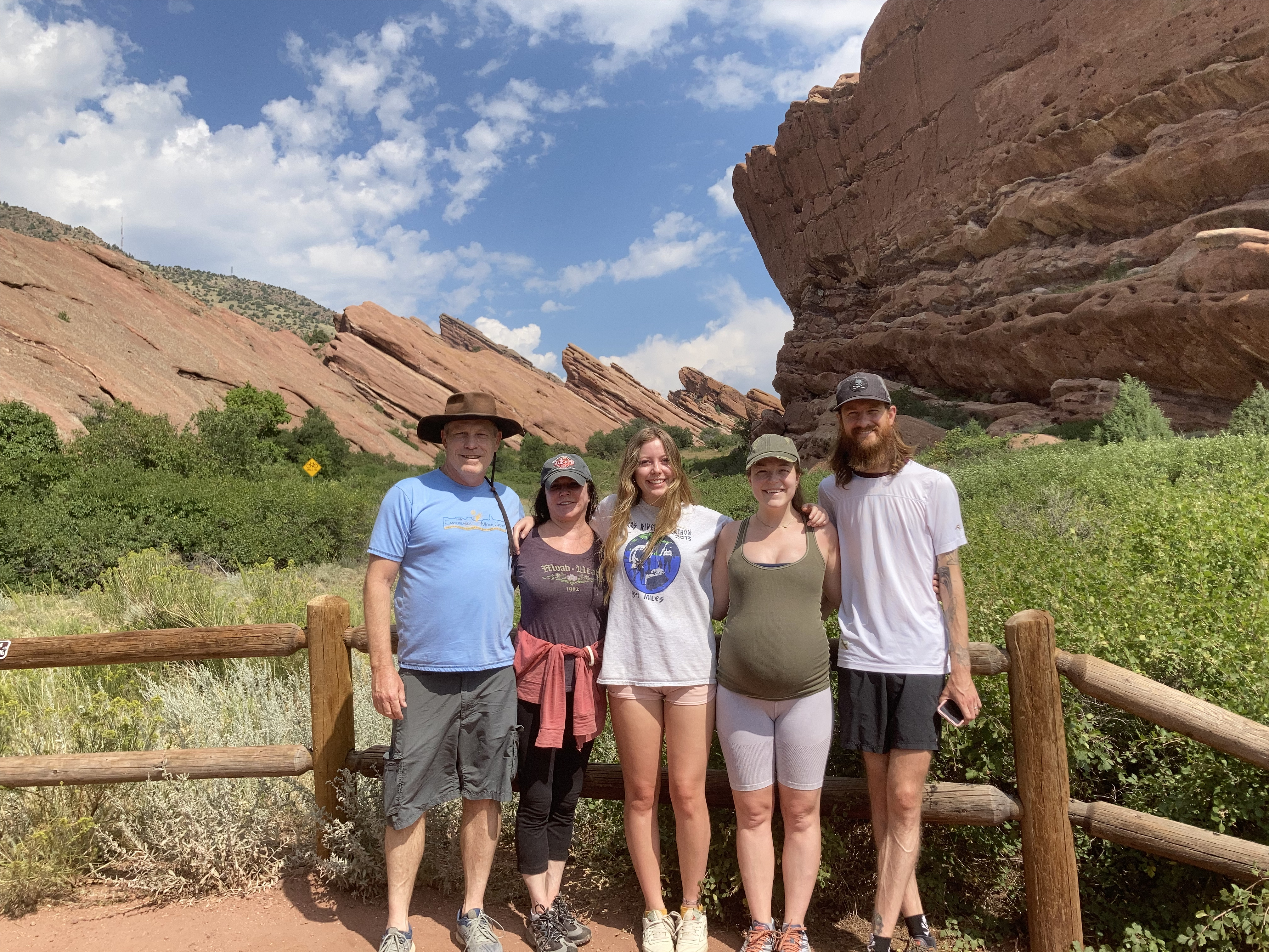
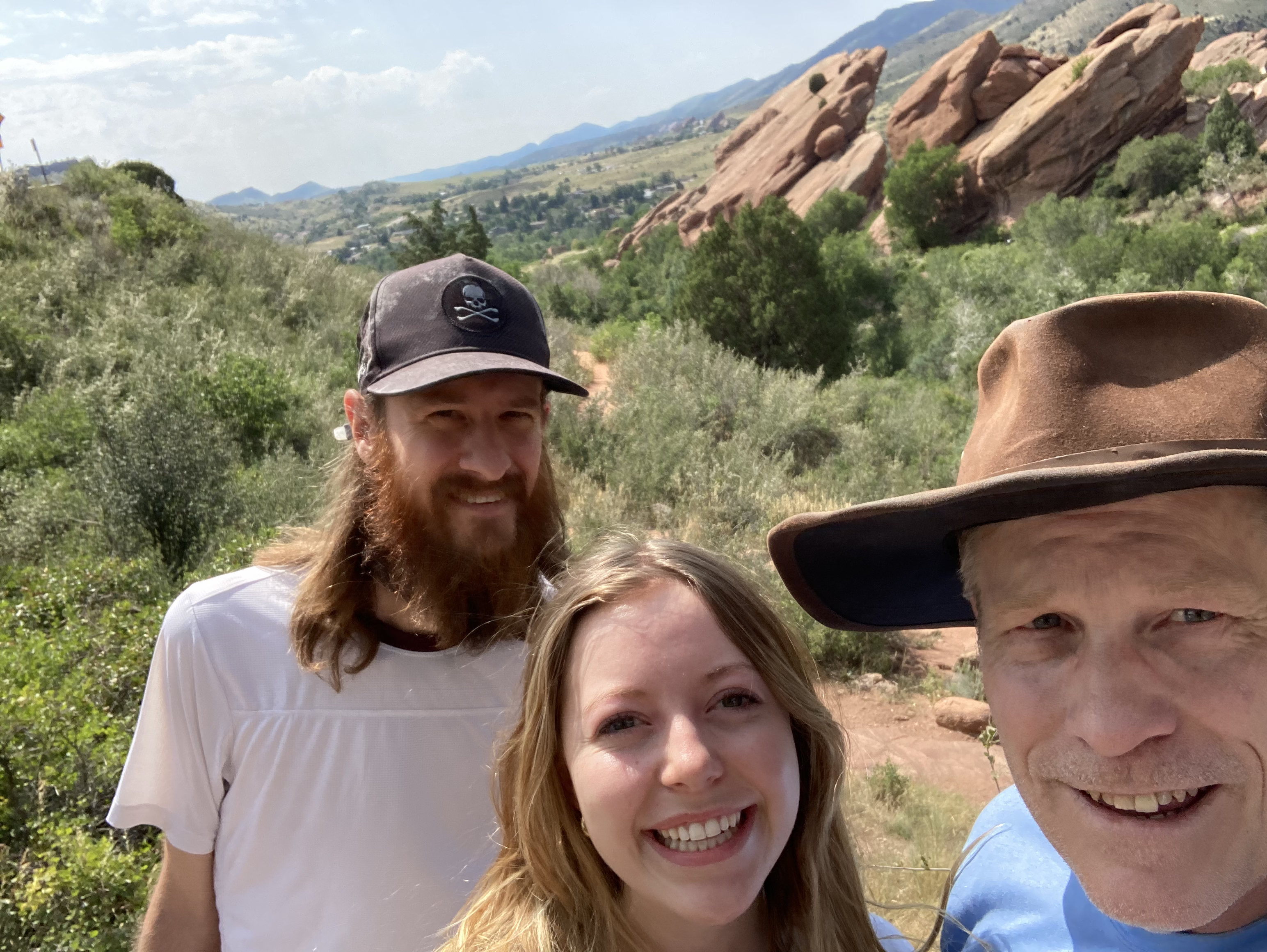
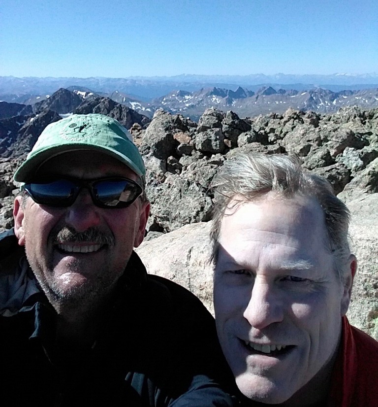
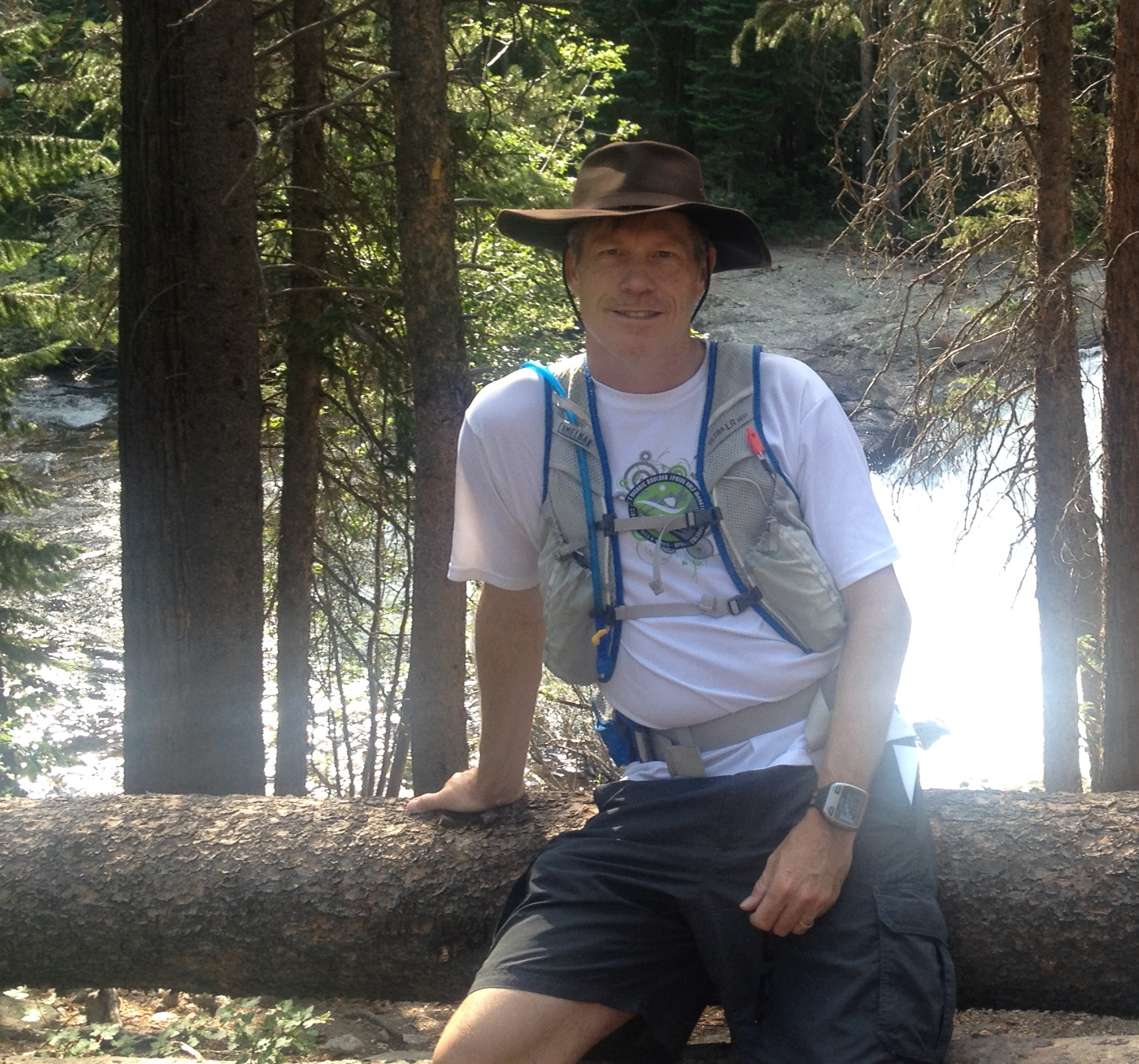
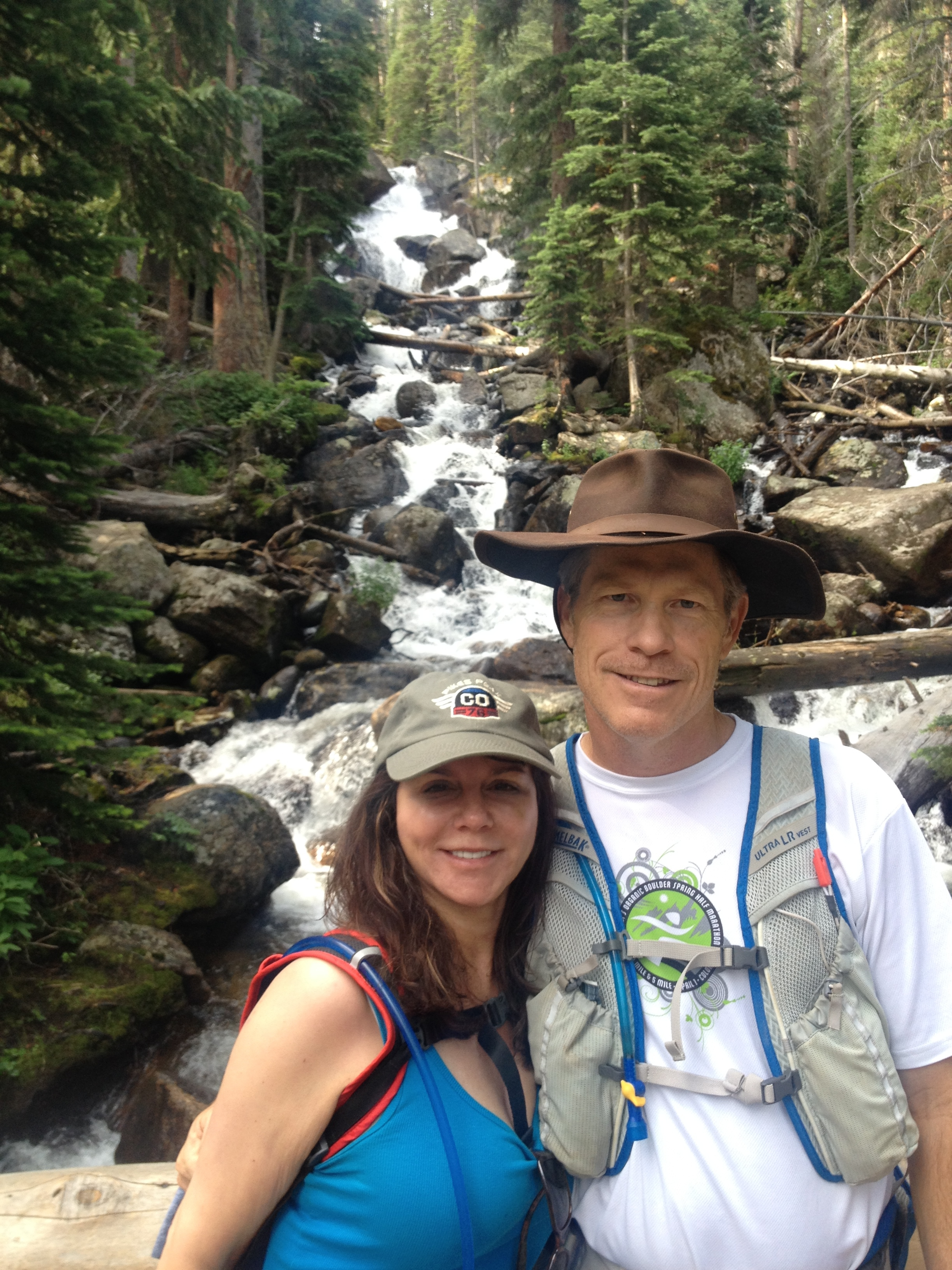
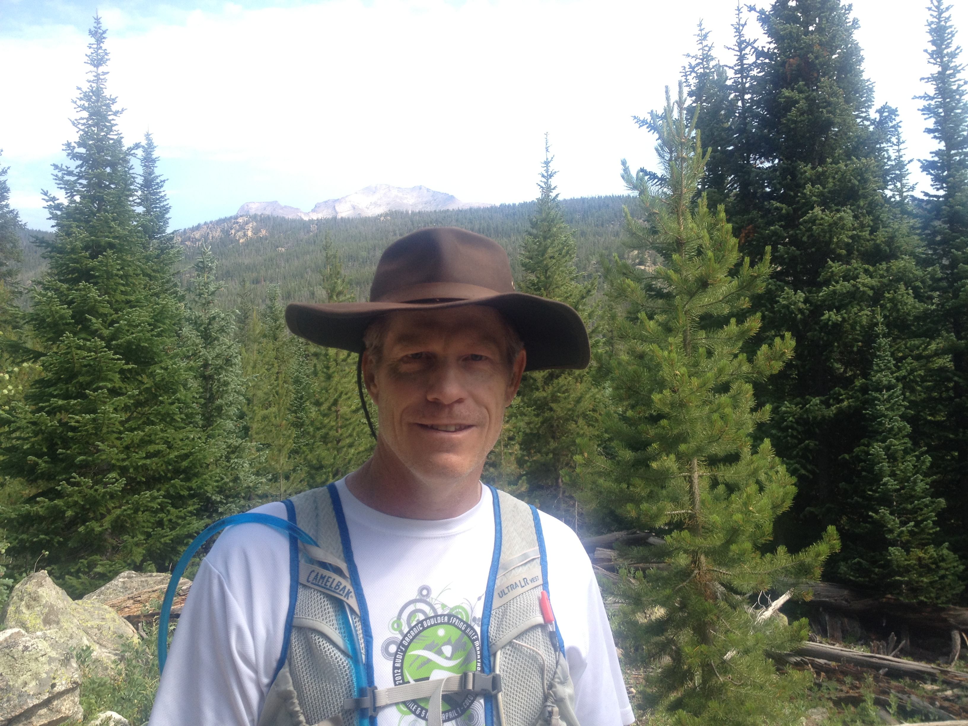
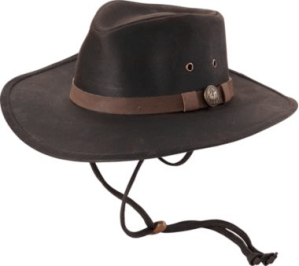
I begin my 80 mile backpacking adventure along the Collegiates West Loop of the Colorado Trail next weekend.  My two best friends from high school planned this reunion of sorts back in April when they thought I was dying from cancer and they might never see me again.  Suckers.  Whatever it takes man, I’ll play the C card if that’s what it takes to get these boys back in the saddle.  The two months of planning though have been brutal.  We’ve been emailing back and forth almost daily with anticipation.  And praying the snow pack melts sufficiently above 11,000 feet to keep this hike from becoming a snowshoe event.  Other than following snow conditions, much of our correspondence has been about gear.  Karen and the girls gave me this waterproof, oilskin fedora this morning for Father’s Day.  It completes my packing list.

JetBoil
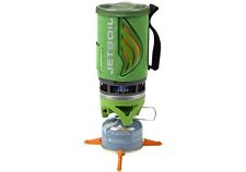
I’ll be packing a ton of new gear.  I bought this JetBoil gas burner for a mountain relay event last year that got rained out from the Great September Flood.  Everything stores inside the canister for a tight fit.  I’m guessing I’ll only need one fuel canister for the trip but I’ll pack an extra in the car.  We will park a car half way on Cottonwood Pass to reload supplies.

black diamond voyager lantern
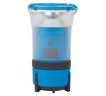
Yet another cool gadget that I have yet to use is this Black Diamond Voyager Lantern.  It was a Christmas gift from my brother-in-law and I’ve yet to go camping since he gave it to me.  I’ll use a headlamp too of course because that works so well when setting up a tent at night.  But this will work well to light up my tent when getting dressed before the sun rises.

seedhousesl1tent-zmSpeaking of tents, this is my trusty one-man, Seedhouse SL1 tent from Big Agnes – an outdoor gear outfit from Steamboat.  I used this tent for my Colorado Trail journey in 2011.  It’s nice knowing I have some durable gear and that I don’t have to buy everything new for this trip.  My sleeping bag also comes from Big Agnes.

Gregory Baltoro 75
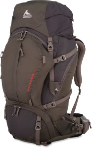
My Gregory Baltoro 75 backpack also makes a return appearance from my first backpacking experience on the Colorado Trail.  This is a massive pack.  I could possibly get by with a smaller pack but I’m not that experienced at packing and don’t have ultra light gear.  I’m experienced enough now though that I know how to pack this puppy.  That link is to an REI video with tips for loading backpacks.  Essentailly, keep heavy gear close to your spine.  Consider loading your sleeping bag at the bottom.  Put gear such as maps and other items you might need ready access to in a quick side pocket.  I’m still trying to decide whether to load a 2 liter or 3 liter camel back water reservoir in my pack.  Huge weight difference and I doubt I’ll ever drink 3 liters on the trail.

Patagonia Puff Jacket
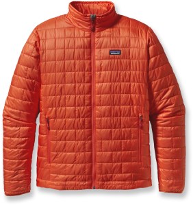
One item that will save space in my pack is my new Patagonia Nano Puff jacket.  This is so light and compressed, relative to my 15 year old, bulky ski jacket.  I might not need it during the day but the temperature can really drop at night.  And I doubt we’ll escape rain.  I also have a rain poncho to go over myself and pack that I got with my swag bag from the Durango Double Ultra last year.  This jacket might have been my first purchase for the trip.  I got it during REI’s annual sale at 30% off.

Salomon Quest 4D GTX Hiking Boot
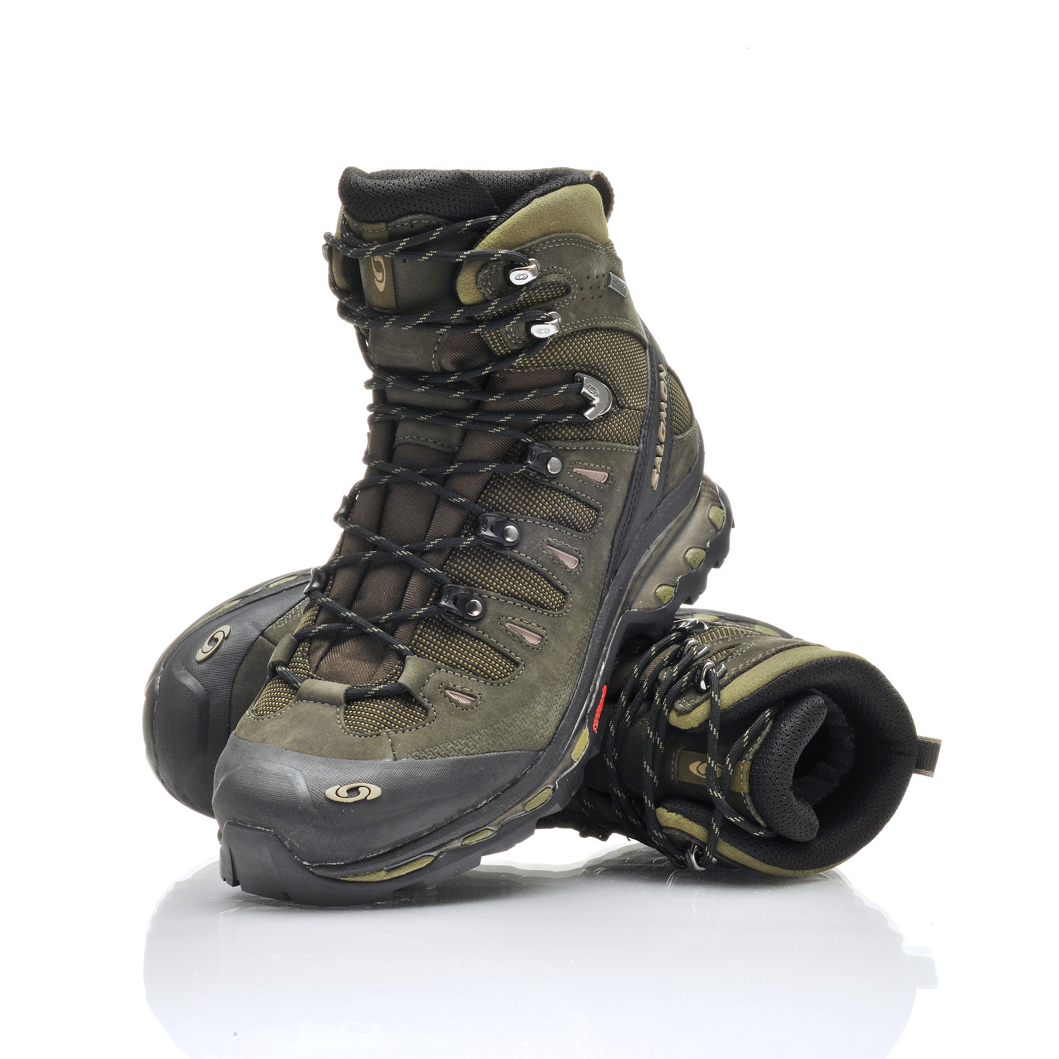
Another really exciting new piece of gear to my collection is this pair of Salomon Quest 4D GTX hiking boots.  I’m excited because I’ve always only hiked in trail running shoes in the past.  I’m hoping these relieve my feet and ankles of the expected fatigue after 12 hours on the trail.  I like the freedom of running shoes.  I absolutely love trail running.  I don’t expect to be running though carrying a 35 pound backpack.  My rationale for purchasing the boots was to be prepared for hiking across snow drifts.  My experience hiking with Rob is that it’s doable without snowshoes but trekking poles are key.  Crossing snow drifts is also much easier early in the day before the sun turns the snow into slush.  Plus I typically let Rob lead so I can follow through his post-hole steps.

BisonBarThe puffie and boots are my two big purchases.  Got meaningful discounts on both.  Food is the last topic area.  Might not qualify as gear to some but food is very important to me.  I hate most sports/energy food.  Porting real food though isn’t too wise backpacking.  Not because of the weight so much as that it can attract bears.  I began reading Bill Bryson’s Into the Woods last night and I’m suddenly fearful of bears.  I discovered these EPIC natural food energy bars recently and they are awesome.  Some guy in Austin, Texas makes them.  You can order them online, I’ve yet to see them in stores.  They offer turkey, beef and lamb along with bison and average a good 200 calories.  It’s not easy replenishing calories while backpacking so high calorie foods are important.  My girls liked these epic bars so much hiking last weekend that I had to order more for my trip.

SteriPEN
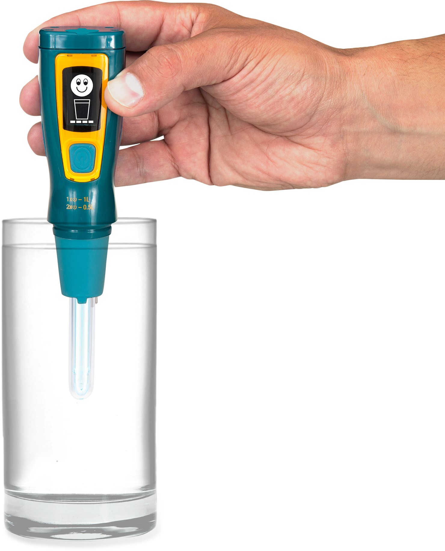
I’m going high tech for water purification.  Mike bought one of these too.  Rob will have his water pump so we’re covered with multiple solutions if this gadget doesn’t live up to its hype.  This only works well though for clear water, but I don’t expect to be wading through any murky streams at 12,000 feet.  When you are hiking across the top of the Continental Divide, this early in the season with the snow melt flooding every gulch, it’s highly unlikely there will be sheep or cattle grazing above the water supply.  I hope to report good results on this SteriPEN water purification tool.  I suspect the way I will use it is to leverage a water bottle for collecting water.  Use this UV light tool to purify the water.  Then pour the water into my reservoir.  Shouldn’t be too kludgy a process.  I’ll report back on the success or failure of all my gear.  I’m writing about it now because I’m organizing and packing this weekend.  I don’t expect to be blogging from the trail but I might take notes on my iPhone’s Evergreen app to assist in recalling details.

Share this:

  • Facebook
  • Twitter
  • Pinterest
  • LinkedIn
  • Reddit
  • More
  • Tumblr
  • Email
  • Print

Like this:

Like Loading...

Twin Sisters

07 Saturday Jun 2014

Posted by Ed Mahoney in Colorado Trail, Ellie Rose

≈ Leave a comment

Tags

Estes Park Resort, Grags, hiking, Longs Peak, Oscar Blues, RMNP, Rocky Mountain National Park, summer camp


Twin Sisters THAfter the snow pack we encountered on last weekend’s trail, our objective today was to find a trail with southwestern exposure.  The Twin Sisters trail in Rocky Mountain National Park fit the bill.  Plus it starts out 1000 feet lower around 9000 feet.  This trailhead sits east of Lilly Lake just off Hwy 7, a few miles north of Long’s Peak Trailhead.  We spent the night nearby at the Estes Park Resort.  A very nice lodge and spa on Lake Estes.  We drove there Friday evening after picking up Ellie from the last day of her computer programming summer camp at CSU in Ft. Collins.  The drive to Estes Park from Ft. Collins is similar to the drive from Longmont.  You take Hwy 34 via Loveland instead of Hwy 36.

boulderingThe Weather Channel had us set for 50° and rain.  Instead it was gorgeous.  Clear skies and 60°.  Parking at the trailhead was nearly full.  Mostly for a wedding across the road at Lilly Lake.  This is clearly a very popular trail, but we got there early enough with our short drive from Estes Park.  The trail begins for a few hundred yards on a dirt road that’s closed to traffic.  It then veers off to the left with a large sign.  The first mile is a bit of a workout up to these cliffs.  The slope flattens out once it completes some switchbacks and turns south.  I think these cliffs are part of the Grags formation, which are more popular for climbers than hiking.

landslideKaren I turned around when we encountered this landslide that obliterated a hundred yard swath of trail.  Brit and Ellie were undaunted.  They maintained course for the saddle that sits between the Crags and the Twin Sisters Peaks.  This avalanche was pretty impressive.  Apparently caused from flooding, it knocked out trees clear down to Hwy 7 leaving quite an ugly scar on the mountain.  We reached our turn-around point at just over an hour of hiking which gave us a two hour hike total.  We waited for the girls on a bench over-looking Lilly Lake.

Lilly LakeBrit and Ellie took another hour or so to climb up the steep switchbacks that lead to the saddle.  They said they had to scramble a bit using their hands – the trail was so steep.  Doubtful Karen would have liked that.  I wouldn’t say this trail was crowded but we encountered quite a number of other hikers – including a couple of shirtless boys that Ellie said were eying Brit.  Brit told Ellie she thought the boys must go to CU – because they were “buff”.
I highly recommend this trail for family hikes.  The views of Long’s Peak to the west are awesome.  It’s definitely a workout but very doable by all skill levels.  And if you want to let the kids hike, you can choose to hang out at Lilly Lake.  There’s a short mile trail around the lake that I wouldn’t mind visiting for a run.  The trailhead has a restroom, and the scenery is stunning.  We drove back home along Hwy 7 and stopped for lunch at Oscar Blues in Lyons.  Looks like it might rain now but we had a beautiful Saturday morning.

Share this:

  • Facebook
  • Twitter
  • Pinterest
  • LinkedIn
  • Reddit
  • More
  • Tumblr
  • Email
  • Print

Like this:

Like Loading...

Fisher Towers

18 Sunday Mar 2012

Posted by Ed Mahoney in Colorado Trail

≈ Leave a comment

Tags

hiking, march madness, Moab, Titan, trail

The 2012 season’s first hike and camping began not in Colorado but near Moab, Utah off highway 128 at Fisher Towers.  I drove to Grand Junction Thursday night on my journey to run the Moab Half Marathon on Saturday.  Rob was still returning from Durango where he was getting some new ink to mark the Mayan Apocalypse.  Sue hosted me and we watched 11th seed CU win in the first round of the NCAA tourney over UNLV.  Rob returned in time to see the victory.  Afterward we watched some Comedy Central shows Rob had recently DVR’d.

Friday morning the three of us ate breakfast at The Egg & I, Sue warned me to look out for Rob, and then we drove out of Colorado west on I-70.  Moab is less than two hours away and we took the exit for Hwy128 rather than Hwy 191.  Most mapping apps might suggest highway 191, but Hwy 128 is infinitely more scenic.  Plus this is the route to the trail head where Rob planned for us to get in a short hike.

Fisher Towers is a series of sandstone pillars that emerge in a southwesterly direction from a mesa on its northeastern flank.  Wikipedia describes them as “fins”  – three primary clusters of multiple sandstone spires.  These rock formations are instantly familiar as everyone has seen them in the movies or most recently in the Citibank commercial where Katie Brown summits the Ancient Art tower and stands on top.

I had suggested we get in a 3 to 5 mile run today since I hadn’t run much during the week and Rob thought this hike would be as good as any run.  Boy was it.  We started off running in fact, and I rediscovered my trail legs.  The hike is a bit technical in places, such as when we had to climb down an iron ladder.  After scaling the ladder, we turned left and continued back uphill.  We didn’t take any water on this hike thinking it would be short enough, but the dry air was aggressive in its attack to our mouths and throats.  My lips felt as if they had three  years of dead skin caked on to them.  Not bringing water was a gear fail, otherwise our shorts and t-shirts were perfect for the weather.

We watched some climbers working the cork screw summit of the middle cluster termed Ancient Art.  This was mouth-open, awe-inspiring, scary stuff.  Sometimes you forget what it’s like to watch death-defying stunts in real-life.  We watched a guy stand on the top like Katie in the commercial. For reals.  If Charlie Sheen has tiger blood, these climbers must have Mayan DNA.  Incredible!

After roughly an hour for 2.5 miles, we made the trail end.  If I described the view as high altitude desert, you probably wouldn’t be very impressed.  You have to experience it.  Hiking over the slick rock and breathing the rock-filtered air.  This is an amazing part of the world and well worth driving across the state border to hike or mountain bike.

The trail wasn’t crowded exactly, but we had company.  The trail head was full of cars, but mostly for climbers.  As we turned to depart from the trail end we encountered 3 sirens.  They nearly talked us into staying before our thirst brought us to our senses and we continued back to the trail head.  We discovered this rock window on the return – not sure how we missed it on the way in.  I could picture Wilma serving up a rack of dinosaur ribs to Fred at this spot.

I can’t faithfully recount every sight on this most visual hike.  There was also a flock of teenage hikers strolling barefoot across the trail.  Natives.  Back at the car we drowned our thirst with bottled water.  We then headed toward Moab on Hwy 128 and stopped near Negro Bill Canyon to stake out a camping site.  After pitching our tents, we resumed the trek into Moab for lunch, our race bibs, and beer at the one state owned liquor store.  We spent the remainder of the day ensconced at our camp site drinking beer until it was time to meet up with friends for dinner at The Red Cliffs Lodge, where we continued drinking and generally prepping our bodies for the next day’s half marathon.

40.137598
-105.107652

Share this:

  • Facebook
  • Twitter
  • Pinterest
  • LinkedIn
  • Reddit
  • More
  • Tumblr
  • Email
  • Print

Like this:

Like Loading...

Camping

05 Monday Sep 2011

Posted by Ed Mahoney in Storytelling

≈ Leave a comment

Tags

Camping, Handcart, hiking, Labor Day, Mt. Bierstadt, Northwest Hills, posole, Whale Peak

Few would ever confuse Karen for a camper.  As they say in Austin, you can take the girl out of Northwest Hills, but you can’t take the NW Hills out of the girl.  Still, she was quite a sport this Labor Day weekend as we camped out with a pack of neighbors at the Handcart camping site 5 miles west of Hwy 285 on CR 60 in Hall Valley and a short hike from Whale Peak.  Karen even cooked everyone some tasty breakfast tacos Sunday morning.

It’s been an awesome weekend.  We were a bit late to arrive Friday night.  Couldn’t cut out from work any earlier and hit heavy holiday traffic on I70 and Hwy 285.  But we got there with plenty of daylight to pitch the tent.  We didn’t have to worry about cooking as Dave had posole ready for the first course and grilled us up some fantastic fajitas.  A cool front rolled in offering us the first taste of fall with a low of 45° overnight and 60s during the day.

Several of us hiked up Mt. Bierstadt Saturday.  This picture captures Susan, Scott and Julie about half way up the trail.  We alternated donning our wind jackets as the clouds danced back and forth across the sun.  Kieth cooked a shrimp boil Saturday night that could have made a Cajun cry for having missed out.  I drank some beers after the 2.5 hour hike, followed by some wine, topped off by a handful of TnTs in honor of Keith’s British background.  The clouds threatened us with a few rain drops but held it in check as we enjoyed a magical night around a perfect campfire.  Ellie sang us some tunes and before I knew it I was sound asleep.  We finished the camp out the next morning with Karen’s breakfast tacos.  Back home on the eastern slope of the Front Range now enjoying the start of autumn.

40.137598
-105.107652

Share this:

  • Facebook
  • Twitter
  • Pinterest
  • LinkedIn
  • Reddit
  • More
  • Tumblr
  • Email
  • Print

Like this:

Like Loading...

Search this blog

  • Boulder Marathon
  • Britt&Eric
  • Colorado Trail
  • Covid-19
  • covid-noir
  • cyber war
  • Ellie Rose
  • Geek Horror
  • Marathons
  • Margot
  • Medical Files
  • Novel
  • Other Stories
  • Politics
  • ReBlog
  • Running
  • Snowboard
  • Snowshoe
  • Storytelling
  • training plan
  • Victoria BC

Buy Full Spectrum Cyberwar at Amazon

Buy Cyber War I at Amazon

Buy on Amazon India for ₹99

Buy on Amazon U.K. for £2.27

English Edition on Amazon Germany

Buy on Amazon Brazil for R$11.29

Archives

Blog Stats

  • 135,436 hits

Girlfriend Cult

Recent Comments

Ed Mahoney on ATX Half 2023
georgeschools on ATX Half 2023
Terry Collier on ATX Half 2023
Ed Mahoney on ATX Half 2023
Susan on ATX Half 2023

Recent Posts

  • Happy Memories March 25, 2023
  • ATX Half 2023 February 22, 2023
  • Adelsverein January 28, 2023
  • A Runner’s Day January 7, 2023
  • Last Run of the Year December 31, 2022
  • Christmas, for me… December 26, 2022
  • Craft Shopping for Christmas December 10, 2022
  • A Slow, Late Fall Run November 25, 2022
  • November Runs November 20, 2022
  • Tech Debt November 19, 2022
  • The Runner’s Field of Battle November 13, 2022
  • Stealin’ from God October 24, 2022
  • A New Start October 23, 2022
  • Baby Margot Birthday October 9, 2022
  • The City of Flowers September 24, 2022
  • Dog Park by the Sea September 19, 2022
  • The Lane of Pain September 17, 2022
  • Run Rabbit Run August 28, 2022
  • Wild Horses August 21, 2022
  • The Day Running Died August 17, 2022
  • Boulder Marathon Training – Week One August 7, 2022
  • Mount Sanitas July 30, 2022
  • The Trail and Me July 23, 2022
  • Mount Zirkel Wilderness July 13, 2022
  • Full Team Hike July 4, 2022
  • Village to Village July 3, 2022
  • Beaver Creek July 2, 2022
  • Summer is Here June 12, 2022
  • Birthdays May 22, 2022
  • Fall River Road March 25, 2022
  • A Tale of Two Gerasimov’s March 11, 2022
  • The Hero February 26, 2022
  • Full Spectrum Cyberwar February 24, 2022
  • Run Nan, Run February 20, 2022
  • Running Sunrise to Sunset February 13, 2022
  • Cyberpunk Runner February 5, 2022
  • A Winter’s Run January 15, 2022
  • Turkmenistan January 2, 2022
  • Counting Families at Christmas December 26, 2021
  • Austin Boardwalk December 23, 2021
  • Like Christmas for the First Time December 19, 2021
  • Restoration November 27, 2021
  • India Kinks November 15, 2021
  • Run a Little, Write a Little November 6, 2021
  • Horizons October 30, 2021
  • The Vitality Kick and other Abnormal Obsessive Behaviors October 19, 2021
  • The Ten Week Plan October 11, 2021
  • Pearl Street Marathon October 10, 2021
  • Confidence Builder October 2, 2021
  • Margot Faye September 25, 2021

Colorado=Security

Blogroll

  • Alohawk's Blog
  • Barbie's Blog
  • Boggy Creek Lumpster
  • George Schools Blog
  • I, Cringely
  • Prostate Chronicles
  • Shut Up + Run
  • Sustainable Sunrise
  • The Rogue Botanist

Web Sites

  • Amazon Author Page
  • Austin Marathon
  • Bolder Boulder
  • Brit's YouTube Songs
  • Colorado Marathon
  • Colorado Runner Magazine
  • Colorado Trail
  • Girlfriend Cult
  • Lobo Media Ltd
  • My YouTube Site
  • Race Pace Calculator
  • Shoes & Brews
  • Trail Runner Magazine
  • Zaremba Graphic & Web Solutions

Goodreads

Top Posts & Pages

  • Performance Enhancers
  • Foot Fetish
  • Muscari Neglectum
  • Runner Porn
  • Happy Memories

Top Clicks

  • edmahoney.files.wordpress…
  • edmahoney.files.wordpress…

RSS Feed

  • RSS - Posts
  • RSS - Comments

Blog at WordPress.com.

  • Follow Following
    • A Runner's Story
    • Join 248 other followers
    • Already have a WordPress.com account? Log in now.
    • A Runner's Story
    • Customize
    • Follow Following
    • Sign up
    • Log in
    • Report this content
    • View site in Reader
    • Manage subscriptions
    • Collapse this bar
 

Loading Comments...
 

    %d bloggers like this: