
 My first couple of runs in Austin were tolerable because it’s been raining down in Texas. That didn’t help much with the humidity, but you can’t have it all. Not sure which I’d prefer to avoid, melting under a blazing sun or drowning in humidity. Probably end up drenched in a puddle of sweat either way. I didn’t mind running in the rain. It’s such a warm, comfortable rain in Texas. Try running an hour in the mountains during the rain and you’ll die from hypothermia. Colorado rain is really just a warm snowfall.
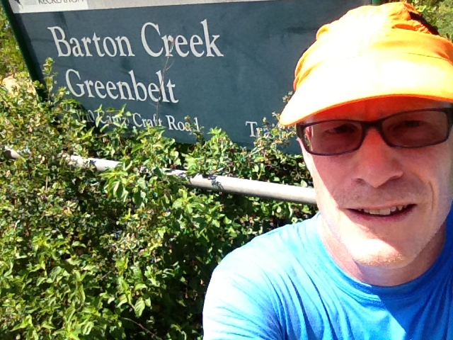
Per plan, I made it down to the Barton Springs Greenbelt today. I’ve always launched from the Loop 360 Trailhead – which is about halfway along the trail. Today I decided to learn some new trailheads and started on the Hill of Life Trail which begins at the Camp Craft Trailhead. You find this trailhead at the end of Scottish Woods Trail, around the corner a few feet to the right on Camp Craft Road. There are signs along Loop 360 for the Scottish Trail intersection. You take the southwest street. It’s a residential street that goes for maybe 200 yards before ending at Camp Craft Road. There were tons of cars parked along the street, setting my expectations for a crowded trail.
The crowd began immediately at the trailhead where some organized training event was finishing up. The coach was yelling out times for a couple dozen runners coming up the hill. This trail starts down what looks like a creek bed, which is to say an extremely rocky 10% slope. It reaches Barton Creek after a half mile. I heard the coach counting off about four and a half minutes. That sounds right for climbing a half mile hill. I’m guessing he was having his runners repeat hill climbs. Hard to say how many.
This crowd thinned out once I hit the main trail, but I was constantly passing hikers and bikers. One guy passed me with a couple of dogs. And I passed a couple of bikers that had passed me earlier. The trail was too technical for them. It’s fairly flat but has some big rocks in places. I hesitate to say it isn’t well marked. It has green mile markers every quarter mile. But as you could imagine near a creek, the trail constantly branches out and it’s difficult to know which is the main path at times. The branches typically fork back together so it’s usually not too critical but some decisions can lead you back uphill to the road and those are to be avoided.
 At one such decision point, I forked left which I quickly understood was going to lead me up to the road. I decided to stay with it because others were on it and I figured I might learn of a new trailhead. Plus this was near 3 miles and would give me a nice 6 mile run. Had I continued on the right fork I would have encountered another option toward this trailhead, but marked by this sign. The trailhead turned out to be what’s called Twin Falls. You park along the MoPac service road on the southwest exit ramp of its intersection with Loop 360. I returned back down to the main trail forking left to complete the Twin Falls loop clockwise. I went in the direction of the red arrow on the sign which I expect points to Twin Falls. The two miles of Barton Creek between Twin Falls and the Hill of Life contain some good swimming holes and explains where many of the hikers were headed. I wouldn’t call these swimming holes billabongs exactly, but they can become isolated ponds when the creek dries up in the winter. Sculpture Falls is another popular spot and there are actually restrooms near the creek where it meets up with the Hill of Life.
 I drove around after today’s trail run looking for the Greenbelt map I expected to find for sale. I started at the REI Store on Lamar. They directed me to Lance Armstrong’s bike shop which is named Mellow Johnny’s. They weren’t selling it either but printed me off a free copy of the trail and called around to find it for me. They discovered I could buy a copy at Whole Earth located a few blocks up Lamar. I did buy it there and can highly recommend it for the detail of all the unmarked trails and the six different trailheads. Proceeds go toward the Save our Springs Alliance. These pictures probably look the same but the first one up top is at Camp Craft and this one here is at the Twin Falls Trailhead.
